
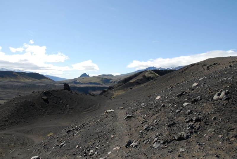
Ash deserts as far as the eye can see, knee-deep crossings of icy glacier rivers, ever-changing landscapes – and all that in four days, far from civilization in the south of Iceland.
The Laugavegur is a 55-kilometre trail that is regularly listed as one of the world’s best. And after walking it myself, I must say I completely agree with that assessment.
For most hikers, the adventure starts in the capital Reykjavik. We took an all-terrain bus with a few other backpackers to the starting point in Thorsmörk, a journey that takes about four hours. Towards the end, the road winds along the foot of Eyjafjallajökull – the volcano whose dust cloud paralysed European air traffic in 2010.
After a fresh night at the campsite in Thorsmörk – the temperatures are in low single digits at night, even in high summer – we set off. It is 55 kilometres north from here to our destination, Landmannalaugar.
You can also walk Laugavegur in the opposite direction, from north to south and most hikers do so as it is a bit more downhill. We have to walk more uphill in the south-north direction, but we have most of it to ourselves and can enjoy the countless colours, smells and sounds alone.
Stunted birches, icy water
The first kilometre leads through a small birch forest, which seems untypical for Iceland. The climate means the trees do not grow very straight. No sooner have we passed the last little trees than an ice-cold glacier river confronts us. Even at the height of summer, if you can speak of that at all in Iceland, the water is only a little above freezing point. Now we have to wade through it with our 13-kilo backpacks. Our feet are stung by the sharp stones, like thousands of pinpricks. Fortunately, the crossing does not take long.
The path then leads us into a volcanic landscape, criss-crossed by small rivers. The lava ash crunches dry under our boots because it hasn’t rained for days – a rare bit of luck for hikers in Iceland.
The ash landscape seems to have no end, you just walk and walk. You come to understand why NASA chose Iceland for moon landing training in the 1960s. And even though we are walking away from Eyjafjallajökull, it doesn’t seem to be getting any smaller.
Eventually we see many colourful tents. That is our campsite. If you manage to book in time, you can stay in huts, and there are basic facilities such as toilets, and glacier water for brushing your teeth.
From desert to river
Summer in Iceland means that it practically never gets dark. The sun rises at about 4 am at this time of year. The most beautiful sound when you wake up in the tent is the silence, because that means it isn’t raining. And that makes for perfect hiking conditions.
The second day of the hike begins with ash again – in every conceivable shade of grey and black. It’s hard going, like walking on a sandy beach, and you feel like you’re not making any progress because it looks identical for mile after mile.
I am captivated by this dark ash desert, but then we hear a splashing and gurgling – a mountain river, at 10 to 12 metres the widest and most powerful on this tour. The water is knee-deep, so there’s nothing else for it but to take your hiking pants and boots off, and grit your teeth.
Fire and ice in a surreal landscape
The next night is stormy, but the rain doesn’t last long and soon the sun is shining again. The next river awaits, where we need around 30 minutes to find the right place to cross.
Shortly after the river, we climb steeply to about 1,000 metres, and into another world. There’s no more green here, instead the landscape is dominated by snowfields. Between them, again and again, we see hot springs from which smoke rises – ice and fire side by side. It seems surreal.
We reach the highest hut on the trail. Normally, the third stage ends here, after just under 12 kilometres. But when we arrive, the hut host advises us to keep going. “There are heavy storms coming up tomorrow!”
So we walk the last 12 kilometres to Landmannalaugar, even though our feet are already hurting.
Spitting monster and colourful mountains
On the way to the mountain, we descend into the valley. Suddenly the landscape is completely different from the previous days. As we descend, we see green, blue, red and yellow on the mountains on the left. In contrast, the lava rocks on the right just seem monotonous.
At the end of the hike we cross another old lava field covered with moss. The path meanders across this until a view of countless tents opens up. We’ve reached Landmannalaugar.
The reward at the finish is a jump into the river right next to the campsite. And this is no icy ordeal – a hot volcanic spring turns it into a pleasant bathtub soak for our tired bodies and aching limbs.
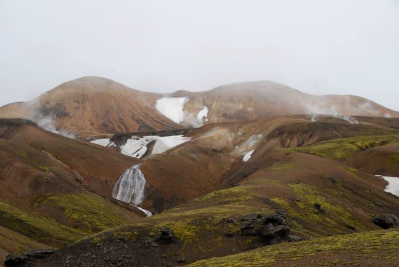
The steam rises from hot springs while snow lies beside them – there’s never a dull moment on an Icelandic hike. Finn Huwald/dpa-tmn

Not much to see here along the Laugavegur where the sign on the right points to the south and the sign to the left points to the north. Finn Huwald/dpa-tmn
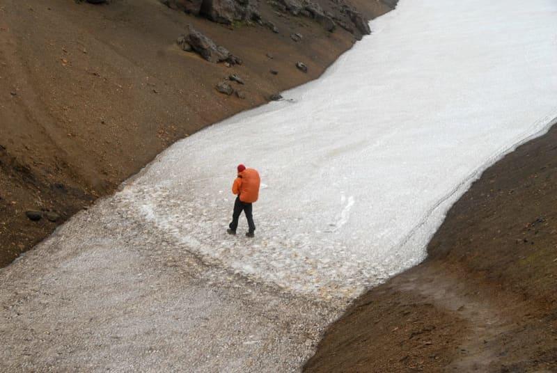
Shortly before Hrafntinnusker, the highest hut on the trail, you have to cross one of many snowfields. Finn Huwald/dpa-tmn

One of the most famous volcanoes since 2010: the hike starts in Thorsmörk within sight of Eyjafjallajökull. Finn Huwald/dpa-tmn
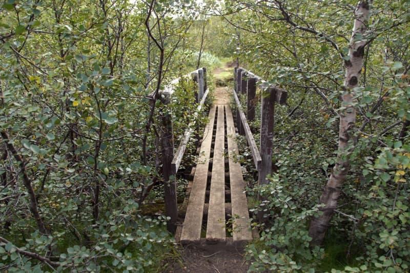
Wild sights await those who hike in Iceland. Finn Huwald/dpa-tmn