
![[OC] Map plot of all summits, mountain passes and huts I have reached in the Alps over the past 10 years](https://www.byteseu.com/wp-content/uploads/2025/12/tvq7jeh1116g1-1536x1051.jpeg "[OC] Map plot of all summits, mountain passes and huts I have reached in the Alps over the past 10 years")
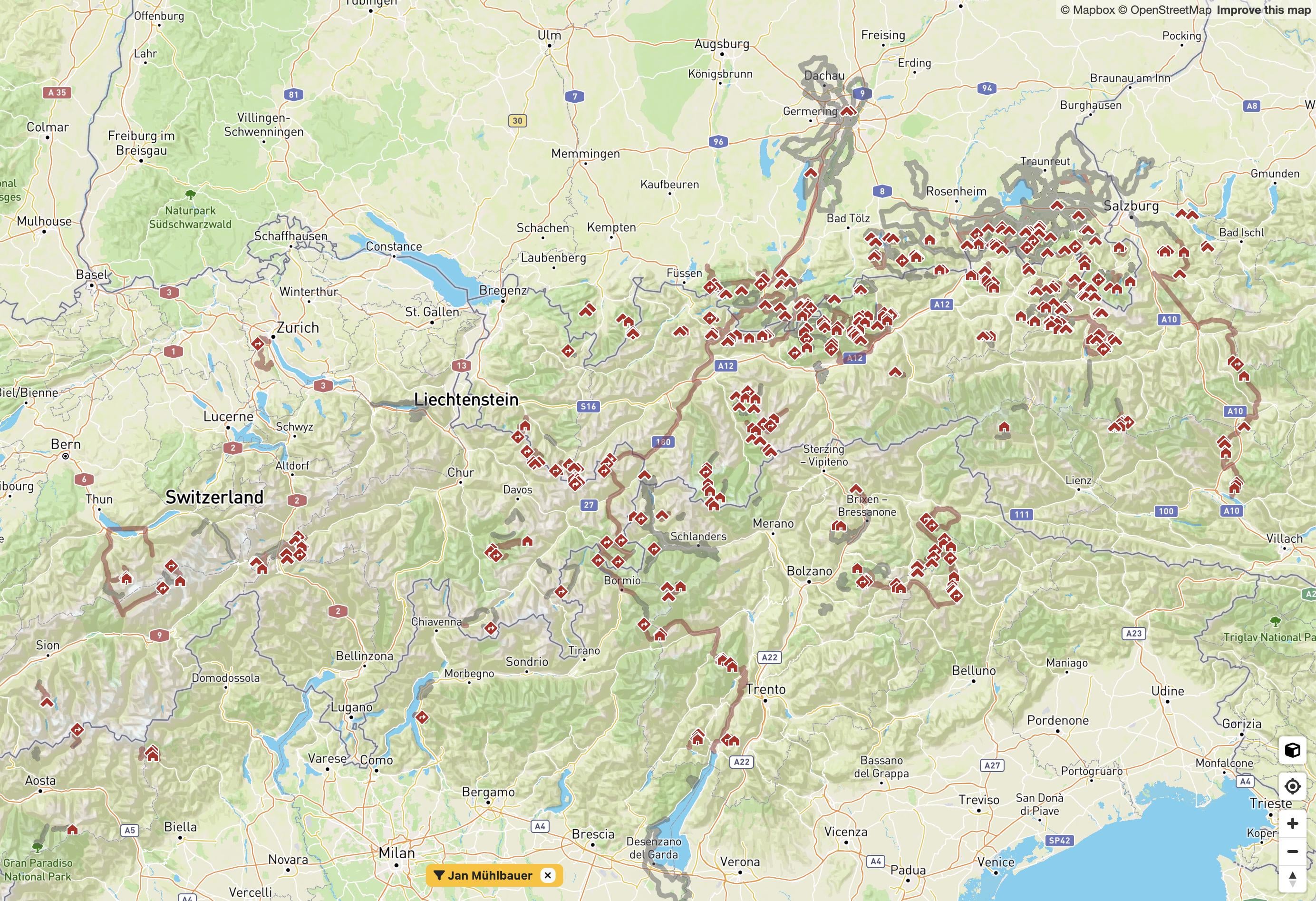
For a decade I have been tracking my mountain adventures year-round using a gps watch, mostly a Garmin Forerunner.
I combined this GPS data with openstreetmap features to identify which summits, passes, and huts I’ve reached in the Alps. Guess my upcoming travels will have to clear the white spots…
I built a tool for analysing my activity history, which I used to generate this map (peakproject.de).
Posted by JanM5050
3 Comments
OK, tomorrow I am retiring and starting a new 10-year project to meet or exceed what’s in this graph.
Your name is on screen (bottom mid) , maybe you want to change it
Geil, bin ich neidisch. It looks like you allready did the meran höhenweg? Is that right? I plan on going next year. Any hints/tips?
Did the Karwendel this year (2 weeks) and it was a fucking blast….