
![A year of work mapping U.S. regional food traditions [OC]](https://www.byteseu.com/wp-content/uploads/2025/12/s9yxfj4zfk7g1-1024x768.png "A year of work mapping U.S. regional food traditions [OC]")
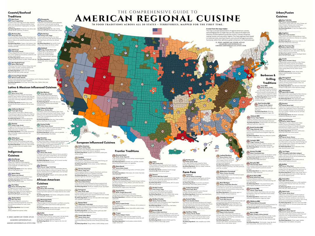
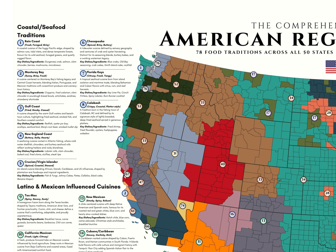
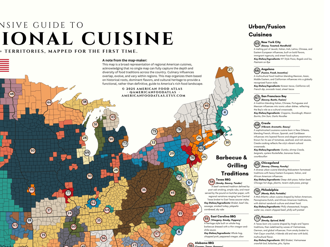
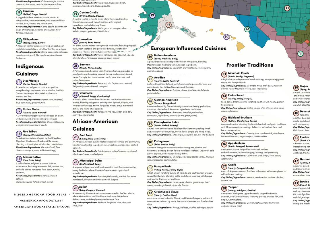
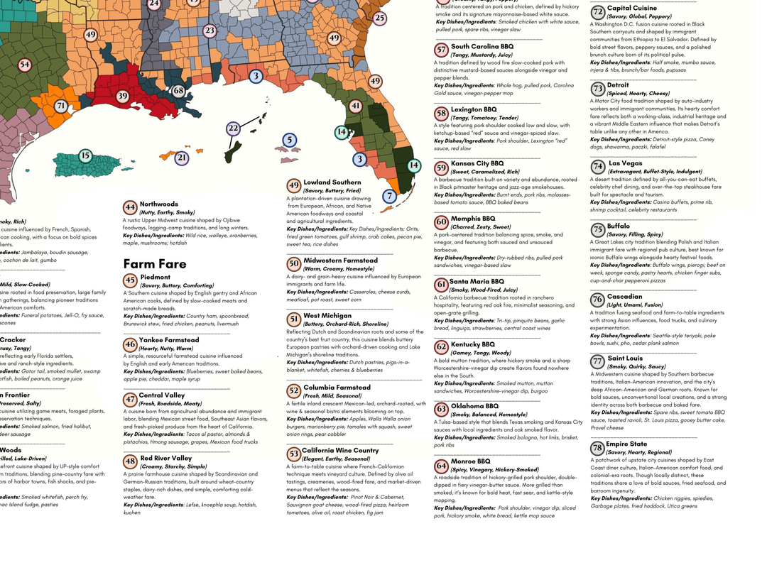
After a year of research, debate, and help from many of you in your home regions, I’ve finished a national map of 78 U.S. food regions. Each area is based on distinct culinary traditions shaped by geography, culture, and history, from Gullah and Tex-Mex to Monroe BBQ and Crucian cuisine.
I’d love your feedback: Did I miss something obvious? Should a region be renamed, removed, or split further?
A version of this map’s headed to print next year as part of a national cultural atlas, so this is the last round of tuning before it gets locked in.
Methodology note:
This map is interpretive rather than purely statistical. Regions were defined using a mix of historical settlement patterns, agricultural zones, immigration history, regional dishes, and feedback from locals across multiple revisions.
This is the 5th major revision, and I’m posting here specifically to invite critique before it goes to print as part of a larger cultural atlas.
Edit- just tried to reupload this in higher resolution. I went as high res as Reddit would let me. Sorry if it's still blurry or unreadable. DM me or look at links in my profile and I'll point you to a higher-res version
Posted by piri_reis_
7 Comments
**Sources:**
This map synthesizes multiple qualitative and semi-quantitative inputs rather than a single dataset, including:
• U.S. Census & ACS ancestry / immigration data (county & metro level)
• USDA agricultural production data (major crops & livestock by region)
• Historical settlement patterns (secondary sources, historical atlases, state histories)
• Regional restaurant menus, food festivals, and local culinary institutions
• Iterative feedback from residents, cooks, historians, and prior Reddit threads across 5 revisions
**Method:**
Regions were delineated interpretively by overlaying these inputs and identifying areas where culinary traditions consistently cluster. Boundaries are approximate and intended to reflect dominant traditions rather than strict exclusivity.
**Tools:**
Base map + county shapefiles, GIS editing (QGIS), Adobe Illustrator for final layout and labeling.
This is cultural cartography rather than a purely statistical model, and overlap between regions is expected in reality.
Can you post a legible version for phone users ?
The topic is interesting but this is the most frustrating way to view a graphic
Can you upload a full resolution image somewhere?
Reddit likes to compress images. At least on mobile.
I cannot read anything in the first image.
You put all this work into your research and then made it as illegible as possible.
The only thing I can make out is my area is labeled “6 7” so I could care less what the rest of it says
im super interested in this, but the links in your profile go to your insta, which is still too low rez to read, twitter which breaks when attempting to use it without an account, and to get a poster, which is actually awesome, and i might buy….if i could read the whole thing first.
Do you have a website where the whole thing is hosted or something? a dropbox, something with it?