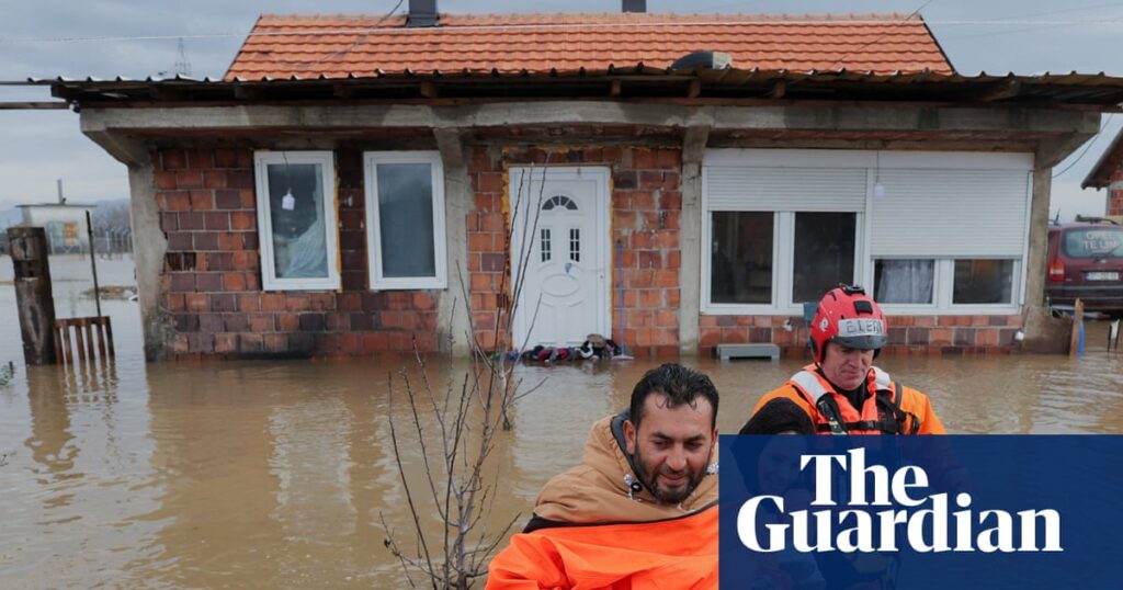
Kosovo has seen prolonged, intense rainfall this week leading to widespread flooding. Cities, towns and villages were inundated as rivers overflowed their banks. Communities were cut off and emergency services rescued people trapped in their homes. People lost their water supply as well as electricity in the Drenas, Malisheva and Rahovec municipalities after flood water entered electrical substations.
Personal weather stations across the south-west of the country recorded more than 50mm within 24 hours on Tuesday and Wednesday, with some local stations recording about 80mm in the municipality of Malisheva. This followed previously heavy rainfall from Saturday to Monday, during which official weather stations at Junik and Gllogjan in the west of the country recorded 231.5mm and 151.6mm of rain respectively within two days. A further 130mm fell in the region of Junik on Tuesday, exacerbating the flooding with landslips.
A drone view shows a flooded area in Obilić, Kosovo. Photograph: Valdrin Xhemaj/Reuters
The UK Met Office issued a red warning of severe winds from 4pm to 11pm on Thursday across Cornwall and the Scilly Isles as Storm Goretti barrelled through the Channel. While the far south-west of England had extreme wind gusts close to 100mph, it was Meteo-France that named the storm, as north-western France was expected to take a battering. Destructive wind gusts above 80mph were forecast, with gusts of 132mph seen in Normandy and 94mph in Brittany overnight. Locations as far inland as Paris had some very strong winds overnight, with gusts reaching 65mph.
Coastal flood warnings were also in place in north-western France; the northern coasts of Brittany were under warnings for waves of 6-9 metres, with storm surges of 1.5 metres at high tide.
Storm Goretti will continue to track east into mainland Europe into the weekend, and while severe winds will ease somewhat as it does so, blizzard conditions could be a threat. Significant snow may fall across Germany and the Benelux region.

