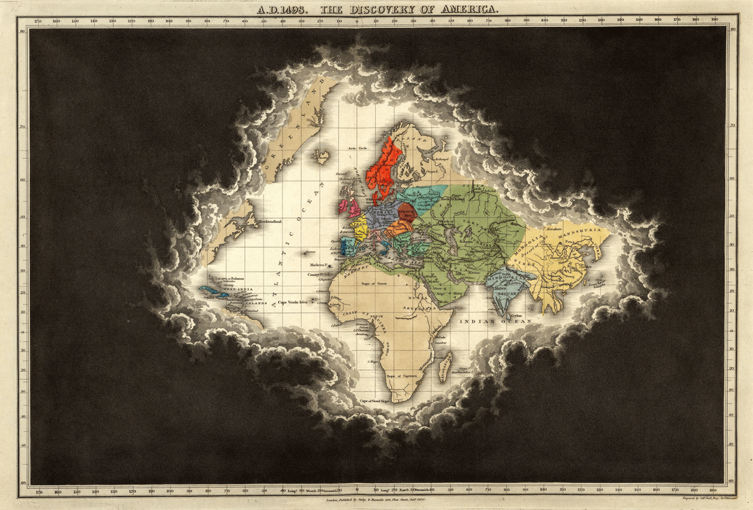
This map (A.D. 1498. The Discovery Of America) is from Edward Quinn's Historical Atlas from 1830.
Here's the full image if anyone wants
Posted by Parzival_2k7


This map (A.D. 1498. The Discovery Of America) is from Edward Quinn's Historical Atlas from 1830.
Here's the full image if anyone wants
Posted by Parzival_2k7
35 Comments
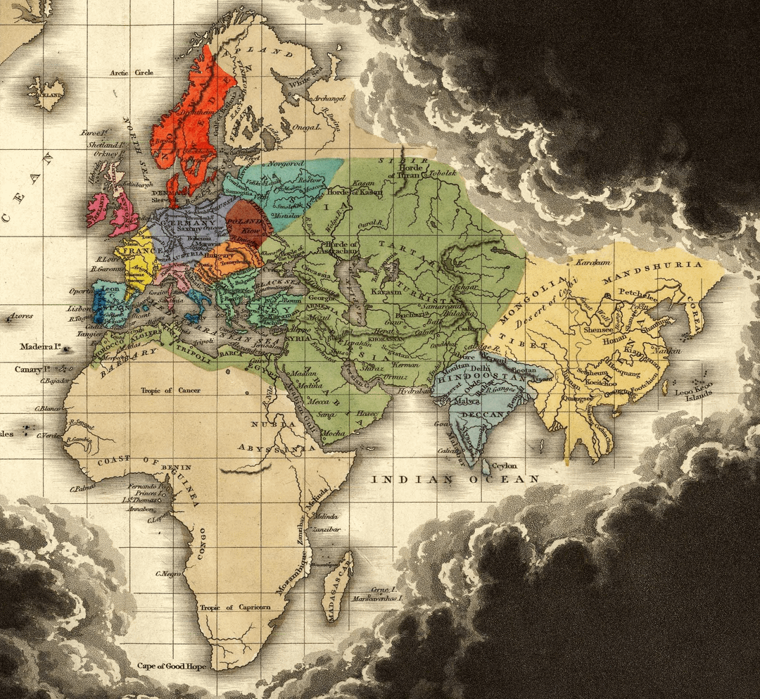
Why is Mongolia unexplored?
Wasn’t it the center of the Mongol invasion, and doesn’t the whole world already know about them?
Known world _to Europeans_.
crazy to think how much of the world was still a mystery back then
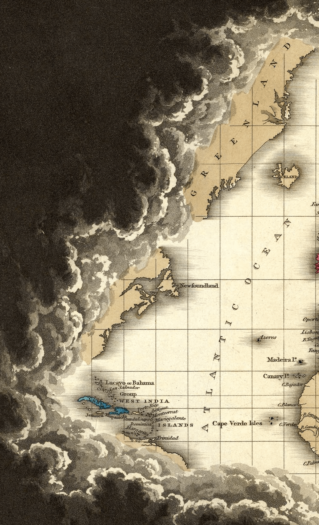
Most of Finland and Iceland should be red.
Japan was mentioned by Marco Polo a few hundred years earlier. Odd that it’s missing here.
Known to whom?
Yeah sure. Poland moved somewhere east of the Vistula, “Germany” miraculously created, reaching from Paris to Krakow and Vilnius. Eastern Europe practically as a “tabula rasa”. Geez.
Just another map without New Zealand, pathetic!
Well, known to Europeans anyway.
* to the Europeans.
I’m sure there were others around beyond the clouds
They deflated norway…
I’ve long been aware of the East Indies, but this might be the first time I realized that the Caribbean islands were once (erroneously) known as the West Indies.
Of course, they did name the natives *Indians*, so I shouldn’t be surprised.
Weren’t the Greenland settlements on the west coast?
I am pretty sure the people in America knew about themselves.
Neat artistic interpretation. Are there other time periods in this manner?
So was it made in 1830 or in 1498?
The edge of one person’s known world is the centre of another’s
Paris and New Zealand are missing on this map.
This is completly wrong though. Brasil, Central america, Japan, China India, Most of coastal africa were quite known and settled by europeans at the time.
Maybe the author wasn’t that knowledgeable?
The real atlas obscura
Interesting to see Poland so far to the East. The country really drifts to the west over centuries.
Maybe show this map to Putin and explain to him that Russia needs to be shrunken to its original true size. Since he is so obsessed with historic maps
ITT: People stating the obvious.
I do appreciate how it’s all place names and geographical features, but has a special mention for the Great Wall
BLACK SHEEP WALL
Mexico’s independence was in 1821, pretty sure Spain knew the territory because it was up high into California back then and Central America.
[Yandexed a bigger image](https://upload.wikimedia.org/wikipedia/commons/2/23/A.D._1498._The_Discovery_Of_America.jpg). Just wanna say an extra F.U. to National Geographic for apparently having a large resolution edition but telling me to “respect the copyright” when I right clicked, on a map from 1830.
– Americans on this map: “to Europeans!!!”
– Americans elsewhere: “that’s exactly the World’s vision”
I love the concept of this map so much to look past its flaws
Well, looks like the allied forces didn’t have their tech center ready. Pathetic.
I see Palestine!
This is a map of the known world by Europeans. Other people knew about other parts of the world because they were there
Yeah America’s wang, AKA Florida, was untouched.
a lot of dark blue missing around the coast of Africa though, and Brazil
I recently learned that Brazil was discovered while the Portuguese were trying out a new route around Africa. The plan to get around Africa before then was to hug the coast while sailing south. Once the location of the southern tip was identified though (1488) they had an idea for the 1497 journey to sail their boat way southwestward from portugal in order to catch trade winds that would blow them east around the southern tip, but they didn’t go far enough southwestward and ended up too far north when they hit the southern tip of Africa. In 1500 they decided to go even further southwestward to be able to swing around the continent and went so far west doing this strategy that they discovered the area now known as Brazil.