

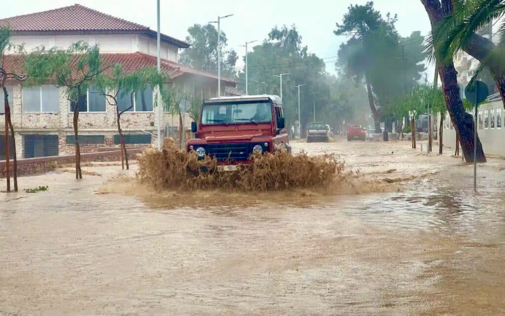
Three bad weather systems with heavy rainfall will hit Greece late on Sunday. Photo of a car in a flooded street in Greece. Credit: Greek Reporter
Greece is bracing for a new wave of severe weather with heavy rainfall and thunderstorms similar to the one that hit the country with floods causing two deaths in floodwaters.
According to the Hellenic National Meteorological Service (EMY), three consecutive waves of bad weather systems will hit Greece starting late on Sunday, following a short break of fair weather.
The first wave of severe weather will initially appear in the eastern Aegean and move towards the Ionian Sea – The phenomena will be intense in Attica, Eastern Macedonia and Thrace, and on Crete as well. It will be characterized by rains and storms in several parts of Greece.
According to EMY, the phenomena will be characterized by rainfall, strong winds, and intense phenomena in several areas.
In his weekly weather analysis, meteorologist Theodoros Kolydas speaks of continuous atmospheric disturbances, with weather systems succeeding one another without significant breaks.
According to his assessment, the rainfall will be long-lasting and frequent, while southeasterly winds are expected to keep thermometers at levels higher than normal for the season.
As he states, on Monday the phenomena may be strong mainly in the west, north and east Aegean, with an increased chance of locally heavy rainfall.
“We will be going through a week of weather where one system will come after the other in a total of three waves. The rains will be heavy and the southerly winds will keep the temperature at levels above normal. The phenomena may be strong on Monday in the west, north and east Aegean,” Kolydas stated on television.
Gale force winds in the Ionian Sea
According to meteorologist Sakis Arnaoutoglou, last week’s days of sunshine will give way to a new bad weather system that will initially appear in the eastern Aegean and then move towards the Ionian Sea.
As he points out, in the Ionian Sea region the winds will strengthen significantly, reaching 7 Beaufort points in places, with Corfu and the neighboring islands at the epicenter. On Monday, gale force winds will extend to the entire country, creating conditions that may affect the operation of coastal ferry routes.
On Monday also, strong phenomena are predicted for Kavala, Xanthi, Drama, and Thassos, while Attica will also be affected by heavy rains and storms until noon, accompanied by strong winds and a noticeable drop in temperature.
The phenomena will be particularly intense in the south of Crete as well as in the southwest of the country, with lower temperatures compared to previous days.
The weather on Monday
Cloudy in places with increased rain in most of the country. Sporadic storms will occur initially in the west and north and gradually in the remaining areas.
The phenomena, which will probably be strong in places in the west, north and eastern Aegean, will stop in the northwest in the evening hours. Snowfall will be recorded in the mountainous areas of the western and northern parts of the country.
Winds will blow in the west south-southeasterly 5 to 7 Beaufort points, quickly turning to west-southwesterly 4 to 6 Beaufort points. In the east, south-southeasterly 5 to 7 and in the Aegean locally 8 Beaufort points turning to southwesterly with a slight weakening in the central and northern parts in the afternoon.
Temperatures will record a slight drop, with the exception of the eastern Aegean. In the Ionian Sea and the mainland it will reach 15 to 17 degrees Celsius (59 to 62.6 Fahrenheit), while in the northwest it will not exceed 12 to 13 (53.6 to 55.4 Fahrenheit) and in the rest of the country it will reach 18 to 19 degrees Celsius (64.4 to 66.2 Fahrenheit).
The weather on Tuesday through Thursday
Temporarily increasing cloudy weather with local rains and sporadic storms mainly in the eastern and southern parts of Greece and temporarily in the Ionian Sea. The weather will improve in the afternoon in the west.
Light snowfalls will be noted in the mountainous areas of the Greek mainland. Winds will blow in the east and south south-southwest 4 to 6 and locally 7 Beaufort points. In the rest of the country, north-northwest 4 to 5 and gradually in the Ionian Sea 6 Beaufort points. points. Temperatures will drop slightly in the east and north of the country.
Meteorologists say that the weather will remain the same on Wednesday and Thursday; cloudy with rainfall, sporadic storms throughout the country, especially in the eastern Aegean.