
![[OC] Community-sourced map showing where automated license plate readers are deployed across the US](https://www.byteseu.com/wp-content/uploads/2026/02/zoi5pv05nclg1-709x1536.jpeg "[OC] Community-sourced map showing where automated license plate readers are deployed across the US")
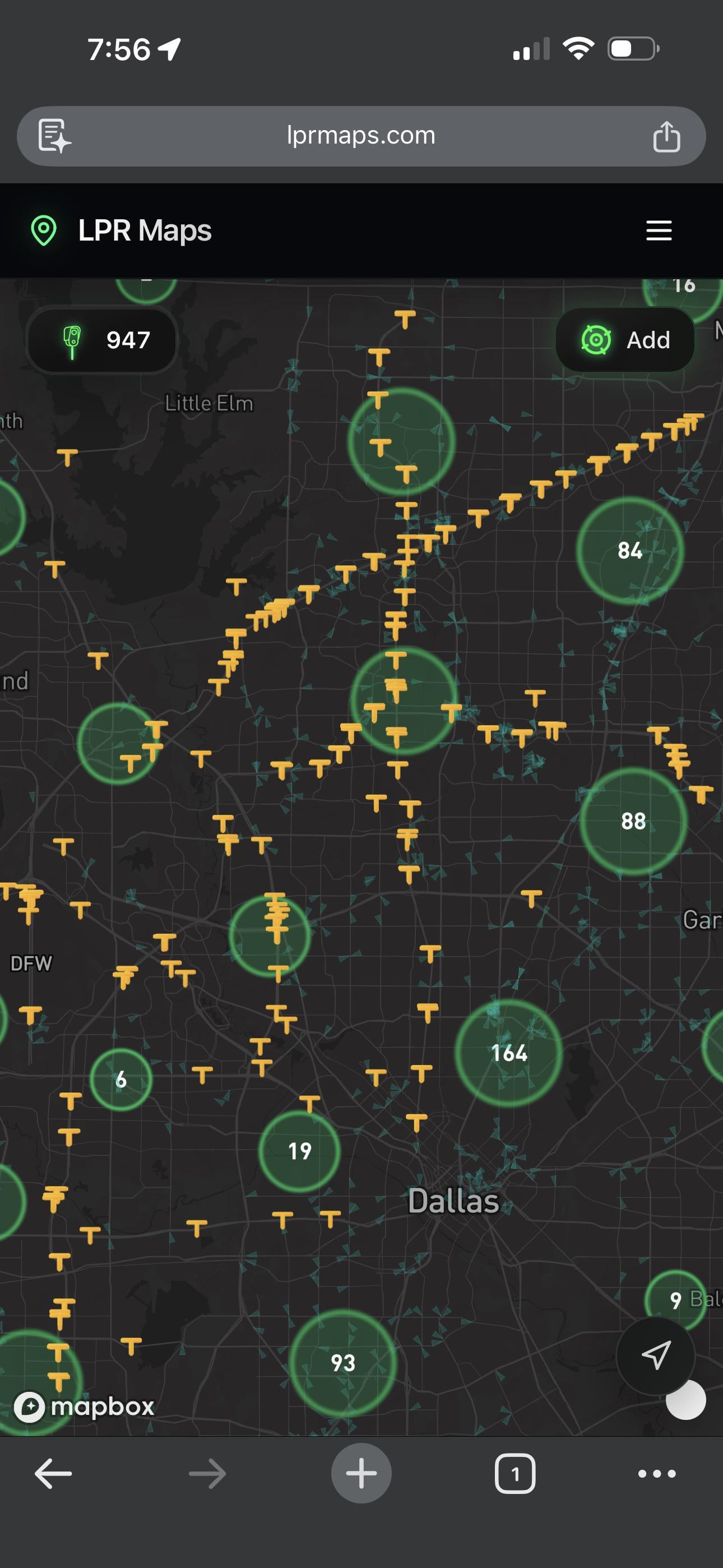
There’s a growing crowdsourced project mapping the locations of ALPRs (automated license plate readers) — the cameras that silently log every plate that drives by and store it in a database.
The map is at https://lprmaps.com and it’s interesting to see the density start to take shape as more people contribute. Some areas are way more saturated than you’d expect.
These systems have expanded massively in the last few years, but there’s no public registry of where they are. This is an attempt to change that through community reporting, similar to how Waze crowdsources traffic data.
Posted by skinnystick22
5 Comments
Now we need a car navigation app that creates routes that avoid these cameras
This country has turned into a freedom of business not of people
So its like the [deflock.org](http://deflock.org) map? Looks like its got about 5k less cameras reported. It’s missing almost all of them in my area. There’s about 9 near by and it only shows one.
why does the site have the same nodes as deflock.me. why does it lack the same ones I know aren’t on there in my local area? I know the answer: cuz I see it’s using openstreetmap
more importantly? why does the site require me to log on, and why does the terms of service page come back with Page Not Found.
Flock’s CEO has already said that he views people reporting these cameras as terroristic behavior, and this website is trying to get people to sign in. this feels like a honeypot reskin of the Deflock website to gather information on people that want to report cameras.
No, thanks.
Privacy seems to be a foreign concept in the US. They even publish mug shots of people, although their guilt is not proven yet.