

Authorities raised the volcanic alert level to V1 in the Faial–Pico channel, Azores, Portugal, on April 9, 2026, following low-magnitude seismic activity that began on April 1. The earthquakes occurred along a NE–SW trend west of Madalena to north of Lagido, spanning depths from 20 km (12 miles) to near the surface. The activity is located within the offshore volcanic system associated with Pico volcano, whose last confirmed eruption occurred in 1720 (VEI 2).
Low-magnitude seismic activity has been recorded since April 1, in the Faial–Pico channel, Azores, Portugal, within a NE–SW oriented structural zone extending from west of Madalena to north of Lagido. The activity encompasses the Cachorro Submarine Volcanic System and includes earthquakes distributed from approximately 20 km (12 miles) depth to near-surface levels.
The Azores Seismovolcanic Information and Monitoring Center (CIVISA) reported that seismicity during this period remained slightly above reference levels. In response to the observed activity, the agency raised the volcanic alert level for the Faial–Pico channel to V1 on April 9.
According to CIVISA’s volcanic alert scale, level V1 corresponds to a system in a meta-stable equilibrium phase with weak activity above reference levels. The activity at this level may be of tectonic, hydrothermal, and/or magmatic origin.
The affected zone includes offshore volcanic structures within the Faial–Pico channel. CIVISA states that, in submarine environments, eruptive activity may occur with limited precursory signals detectable by monitoring systems.
Seismological observations from early April include several small earthquakes recorded near Pico Island and Faial, some of which were felt locally at low intensity.
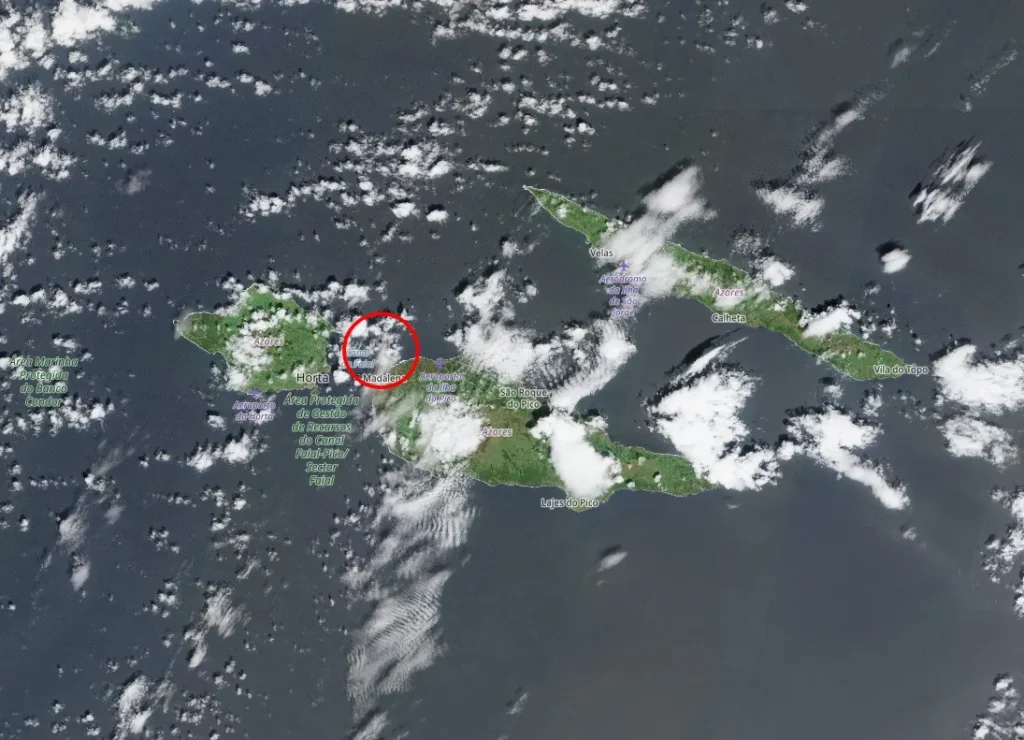 Seismic activity zone in the Faial–Pico channel offshore Pico Island, Azores, Portugal, marked by red circle. Satellite image acquired on April 14, 2026. Credit: CopernicusEU/Sentinel-2, The Watchers
Pico volcano is located on Pico Island and it’s the highest volcano in the Azores, rising to 2 351 m (7 713 feet). The edifice is predominantly basaltic and lies west of an older linear volcanic system with numerous flank cones that form most of the island.
Historical eruptions of Pico have originated primarily from flank fissures. An eruption beginning in 1562 (VEI 2) produced lava flows that reached the northern coast, while fissure eruptions in 1718 (VEI 2) affected both the north and south flanks. During the eruption in 1720 (VEI 2), lava flows from the southeast flank reached the ocean.
The current seismic activity is located within the offshore Faial–Pico channel. No eruption has been reported in association with this episode based on available information from CIVISA.
References:
1 Seismic activity in Faial–Pico channel and alert level update – CIVISA – Accessed April 17, 2026
2 Global Volcanism Program, 2026. Report on Pico (Portugal) (Sennert, S, ed.). Weekly Volcanic Activity Report, 9 April-15 April 2026 – Smithsonian Institution and US Geological Survey.