
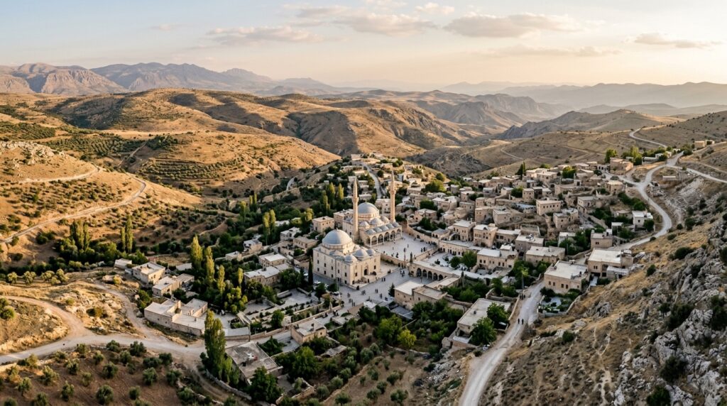
In an empirical study investigating the intersection of religious communalism and spatial production, researchers Büşra İnce and Hatice Kalfaoglu Hatipoglu examined how the Menzil Community, a prominent Sufi-based religious group affiliated with the Khalidiyya branch of the Naqshbandi tradition in Türkiye, constructs its spatial order across national and local scales. Published in the journal City, Territory and Architecture, the investigation addresses a notable gap in urban geography and planning scholarship, which has historically neglected the spatial configurations established by Sufi movements in modern secular contexts. By combining geographic information system mapping of nationwide institutional branches with detailed spatial and morphological analyses of Menzil Village in the Kahta district of Adıyaman, the researchers demonstrated that contemporary religious formations generate sophisticated counter-territorialities that function as alternative spatial orders rather than passive recipients of secular urban planning.
The study contextualizes this spatialization within broader sociological and geographic discussions regarding secularization and modernization paradigms. Historically, modern nation-state formation in Türkiye involved reformist regulatory measures such as the closure of dervish convents and lodges following the 1923 proclamation of the Republic, aiming to diminish religious visibility in the public sphere through supposedly neutral urban planning principles. In response to prolonged marginalization, faith-based groups adapted by cultivating internal autonomy and, especially from the 1990s onward alongside the resurgence of political Islam, establishing alternative socio-spatial structures. The authors argue that such communal formations operate as intentional or contractual communities, defined as voluntary associations organized around shared normative belief systems, common resources, and self-determined modes of governance that actively challenge hegemonic secular spatial arrangements.
To capture the multi-scalar footprint of the community, the researchers formulated a mixed-method methodological framework operating at macro, meso, and micro scales. At the macro level, the team executed a systematic nationwide audit across all cities in Türkiye, compiling coordinate data and identifying architectural typologies for every facility associated with the community through aerial and street-view imagery. Processed using QGIS software, this dataset revealed an extensive operational network extending outward from the primary spiritual hub. At the meso and micro scales, focusing directly on Menzil Village, the authors integrated on-site visual observations, informal field discussions with visitors and residents, diachronic aerial photographic analysis spanning from 2010 to 2025 via Google Earth Pro, and systematic CAD-based land-use drawings to map spatial hierarchies, access thresholds, and physical transformations over time.
Nationwide GIS mapping demonstrated that the Menzil Community operates through a coordinated, multi-centered institutional network rather than remaining confined to an isolated rural enclave. The spatial analysis categorized urban facilities into distinct functional typologies, ranging from small-scale multi-functional association offices housing bookstores, tea houses, and travel bureaus to substantial institutional structures and comprehensive architectural complexes operated under the Semerkand Foundation. While foundational representative offices are distributed broadly across the country to maintain daily links between urban followers and the rural center, comprehensive complexes hosting educational facilities, social welfare infrastructure, and media organizations are heavily concentrated in primary metropolitan centers, specifically Istanbul and Ankara, reflecting an intentional strategic expansion that uses large metropolitan hubs as major operational bases.
At the rural settlement scale, diachronic analysis revealed the dramatic physical evolution of Menzil Village from a modest rural settlement into an intensively developed, ritual-centered religious micro-city. Following its initial partial acquisition in 1972 by community founder Abdülhakim Erol, who relocated from the village of Binvalis in Bitlis to conduct religious education away from the growing political polarization of the 1970s, the community gradually acquired the entire village as private property owned by its leadership. Aerial photography from 2010 through 2025 documented continuous construction, physical densification, and the expansion of multifunctional zones encompassing prayer halls, madrasahs, guesthouses, commercial markets, and logistical hubs, presenting a stark developmental contrast to the architectural stability of neighboring settlements such as Elbeyi Village to the south.
The researchers determined that the spatial organization of Menzil Village is fundamentally anchored by two interrelated structural drivers: religiously coded semantic-normative practices and programmatic self-sufficiency. The primary organizing core of the settlement is the Menzil Mosque, which functions as both the liturgical center and the structural spine from which all surrounding public and communal uses, including courtyards, commercial markets, and dining areas, systematically originate. The daily rhythm of the settlement is tightly bound to religious timetables, including the five daily prayers, dhikr, rabita, and communal repentance ceremonies, complemented by practical welfare routines such as the regular distribution of free soup to visiting pilgrims following the afternoon and evening prayers.
Spatial mobility within Menzil Village is regulated through a strictly controlled, selectively permeable zoning apparatus reinforced by physical gates, structural barriers, volunteer personnel, and surveillance cameras. The central public core, designated as Zone-A, encompasses the primary mosque, marketplace, and the Merkad-ı Şerif mausoleum containing the tombs of former leaders, which forms the focal destination for short-term visitors whose stays are customarily restricted to a maximum of three days. Zone-B comprises specialized madrasah facilities and long-term accommodation for theological students and disciples. Strict gender segregation informed by traditional haremlik-selamlık principles governs these spaces, entirely barring female visitors from Zones A and B while directing them to Zone-C, a higher-privacy quarter providing dedicated guesthouses, prayer areas, and domestic amenities separate from general male foot traffic.
Programmatic self-sufficiency operates as the second foundational driver, enabling the settlement to sustain its intense visitor traffic while reinforcing socio-spatial autonomy. The village integrates traditional rural production, including horticulture, greenhouse farming, and livestock cultivation, with an expanding service and commercial infrastructure featuring hotels, visitor dining facilities, souvenir retail, and a centralized bus terminal. Commercial exchanges operate bilaterally, involving the sale of locally produced agricultural goods to outside markets alongside the distribution of affiliated commercial brands within the village. The authors note that this partial economic permeability distinguishes Menzil Village from completely insular communal models such as certain historic kibbutzim or Christian communes, aligning with Sufi principles that emphasize active engagement with the broader world over complete societal detachment.
The physical fabric of the settlement also dynamically mirrors internal leadership succession and institutional shifts. Following the death of Sheikh Abdulbaki Erol, the subsequent division of communal authority among his three sons led to an overt spatial renegotiation manifested through the partition of existing worship spaces and, beginning in 2025, the extensive demolition of surrounding rural residential fabric to accommodate the construction of a massive secondary mosque complex near the primary settlement axis. Additionally, the presence of Buhara Village in Eskişehir’s Sivrihisar district exemplifies how earlier leadership divisions resulted in the complete geographical replication of the Menzil rural intentional community model in an entirely separate region of Türkiye.
Evaluating the broader urban planning and governance implications, the authors conclude that religion-based intentional communities cannot be adequately understood through technical assumptions of value-neutral planning or simple regulatory prohibition. While recognizing that the constant influx of short-term pilgrims alleviates total institutional isolation, the researchers emphasize critical policy tensions surrounding democratic planning principles, transparency, and spatial equity. Public infrastructure investments, such as state-supported road and dam construction, have visibly accelerated development in Menzil Village compared to surrounding rural areas, highlighting political patronage concerns. The paper underscores that modern urban policy must navigate the delicate boundary between acknowledging the authentic spatial autonomy of religious communities and safeguarding individual rights, gender equity, and universal access to the city.
Subject of Research: Spatial analysis and territorialization dynamics of the Menzil Community in Turkey
Article Title: Religion-based communal formations in contemporary societies: examining the interscalar territoriality of the Menzil Community in Türkiye
Article References: İnce, B., & Kalfaoglu Hatipoglu, H. (2026). Religion-based communal formations in contemporary societies: examining the interscalar territoriality of the Menzil Community in Türkiye. City, Territory and Architecture, 13(1), Article 23. https://doi.org/10.1186/s40410-026-00310-1
Image Credits: AI Generated
DOI: 10.1186/s40410-026-00310-1
Keywords: Urban Geography, Spatial Analysis, Menzil Community, Territoriality, GIS Mapping, Intentional Communities, Sufism, Urban Planning, Religion-based, communal, formations, contemporary