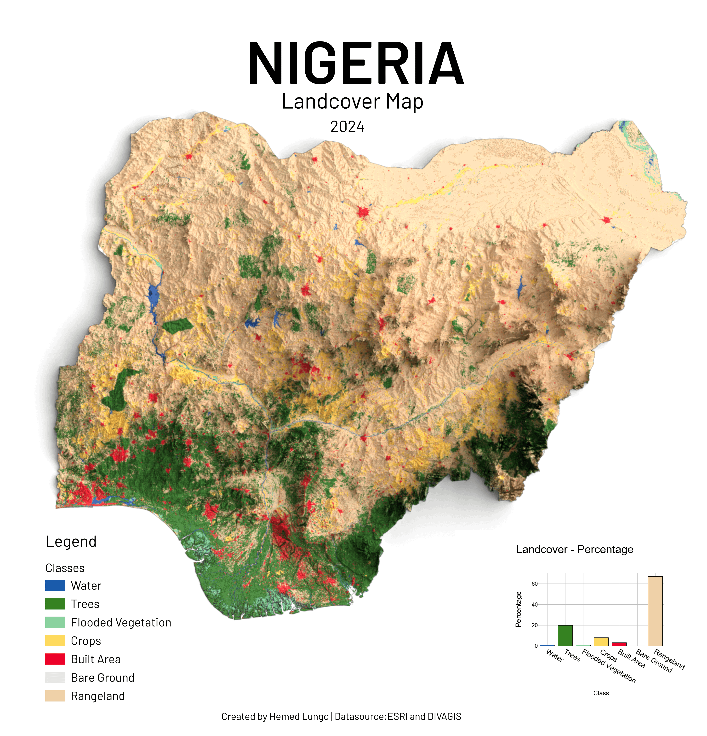
Share Facebook Twitter LinkedIn Pinterest Bluesky Threads [OC] Map Showing Nigeria Landcover Made Using QGIS And Blender Posted by hemedlungo_725
hemedlungo_725 on July 18, 2025 7:11 pm Tools: QGIS and Blender Datasource:Divagis and ESRI Landcover 2024
A_Juicy_Thing on July 18, 2025 7:14 pm The built areas seem rather small for a country of 228 million people. Are there inhabited regions that are not considered built areas?
Shot_Restaurant_5316 on July 18, 2025 9:12 pm How to do something like this? Do you have a tutorial or starting point?
Possible-Balance-932 on July 18, 2025 10:10 pm It seems like a country with a large population like Nigeria has less than 2% of its land area covered by red. If it becomes a planetary city, the population will easily exceed tens of trillions.

![[OC] Map Showing Nigeria Landcover Made Using QGIS And Blender](https://www.byteseu.com/wp-content/uploads/2025/07/7z3obfbylodf1-1477x1536.png "[OC] Map Showing Nigeria Landcover Made Using QGIS And Blender")
4 Comments
Tools: QGIS and Blender
Datasource:Divagis and ESRI Landcover 2024
The built areas seem rather small for a country of 228 million people. Are there inhabited regions that are not considered built areas?
How to do something like this? Do you have a tutorial or starting point?
It seems like a country with a large population like Nigeria has less than 2% of its land area covered by red.
If it becomes a planetary city, the population will easily exceed tens of trillions.