
![[OC] Distribution of Stone Circles in Ireland](https://www.byteseu.com/wp-content/uploads/2025/08/ft5wp6ny3nif1-1536x1086.jpeg "[OC] Distribution of Stone Circles in Ireland")
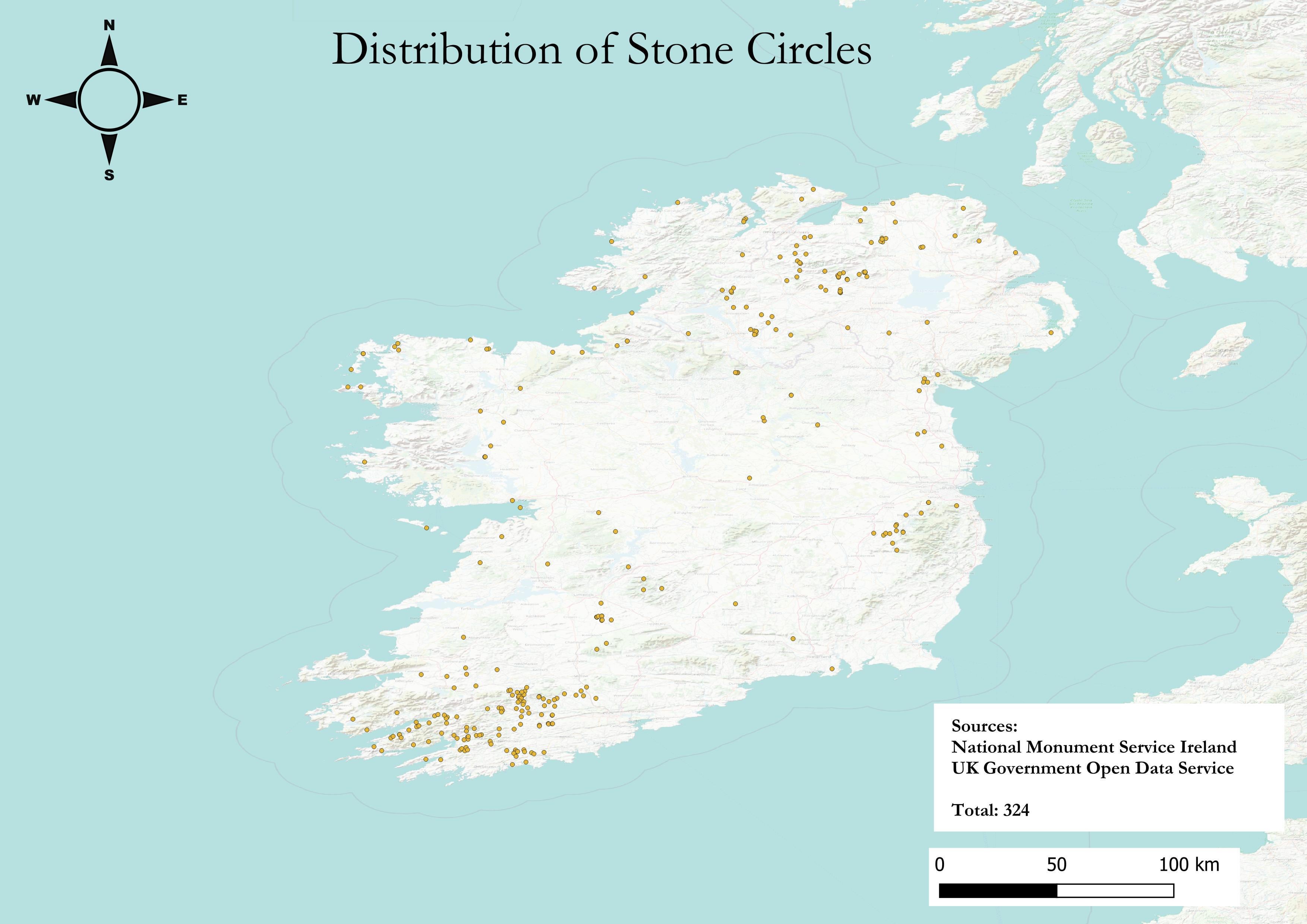
I mapped the distribution of Stone Circles across Ireland. This uses National Monument Service (Ireland) data and combines it with UK Open Data (Northern Ireland). I used PowerQuery to do the data ETL processes, and then ARCGIS to map this.
I'm still very new to mapping data visualisations, so welcome constructive feedback. I wanted to show the geographical features this time so I layered a various maps on top of each other and just changed their transparency. It seems to have worked well but was curious whether there's any issues I should be aware of.
Posted by Sarquin
3 Comments
For those who want to see the actual data sources check out NMS here [https://www.archaeology.ie/collections-and-publications/publications/monument-class-and-scope-notes/](https://www.archaeology.ie/collections-and-publications/publications/monument-class-and-scope-notes/) and the UK Open Data here [https://www.data.gov.uk/dataset/46240fa5-db15-469e-b1c8-0460504b951c/northern-ireland-sites-and-monuments-record](https://www.data.gov.uk/dataset/46240fa5-db15-469e-b1c8-0460504b951c/northern-ireland-sites-and-monuments-record) For the tooling, I used ARCGIS and PowerQuery (Excel). If you want to see more of my mapping attempts, you can check them out here: [https://www.danielkirkpatrick.co.uk/historical-maps-of-ireland/](https://www.danielkirkpatrick.co.uk/historical-maps-of-ireland/)
Circles roll, so it’s not surprising most of them ended up down the bottom.
Wow… TIL there are stone circles all over the island. Its not just Stonehenge!
For all the luddites like myself –
1) What was the purpose of these circles?
2) Why is Stonehenge so popular, since there are so many?