
![[OC] Distribution of prehistoric roads or toghers across Ireland](https://www.byteseu.com/wp-content/uploads/2025/09/e0xj6vujprof1-1024x724.jpeg "[OC] Distribution of prehistoric roads or toghers across Ireland")
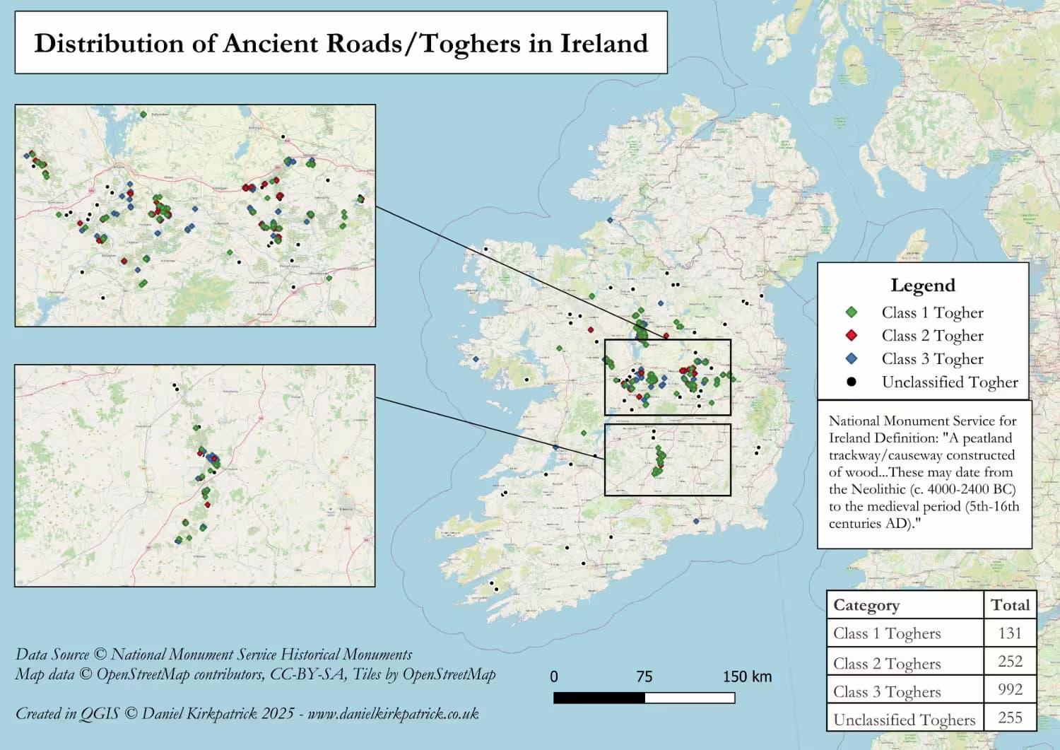
Here are all recorded toghers or roads dating to prehistoric Ireland from NMS data.
The map is populated with National Monument Service data (Republic of Ireland) and was built using some PowerQuery transformations and then designed in QGIS. Note there isn’t data available for Northern Ireland for this.
I suspect there’s a strong correlation between geographical terrain and the location of these roads, but thought I’d post here in case others are interested.
I previously mapped a bunch of other ancient monument types, the latest being on hillforts.
Any thoughts about the map or insights would be very welcome.
Posted by Sarquin
3 Comments
For those who want to see the data sources check out NMS here [https://www.archaeology.ie/collections-and-publications/publications/monument-class-and-scope-notes/](https://www.archaeology.ie/collections-and-publications/publications/monument-class-and-scope-notes/) and the UK Open Data here [https://www.data.gov.uk/dataset/46240fa5-db15-469e-b1c8-0460504b951c/northern-ireland-sites-and-monuments-record](https://www.data.gov.uk/dataset/46240fa5-db15-469e-b1c8-0460504b951c/northern-ireland-sites-and-monuments-record) For the tooling, I used QGIS and PowerQuery (Excel).
If interested in more of my research on the ancient roads across Ireland, particularly the 5 prehistoric highways, you can see it here: [https://www.danielkirkpatrick.co.uk/irish-history/ancient-roads/](https://www.danielkirkpatrick.co.uk/irish-history/ancient-roads/)
Do we know how the prehistoric people decided which class of togher to build in which spot? Perhaps it was by committee.
Cool map. To test the terrain correlation you could use [Unpaved.ai](http://Unpaved.ai) for quick analysis or explore QGIS plugins and Google Earth Pro.