
")
Hello to everyone in r/greece!
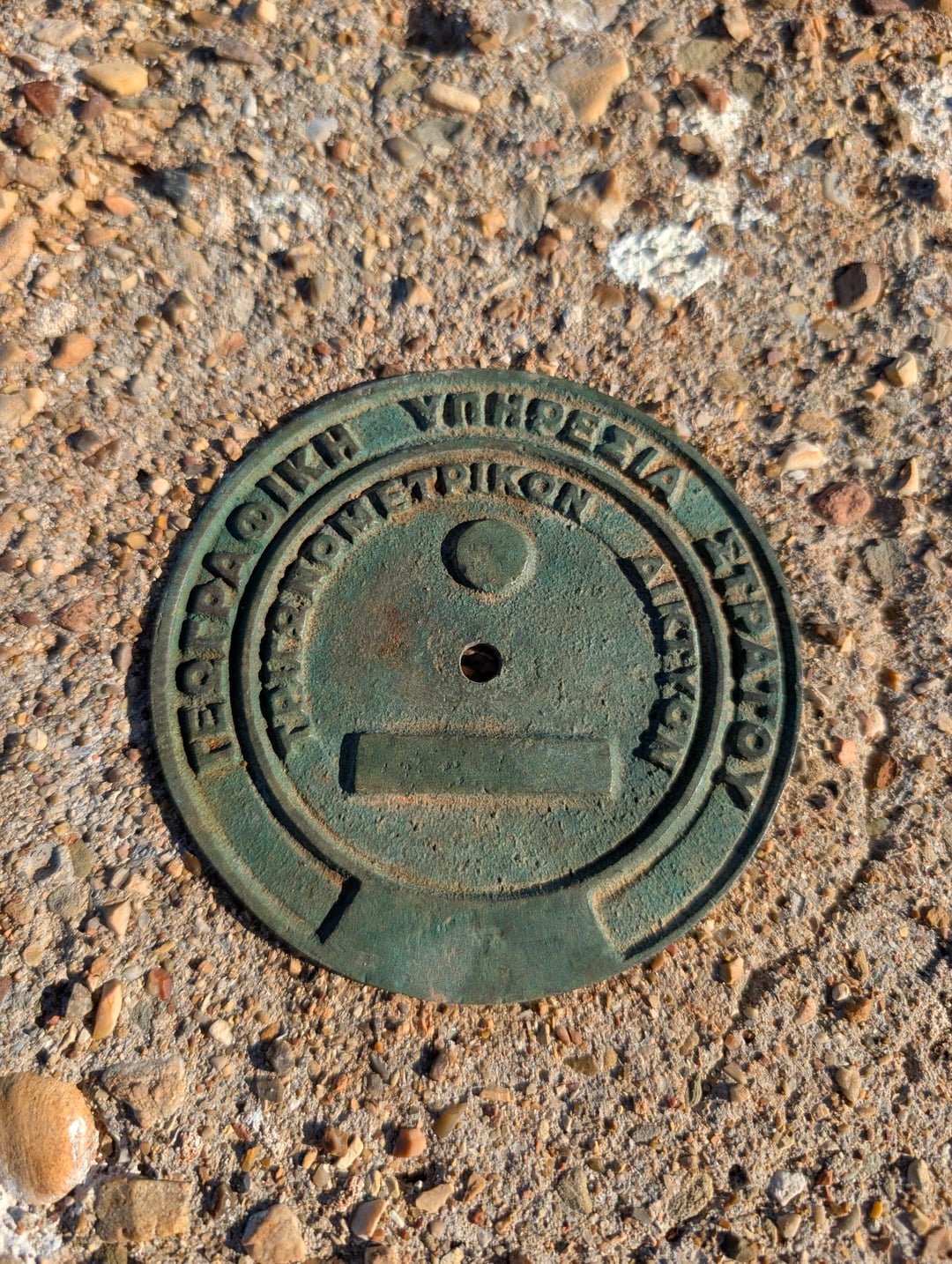
I am an engineer and I have always had a love for the maps and history of topography in Greece. Many may remember the old site, trigonometrika.gr, which was a fantastic resource for the trigonometric points of the Army Geographical Service (GIS). When I saw that the site was no longer active, I decided to make something new so that this effort would not be lost.
So in the last few weeks, I made from scratch the vathra.xyz
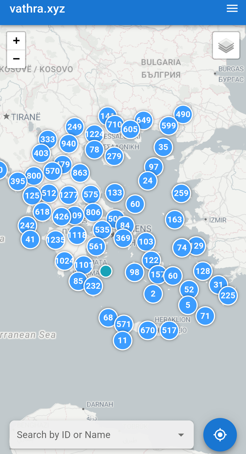
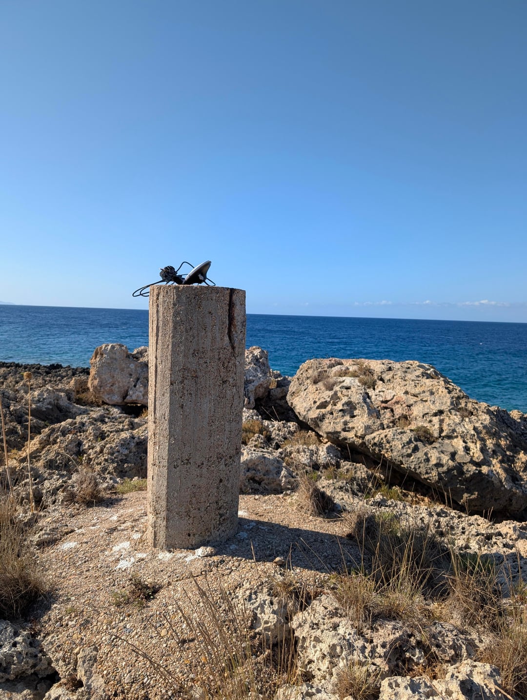
It is a free, open-source, and interactive map depicting all 25,000+ historical trigonometric pedestals throughout Greece. These small concrete columns, often found on mountains and hills peaks, have been the backbone of the country’s mapping for decades.
What you can do on the site: 🗺️ to see all the points on a quick, mobile-friendly map (with satellite and topographic view). 🟢 See their status with color coding. 📍 Find your location and the closest to you. 🔍 Look for specific points with their code or name. ✍️ contribute! This is the most important. If you are a hiker, explorer, or simply find one of them accidentally, you can log in with your Google account, upload a photo, update his status, and add comments about access.
The project is a personal endeavor and the code is fully open (AGPLV3) in GitHub.
I would love to hear your opinion, ideas for improvements, or if you find a bug. The purpose is to make a living file for this small, forgotten aspect of the Greek countryside.
Thanks!
TL;DR (in English): I built a free, open-source, crowd-sourced map for the 25,000+ historic trigonometric survey points across Greece, since the old community site for this is down. You can see all the points, check their status, and if you’re a hiker/explorer, you can log in to upload photos and report on the condition of points you find. I’d love to get your feedback! Check it out at https://vathra.xyz.
https://www.reddit.com/gallery/1ng9vsu
Posted by pierros
6 Comments
Ρε φίλε φαίνεται φουλ ενδιαφέρον αλλά τι είναι αυτά τα “τριγωνομετρικά σημεία” ;
ELIA5
Οταν εξασκούσα το επάγγελμα πριν αρκετά χρόνια παίζει και να σκότωνα για κάτι τέτοιο 🙂 συγχαρητήρια!
Παρά πολύ ωραία δουλειά! Δεν ήξερα ούτε εγώ τι είναι τα τριγωνομετρικα και είναι πολύ ωραίος τρόπος να μάθεις την ιστορία τους και να ψάξεις να βρεις αν υπάρχουν ακόμα.
Έχω κάποιες απορίες αν μπορείς να μου τις απαντήσεις:
– Διάφορα gys id από id ;
– Τι είναι το order;
– Έχεις ένας elevation και μια z coordinate. Παίρνεις τα δεδομένα από διαφορετικά πράγματα;
– Πως διαχωρίζεις αν κάποιο βάθρο ειναι οκ η unknown;
– Πετυχα 1 με αρνητικό elevation. Αν μπορέσω να το ξαναβρώ θα σ το στείλω
– Το reporting τι ειναι ;
Ωραίος!
Edit: θα με κανεις τώρα να πάω να δω την κατάσταση 3-4 στο χωριό μου στα οποία εχω να πάω πάνω από 30 χρονια. Ωραια ασκηση θα ειναι 🙂
Είσαι μαγκας
Is that what those pillars are for? I remember hiking up a tall mountain near my house in Lakonia and wondering why there was a singular little pillar on top.