
![Edo Domains, Clan Crests, and Kokudaka in ~1862 Japan [OC]](https://www.byteseu.com/wp-content/uploads/2025/09/l6iicvuopmpf1-1536x1086.png "Edo Domains, Clan Crests, and Kokudaka in ~1862 Japan [OC]")
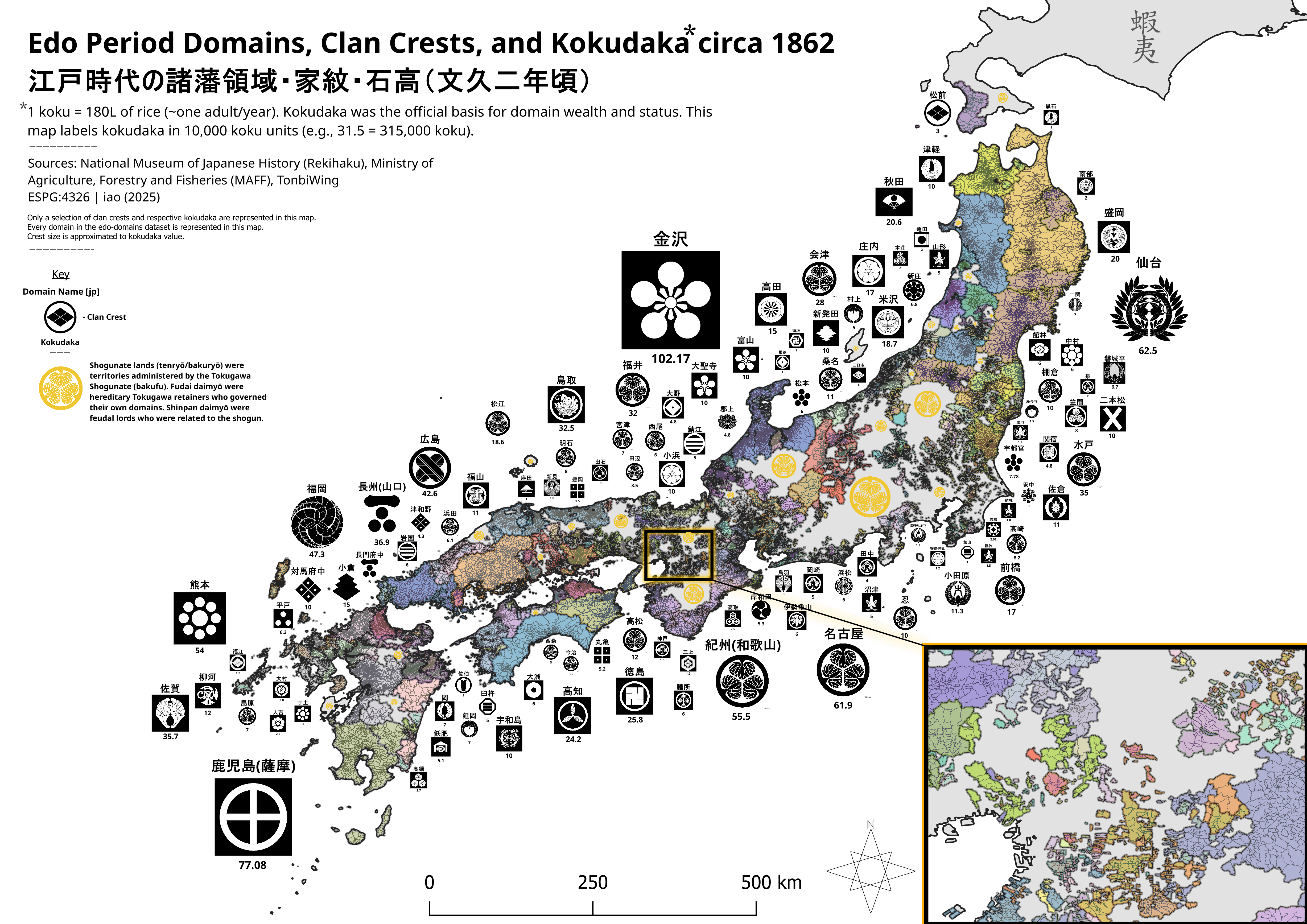
Only a selection of clan crests and respective kokudaka are represented in this map. Every domain in the edo-domains dataset is represented in this map.
Crest size is approximated to kokudaka value.
Edit: https://files.catbox.moe/x03ubu.png <- higher resolution image
Posted by geoiao
4 Comments
[OC] – This map was created using QGIS. The data is from National Museum of History (rekihaku), Ministry of Fisheries, Agriculture, and Forestry (MAFF), and Tonbiwing. The data aggregation was done by me. The data correspondence was done by me.
do you have a more, zoom in-able map?
There are several Tokugawa clans (hollyhock clan). We’re they one united clan or just as separate as any two different clans?
Mountain ranges just muddy the picture. Upvoting anyway because it’s unusual!