
")
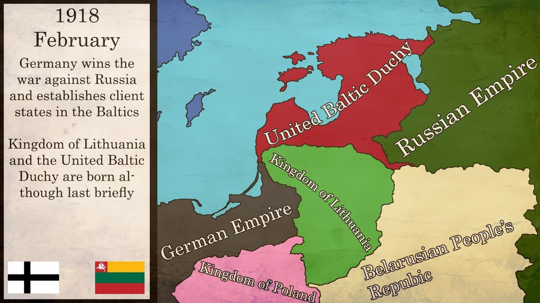
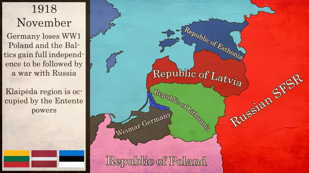
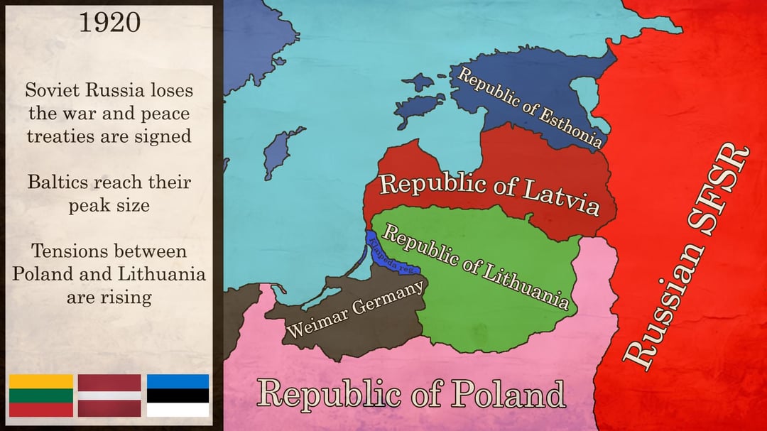

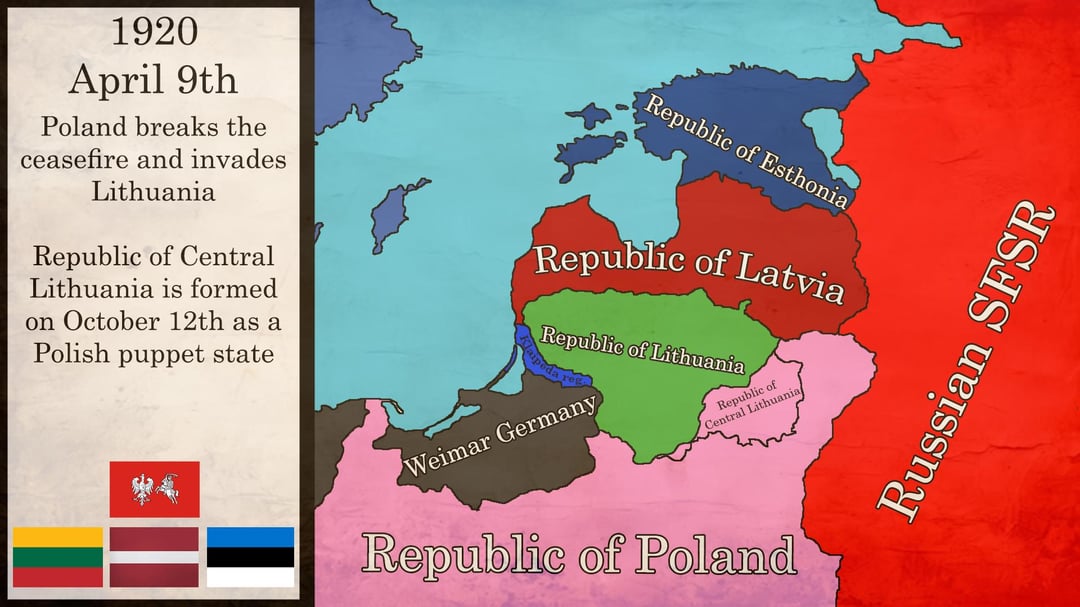

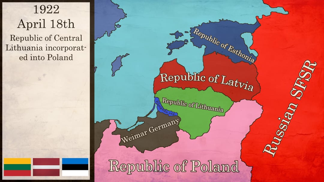
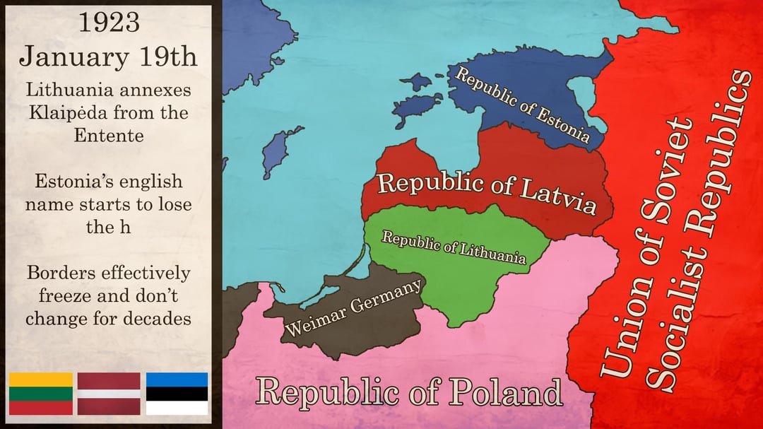
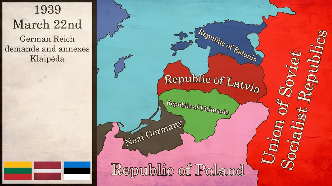
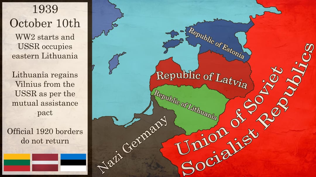
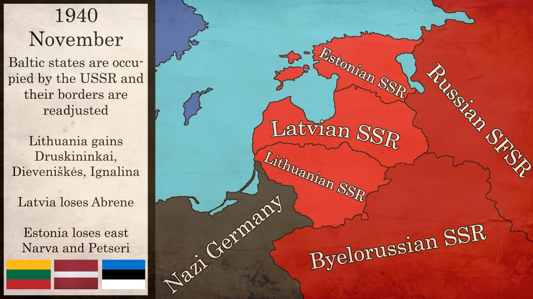
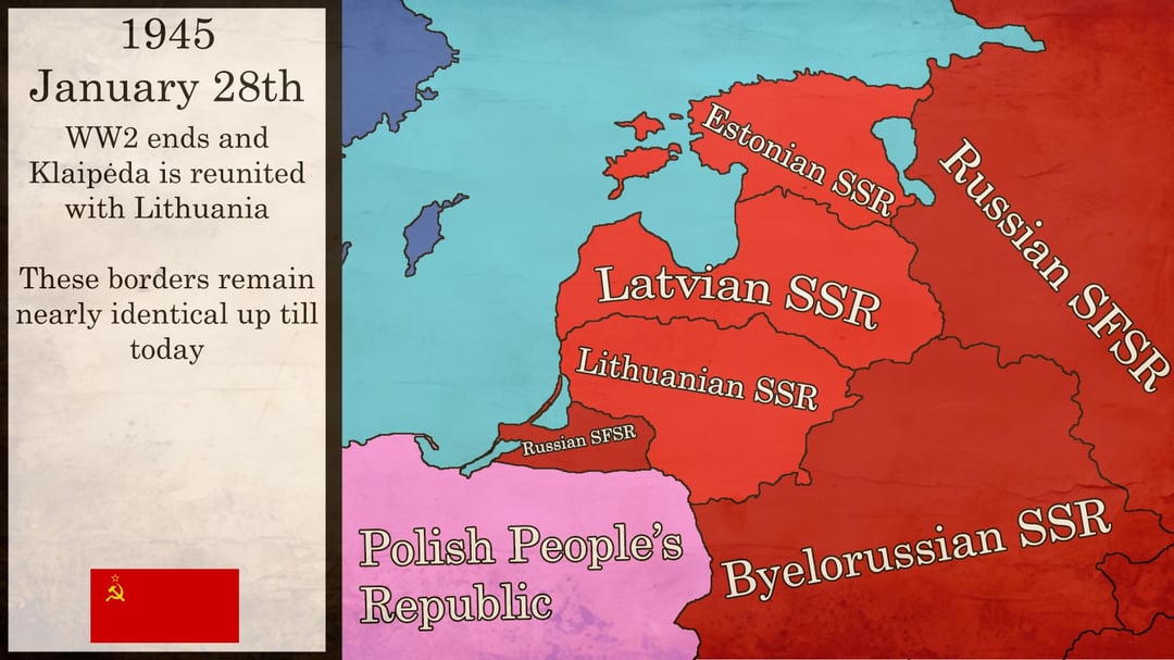
I created these maps, marking the most important territorial changes in the Baltic states. Basically, the interwar period in Latvia and Estonia was peaceful while we were fighting a war with the Poles. Due to conflicts and conflicting territorial ambitions, the maps are not accurate in the early years.
https://www.reddit.com/gallery/1pz6jsj
Posted by statykitmetronx