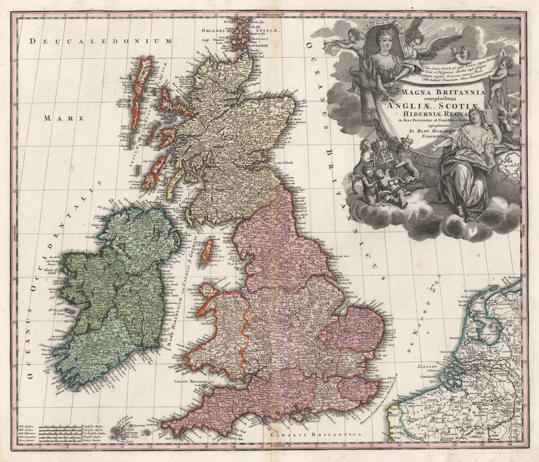
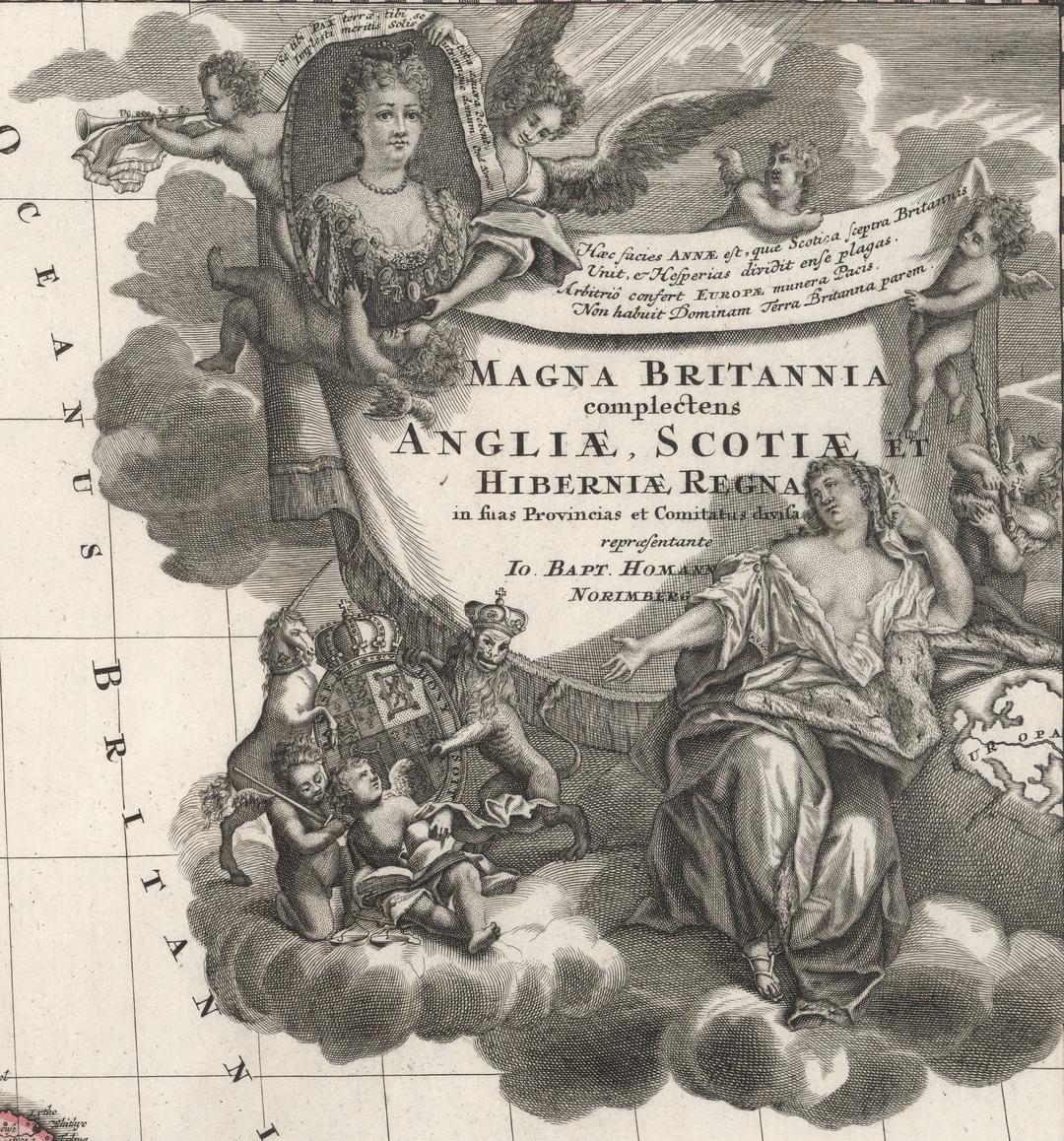
This map (Magna Britannia complectens Angliae, Scotiae et Hiberniae Regna) is by Johann Baptist Homann, the Imperial Cartographer of the Holy Roman Empire, from 1716.
Here's the full image in case anyone wants it.
Posted by Parzival_2k7


This map (Magna Britannia complectens Angliae, Scotiae et Hiberniae Regna) is by Johann Baptist Homann, the Imperial Cartographer of the Holy Roman Empire, from 1716.
Here's the full image in case anyone wants it.
Posted by Parzival_2k7
12 Comments
From an Irish person, thanks for not calling this The British Isles.
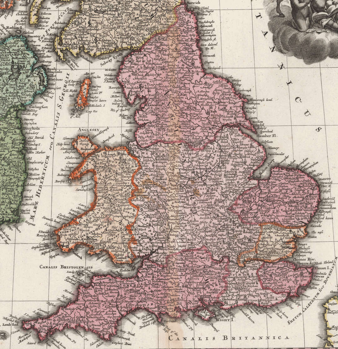
A very niche comment here but the inclusion of Tregaian on Anglesey is absolutely hilarious given it has about three houses and a church. Can only guess it’s because there’s a Manor House nearby but still…
There are some odd choices of which place names are included in this map, in Hampshire they’ve included Fareham and Southwick (small market towns at the time) but not Portsmouth – the headquarters of the Royal Navy!
Interesting that Homann decided to add the ‘heptarchy’ of Anglo-Saxon kingdoms to England.
Finally some actual map porn. I adore looking at old maps, and this is why i joined the sub
I still don’t know how they knew the exact shape of the island
Interesting to see the Google AI response to “Oceanus Britannicus” gets it totally wrong. Claiming that was the old way of naming the English Channel when in fact it’s the North Sea !
https://www.google.com/search?q=oceanus+britannicus&rlz=1CDGOYI_enGB781GB782&hl=en-GB&sourceid=chrome-mobile&ie=UTF-8
Amazing where did you find this!? Or did you recreate/enhance it!?
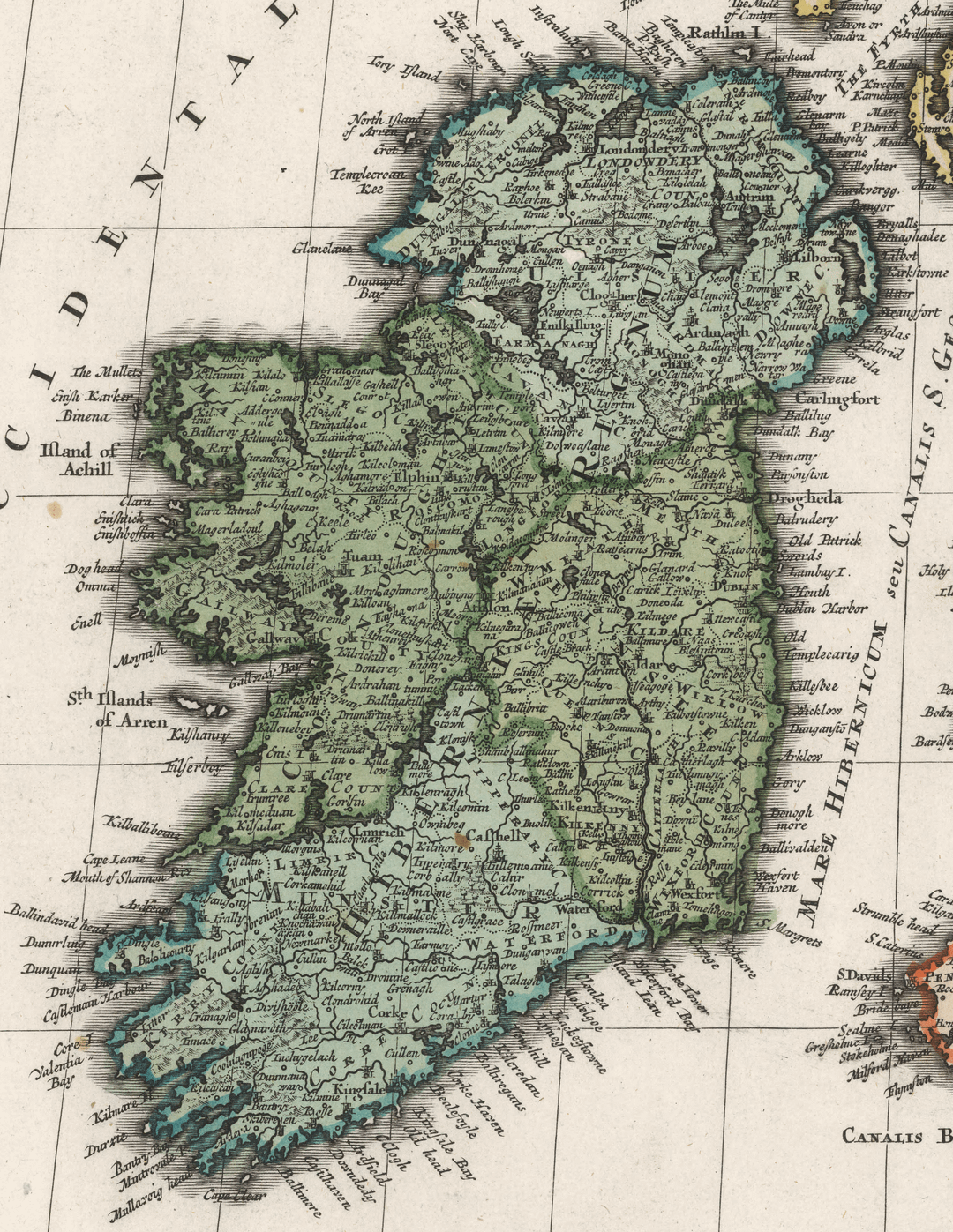
County Clare included in Connacht for some reason. Some really odd placenames included in ireland too. Some very small villages included, but some main towns left out.
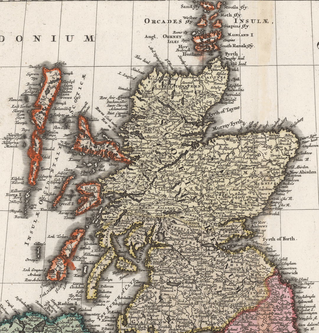
There’s so many markers in the scottish highlands before the clearances which started around 30 years after this map. Today that area is basically a wilderness
I wonder if anyone ever used these for anything back in the day or if they were just supposed to be put on display for prestige.
Cool find. Never knew Ireland wore a cardigan back then. Snug.