
![New map based on direct measurements estimates groundwater depth across the continental United States at a resolution of around 30 meters, as opposed to more common physics-based models with resolutions of around 1km [Communications Earth & Environment]](https://www.byteseu.com/wp-content/uploads/2026/01/S6eS6w7Vqia4-tuYT3yrP9-IGAULiv2HfI9AfuvyxkM-1536x864.jpeg "New map based on direct measurements estimates groundwater depth across the continental United States at a resolution of around 30 meters, as opposed to more common physics-based models with resolutions of around 1km [Communications Earth & Environment]")
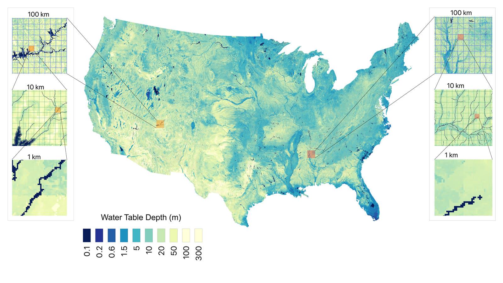
New map based on direct measurements estimates groundwater depth across the continental United States at a resolution of around 30 meters, as opposed to more common physics-based models with resolutions of around 1km [Communications Earth & Environment]
2 Comments
“High resolution US water table depth estimates reveal quantity of accessible groundwater” was published Jan. 14 in the journal Communications Earth & Environment [https://doi.org/10.1038/s43247-025-03094-3](https://doi.org/10.1038/s43247-025-03094-3)
It’s an interesting article, but it feels like a terrible headline. The headline really makes it sound like these values are JUST from direct measurements. But the abstract says “… Here, we develop a high-resolution (approximately 30 m) estimate of water table depth over the continental United States using machine learning that includes uncertainty. …”