

Listen to this article
Estimated 3 minutes
The audio version of this article is generated by AI-based technology. Mispronunciations can occur. We are working with our partners to continually review and improve the results.
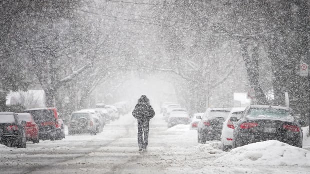
Parts of the Greater Toronto Area are under a heavy snowfall warning, with 10 centimetres expected to accumulate by late Wednesday afternoon, according to Environment Canada.
Residents should plan ahead with extra time for travel due to poor visibility from the heavy and blowing snow, the national weather agency said in a yellow-level snowfall warning.
An Alberta clipper, a low pressure system, is bringing heavy snow to Toronto, Durham and York regions. The snow is expected to ease late in the afternoon, said meteorologist Yoseph Mengesha with Environment Canada.
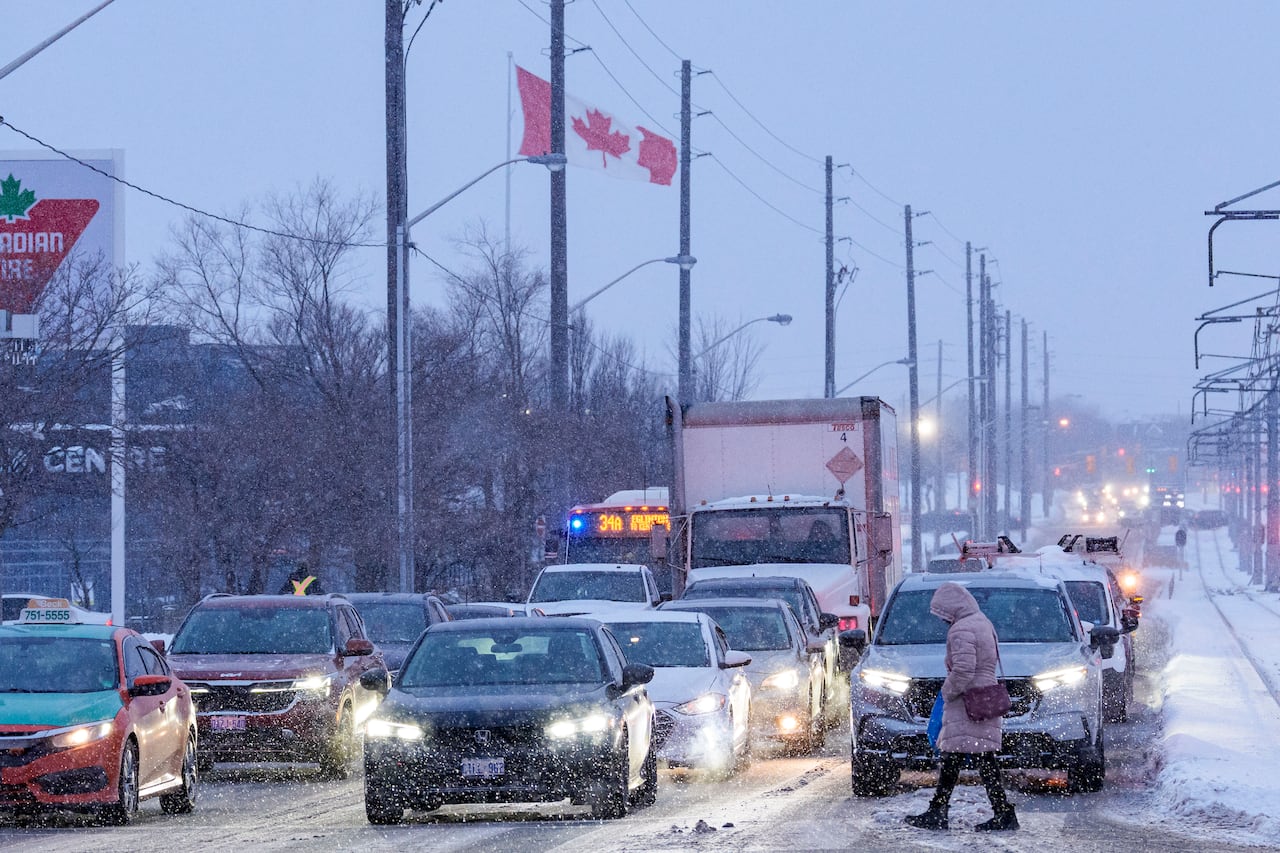
The evening commute may also be impacted, he said.
“Roads could be slippery at times and especially the rush hour traffic will be impacted,” he said, adding wind gusts could get up to 50 km/h in the afternoon.
Western parts of the GTA, such as Halton and Peel region, are not under a weather warning, but will see about five centimetres of snow by the evening.
Environment and Climate Change Canada has changed the way it classifies its weather warnings. CBC Meteorologist Ryan Snoddon explains it’s all about risk and impact.
There’s a high of -1 C in Toronto on Wednesday, feeling more more like -16 with the wind chill in the morning and like -7 later in the afternoon.
Snow will “get progressively heavier” Wednesday and be less fluffy than usual due to the frigid temperatures, said Environment Canada meteorologist Geoff Coulson on CBC Radio’s Metro Morning.
While some flurries are expected this weekend, he said the most concerning issue will be the cold.
“[We’re] looking at a morning wakeup temperature Saturday morning of -20 C which will be the coldest temperature so far this winter in the Toronto area,” he said. “The cold will be the big story going forward.”
Coulson warned people to be prepared and dress properly with winter boots and jackets.
Toronto commuters warned to go slow and plan ahead with heavy snowfall in the forecast Wednesday. (Evan Mitsui/CBC)
For some Scarborough residents, like Patrick Johnson, the snowfall warning is just a normal part of winters in Toronto.
He said people should try not to over-exert themselves while clearing driveways and to “watch out for crazy drivers.”
Mississauga resident Mohammed Ameer said he’s not looking forward to another round of snow that will likely make his commute back home from Scarborough even longer.
“The commute is definitely much slower, a lot more delays and stuff,” he said. “It’s really not fun.”
Airport, city ready for snow
Toronto schools are open on Wednesday, but bus service may face delays due to the weather, said the Toronto District School Board and Toronto Catholic District School Board on social media.
Crews will clear away snow and ice off the airfield and departing planes, said Toronto’s Pearson International Airport on social media.
“A traffic management initiative will be in place this morning for departing flights to ensure the safe and efficient flow of aircraft,” it said.
Snow removal from last week’s winter weather has been paused so city crews can focus on salting and plowing Wednesday, said the City of Toronto on social media Tuesday.
The city said plowing will begin when snow accumulation reaches the required threshold, such as five centimetres on major roads and 2.5 centimetres on expressways.
City crews salted roads Tuesday evening in anticipation of the upcoming snowfall, it said.