

We have evidenced the widespread disruptions provoked by storm Harry on land, but the scale of the cyclone covered the much wider extent of the sea surrounding the Maltese Islands. Though not visible to the naked eye, the STREAM marine digital service revealed that the impacts of the storm actually lasted much longer at sea.
Funded by the Space Research Fund of Xjenza Malta and running operationally at the Institute for Engineering & Transport of the Malta College of Arts, Science & Technology (MCAST) under the direction of Prof. Aldo Drago, STREAM provides unique, quantitative insights based on satellite data, enabling real-time monitoring of the marine environment.
The storm that hit our islands on 20th -21th January presented a situation that elevates the value of data services like STREAM permitting us to view, quantify and assess the impacts of extreme events on the marine ecosystem. It is supported by the JPI-Oceans project entitled “Process-based Assessment for Good Environmental Status” (PAGES) that aims to improve the implementation of the Marine Strategy Framework Directive (MSFD) in European seas by developing and applying process-based monitoring strategies to better understand and assess Good Environmental Status (GES) in marine waters.
A massive dust cloud transported by the storm from the Sahara Desert brought deposition of nutrients at sea. High waves penetrated deep into the sea, causing turbulent mixing up to approximately 100 metres below the surface and reaching up to the seafloor in large areas around the Maltese Islands. This extraordinary wave-induced vertical turbulence led to the resuspension of sediments and the injection of nutrients from below into the upper layer of the winter water column.
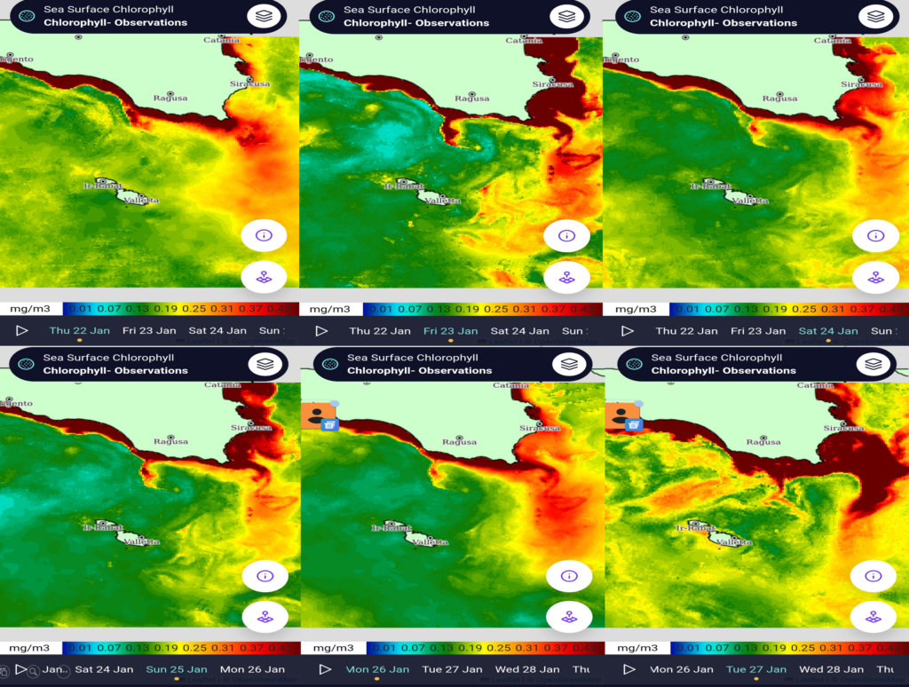
All these factors favoured a ‘fertilised’ sea, leading to higher biological activity, boosting primary production, and the proliferation of phytoplankton blooms which are evidenced by the sequence of satellite snapshots of sea surface chlorophyll concentration (Figure 1) taken from STREAM and showing the scale and detail of the evolving scenario during the six days following the storm.
Primary production is the foundation of the marine food web, supporting small pelagic fish, demersal fisheries, and sustaining healthy marine ecosystems.
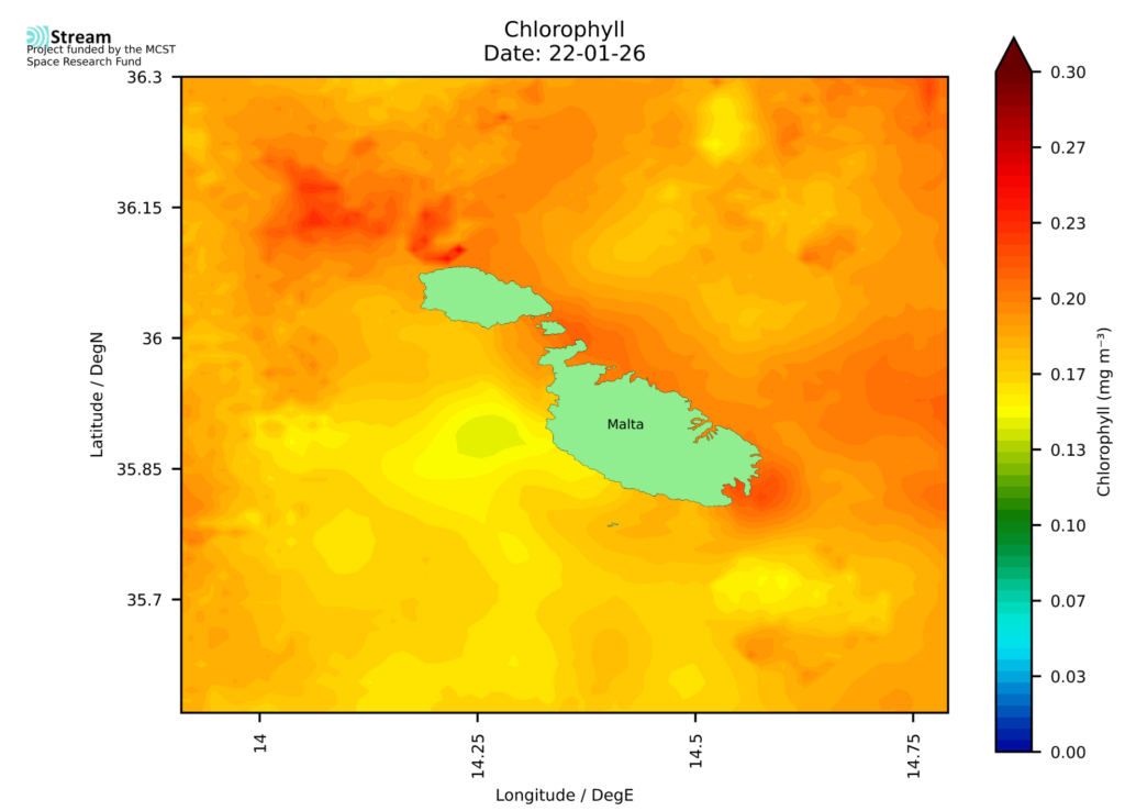
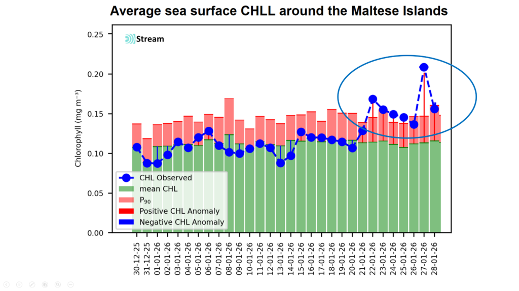
The daily primary production activity averaged along a 2 km strip around the Maltese Islands stepped up after the storm with evident peaks on 22nd and 27th January as shown in the second figure. The zoom on the Maltese Islands for 22nd January (Figure 3) illustrates the extent of the impact of the storm, with spot chlorophyll concentrations on the day reaching 0.26 mg/m³, this being more than double the value of 0.12 mg/m³ expected for this period in January.
This activation of primary production stimulated the marine food web, supporting a more prolific ecosystem and transferring energy to higher trophic levels with a direct influence on fish growth and recruitment. Ultimately, the storm brought not only devastation, but certainly positive outcomes to marine life.
Share this with someone who was affected by the storm
READ NEXT: Xjenza Malta Joins European Brain Health Partnership With €3.5 Million Research Boost