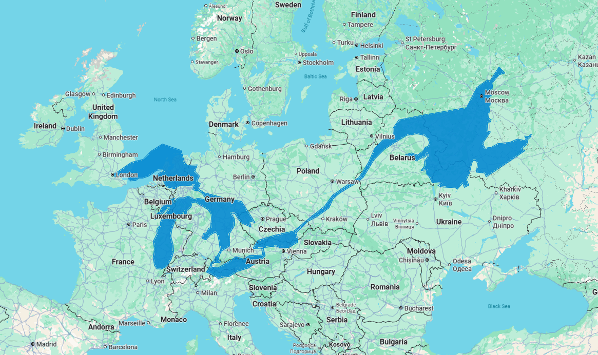
Just a quick tracing of the outline of the Great Lakes, St. Lawrence River, and the Gulf of St. Lawrence to get a rough idea of scale. Done in Google Maps, nothing fancy. Just thought it was neat to see the breadth of this huge and navigable watershed.
Posted by geffy_spengwa


9 Comments
hmmmmmmmmmmmmmmmmmmmmmmmmmmmmmmmm
I’d be living in the Michigan UP at the confluence of 3 lakes, that would be epic
And THAT’s how Rochelle Rochelle made her strange erotic journey from Milan to Minsk!
get rekt Netherlands, you’re smaller than a lake!
The Netherlands would be below sea level.
Lake Superior is huge. It is an inland freshwater sea. Lake Huron and Michigan are also large bodies of water. I drove from Sault Ste. Marie to Duluth and from lower MI to Copper Harbor. It takes a day of driving with stopping for a gas. The nature is amazing, especially between Huron mnts and Porkies.
Netherlands being Netherlands.
Ok. But we got a bigger lake just off to the right.
The lakes themselves look comparable to the Baltic. You might be able to swing Superior, Huron and Michigan around to fit.