

Satellite firm pauses imagery after revealing Iran’s attacks on US bases | Planet wants to prevent “adversarial actors” from using images for “Battle Damage Assessment” purposes.
https://arstechnica.com/space/2026/03/satellite-firm-pauses-imagery-after-revealing-irans-attacks-on-us-bases/
14 Comments
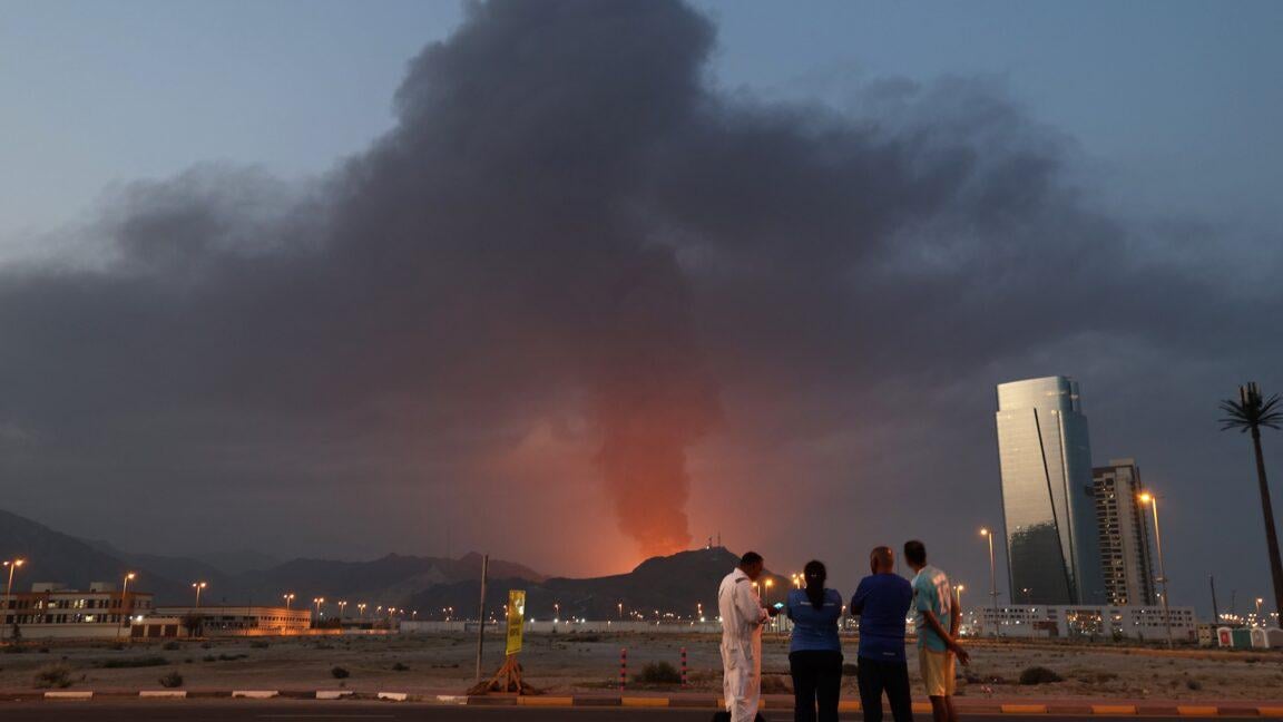
>Planet Labs, one of the world’s leading commercial satellite imaging companies, said Friday it is placing a hold on releasing imagery of some parts of the Middle East as a regional war enters its second week.
>The company, which brands itself as Planet, operates a fleet of several hundred Earth-imaging satellites designed to record views of every landmass on Earth at least once per day. Its customers include think tanks, NGOs, academic institutions, news media, and commercial users in the agriculture, forestry, and energy industries, among others.
>Planet also holds lucrative contracts selling overhead imagery to the US military and US government intelligence agencies.
>“In response to the conflict in the Middle East, Planet is implementing temporary restrictions on data access within specific areas of the affected region,” Planet said in a statement emailed to Ars. “Effective immediately, all new imagery collected over the Gulf States, Iraq, Kuwait, and adjacent conflict zones will be subject to a mandatory 96-hour delay before it is made available in our archive.”
>Imagery over Iran will remain available as soon as it is acquired, the company said. “This change applies to all users except authorized government users who maintain immediate access for mission-critical operations.”
If the DoD did not exercise shutter authority then I don’t see why they would do this proactively. Of course, it’s possible no one who’s left there with decision making authority actually knows they can do this…
ETA: I’m leaving the text above intact but saw some question about the term “shutter authority”. Shutter authority is the legal basis for shutter control which allows the US government to restrict imagery access. This is much less effective now that there are so many international imagery providers.
Seems like a good idea to me
Not the first time someone did this (starlink *cough* Russia)
yep, that will cost extra!
All of the other US satellite imaging companies knew not to do this before the war started. Planet if full of morons.
I suggest looking at NASA FIRMS website. If you zoom in on Tel Aviv there have been no fire events in the city in 31 days. Then look at some big cities not currently in a war zone, there will be fire events in almost all of them. I’m guessing NASA is censoring data on the FIRMS website.
Oh no! The Americans might feel some of the fear they inflict on everyone else! How horrid!
/s for the Americans
We have total air superiority, Iran cannot launch anymore attacks and has been defeated so what if they get sat imagery, it’s moot now.
[deleted]
lots of censorships involved from the Americas – middle east, US interests, Russia, Ukraine.
It’s good that China is slowly stepping in, so censorhip will not be that much of a thing going forward.
Oops, someone blew up a hospital or school.
You mean from us seeing the counter attacks from this illegal war of aggression
they don’t want the Western world to see billions of dollars of destruction.