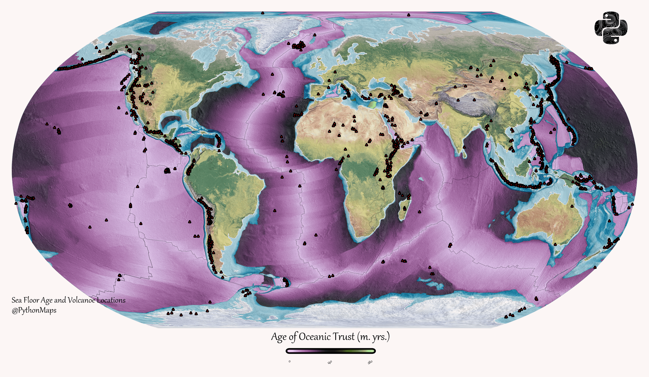
The data source is from NOAA, ‘Marine Geology and Geophysics Images of Crustal Age of the Ocean Floor’. I used GDAL, geopandas and rasterio for data processing and plotted the map using matplotlib / rasterio.
Boop0p on
I don’t understand it. The key has pink, black and green. What I can see (other than land) is pink, black, and light blue. Are you saying that the land is the oldest “oceanic crust”? Also, key says trust rather than crust.
theanedditor on
I’d just like to congratulate you on one of the most unreadable maps every produced. Really well done.

![[OC] Mapping the age of oceanic crust, overlayed with the locations of the world's volcanoes](https://www.byteseu.com/wp-content/uploads/2026/04/cej3dmc588tg1-1536x894.png "[OC] Mapping the age of oceanic crust, overlayed with the locations of the world’s volcanoes")
5 Comments
More can be found on my twitter – https://twitter.com/PythonMaps or Instagram.
The data source is from NOAA, ‘Marine Geology and Geophysics Images of Crustal Age of the Ocean Floor’. I used GDAL, geopandas and rasterio for data processing and plotted the map using matplotlib / rasterio.
I don’t understand it. The key has pink, black and green. What I can see (other than land) is pink, black, and light blue. Are you saying that the land is the oldest “oceanic crust”? Also, key says trust rather than crust.
I’d just like to congratulate you on one of the most unreadable maps every produced. Really well done.
Pretty.
Pretty fuckin useless, that is.
Map of trust? I dont trust this at all.