
Sunday, Apr 5, 2026 09:52 | 1 hour ago | By: EarthquakeMonitor
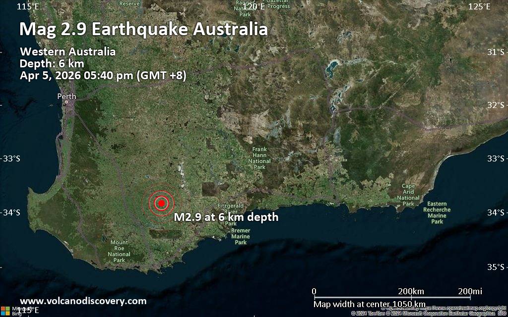
An earthquake of magnitude 2.9 occurred in the afternoon on Sunday, April 5th, 2026, at 5:40 pm local time near Katanning, Western Australia, Australia, as reported by the European-Mediterranean Seismological Centre (EMSC).
According to preliminary data, the quake was located at a very shallow depth of 3.8 miles. Shallow earthquakes are felt more strongly than deeper ones as they are closer to the surface. The exact magnitude, epicenter, and depth of the quake might be revised within the next few hours or minutes as seismologists review data and refine their calculations, or as other agencies issue their report.
Towns or cities near the epicenter where the quake might have been felt as very weak shaking include Pallinup (pop. 78) located 6 miles from the epicenter, Gnowangerup (pop. 590) 8 miles away, and Jackitup (pop. 60) 9 miles away. In Broomehill (pop. 380, 18 miles away), Tambellup (pop. 370, 23 miles away), and Katanning (pop. 3,700, 24 miles away), the quake was probably not felt.
If you felt it, report it through our site or app right now!
Earthquake data:
I felt this quake
Date & time: 2026-04-05 17:40 local time (5 Apr 2026 09:40 GMT)
Magnitude: 2.8
Depth: 6.08 km
Epicenter latitude / longitude: 33.83°S / 117.95°E ![]() (Gnowangerup, Australia)
(Gnowangerup, Australia)
Primary data source: GeoAu