

 Credit: WeatherBell
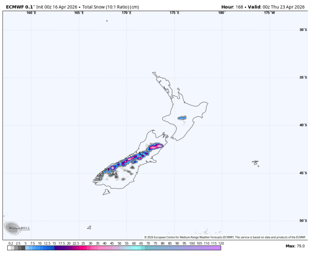
A long South Island storm cycle is the main story for New Zealand this week. After a mostly minor Friday-Saturday stretch and a fading wet burst around Ruapehu, snowfall expands Sunday afternoon and then continues in waves into Thursday, with the strongest and most reliable accumulations focused on Canterbury and inland South Island fields. Confidence is highest from Friday through Thursday midday, when timing agreement is good even though totals still vary by resort and elevation; confidence drops again after that as the next weekend signal turns much less coherent.
Ruapehu starts the period with an ongoing wet burst that fades quickly on Friday. Snow levels there lift from about 1,900 meters toward 2,100 meters and SLRs sit near 4-6, so any last snow is dense and mostly confined to upper mountain terrain. Across the South Island, Friday into Saturday looks more like a quiet setup than a storm cycle. The guidance converges on limited coverage and only minor precipitation, but it still diverges on whether a few higher fields squeeze out 2-5 cm or stay nearly dry. Snow levels generally hold near 1,400-1,700 meters with exposed winds mostly in the 20-40 km/h range, so changes before Sunday should be modest.
From Sunday afternoon through Tuesday night, the guidance lines up on a prolonged South Island storm cycle. Timing confidence is good, with snow pushing in Sunday afternoon and ramping hard Sunday night, but totals still diverge substantially between the lighter and heavier solutions. The best overlap for meaningful snowfall is from Porters and Mt. Hutt south through Mount Dobson and Ohau, where the forecast supports 30-150 cm by Thursday midday, while the Queenstown and Wanaka fields are more elevation-sensitive and generally closer to 6-32 cm. Most guidance also converges on snow levels dropping into roughly 900-1,500 meters during the core of the storm, with colder east-of-the-divide bursts briefly nearer 800-1,100 meters. SLRs mostly run 8-11, so expect dense to moderate snow rather than blower powder, and exposed ridges look windy enough for 30-50 km/h sustained flow with gusts locally 70-110 km/h.
Wednesday into Thursday keeps the South Island active, but the storm becomes more uneven as it winds down. There is still solid agreement on lingering snow for Canterbury and the Mackenzie Basin through Thursday morning, but the guidance diverges more on Thursday afternoon intensity, on how far west the leftovers reach, and on whether Ruapehu reloads at all. Turoa has a modest wet-snow signal of 8-15 cm in the forecast, while Whakapapa may do little if snow levels stay closer to 1,800-1,900 meters. Snow quality also slips later in the cycle as snow levels edge back toward 1,400-1,600 meters and SLRs settle near 6-9. Beyond Thursday, expectations should be conservative: a weak late-weekend top-up is possible, but guidance spread is large and most listed ski areas are still closed, so this looks more like early-season base building than immediate lift-served payoff.
Resort Forecast Totals (Fri Apr 17 – Thu Apr 23)
- Mount Dobson – 88-154 cm
- Mt. Hutt – 78-137 cm
- Porters – 53-94 cm
- Ohau – 27-46 cm
- Cardrona – 20-32 cm
- The Remarkables – 15-25 cm
- Treble Cone – 11-18 cm
- Turoa – 8-15 cm
- Coronet Peak – 6-11 cm
- Whakapapa – 0 cm