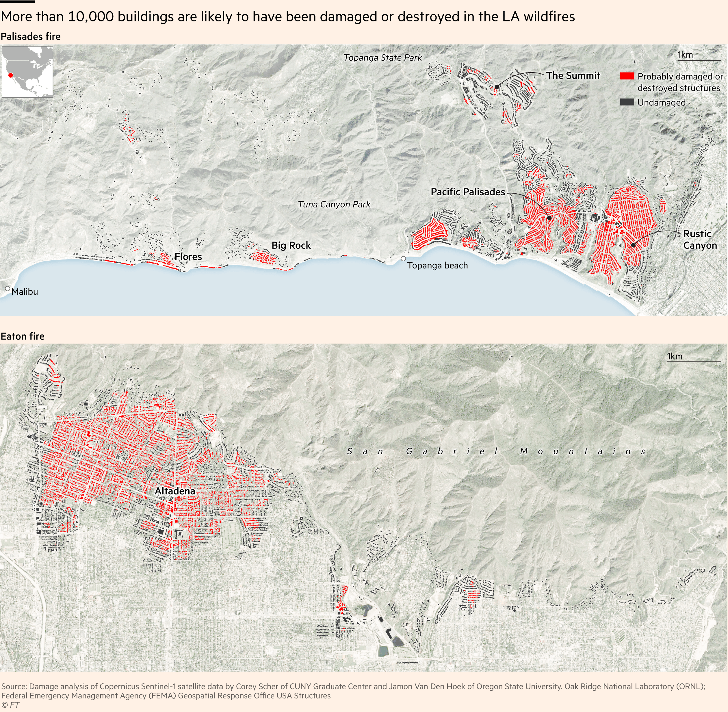
Source: Damage analysis of Copernicus Sentinel-1 satellite data by Corey Scher of CUNY Graduate Center and Jamon Van Den Hoek of Oregon State University. Oak Ridge National Laboratory (ORNL); Federal Emergency Management Agency (FEMA) Geospatial Response Office USA Structures
Tools: QGIS and Illustrator
Sniperchild on
Is the area between the buildings all forest that was on fire?
amazonhelpless on
Dr. Van Den Hoek is a badass.
montecarlocars on
This is a great quick reference, but be aware it’s not 100% accurate–a house I’ve heard was destroyed in the Palisades fire is showing on this map as “undamaged.”
Deathglass on
Is that even LA? I don’t recognize any of the places on the map
Cityplanner1 on
Any idea of the population of the houses that burned. My guess is around 30,000 people lost their homes in these maps.

![[OC] Maps showing likely damaged structures from LA fires](https://www.byteseu.com/wp-content/uploads/2025/01/x110bwx9g6ce1-1536x1502.png "[OC] Maps showing likely damaged structures from LA fires")
6 Comments
Source: Damage analysis of Copernicus Sentinel-1 satellite data by Corey Scher of CUNY Graduate Center and Jamon Van Den Hoek of Oregon State University. Oak Ridge National Laboratory (ORNL); Federal Emergency Management Agency (FEMA) Geospatial Response Office USA Structures
Tools: QGIS and Illustrator
Is the area between the buildings all forest that was on fire?
Dr. Van Den Hoek is a badass.
This is a great quick reference, but be aware it’s not 100% accurate–a house I’ve heard was destroyed in the Palisades fire is showing on this map as “undamaged.”
Is that even LA? I don’t recognize any of the places on the map
Any idea of the population of the houses that burned. My guess is around 30,000 people lost their homes in these maps.