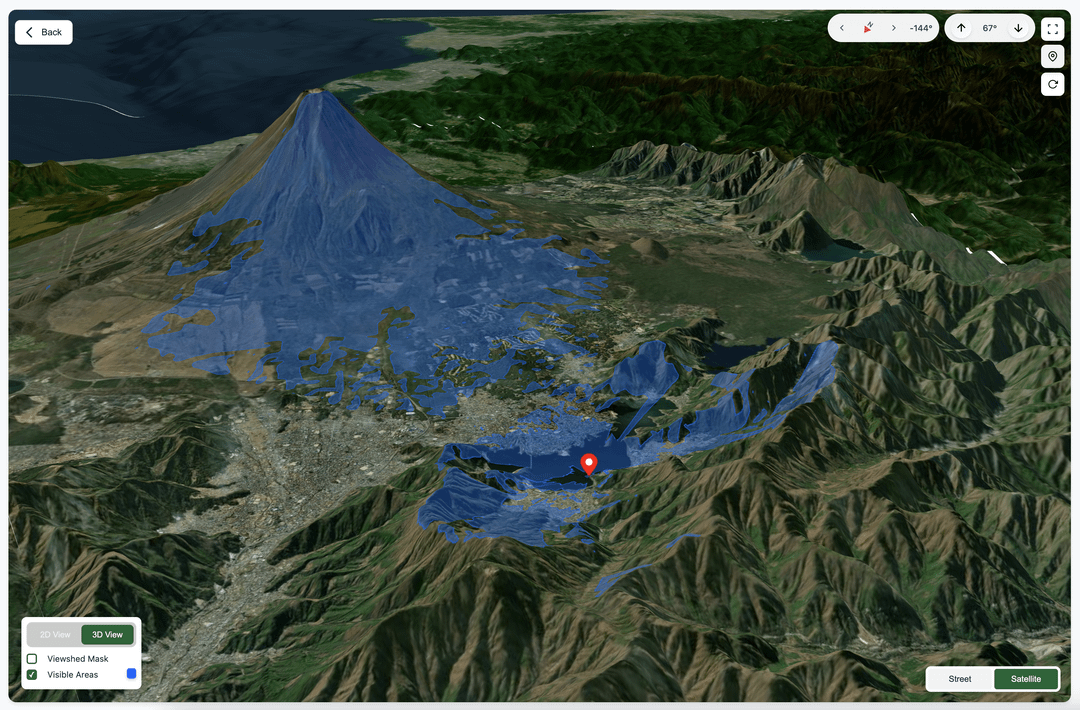
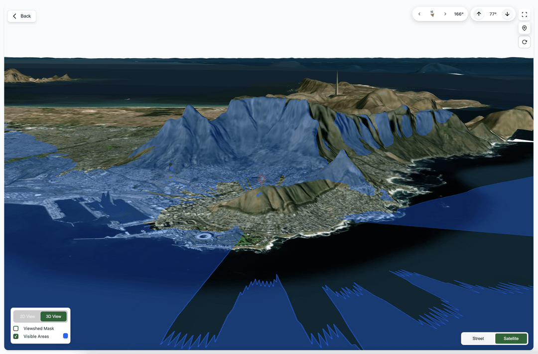
Did it based on NASA’s SRTM Digital Elevation 30m and cool libraries like three.js to plot it. You can try any location at [uptowhere.com](https://www.uptowhere.com/)
Would love to recieve feedback on it to be able to improve it 🙂
Motti66 on
Great! This helps planning any trip for hiking for instance.

![[OC] Visualizing exactly what you can see from any point on Earth](https://www.byteseu.com/wp-content/uploads/2025/03/gqmzr9iagune1-1024x673.png "[OC] Visualizing exactly what you can see from any point on Earth")
4 Comments
is this a 3d upgrade for [Heywhatsthat.com](http://Heywhatsthat.com) ?
Did it based on NASA’s SRTM Digital Elevation 30m and cool libraries like three.js to plot it. You can try any location at [uptowhere.com](https://www.uptowhere.com/)
Would love to recieve feedback on it to be able to improve it 🙂
Great! This helps planning any trip for hiking for instance.
well the only down is the long calculation time…