NASA image reveals evidence of ancient “megamonsoons” in western US
https://www.newsweek.com/nasa-megamonsoons-western-usa-wyoming-pangaea-triassic-2061053


NASA image reveals evidence of ancient “megamonsoons” in western US
https://www.newsweek.com/nasa-megamonsoons-western-usa-wyoming-pangaea-triassic-2061053
3 Comments
By Melissa Fleur Afshar – Life and Trends Reporter:
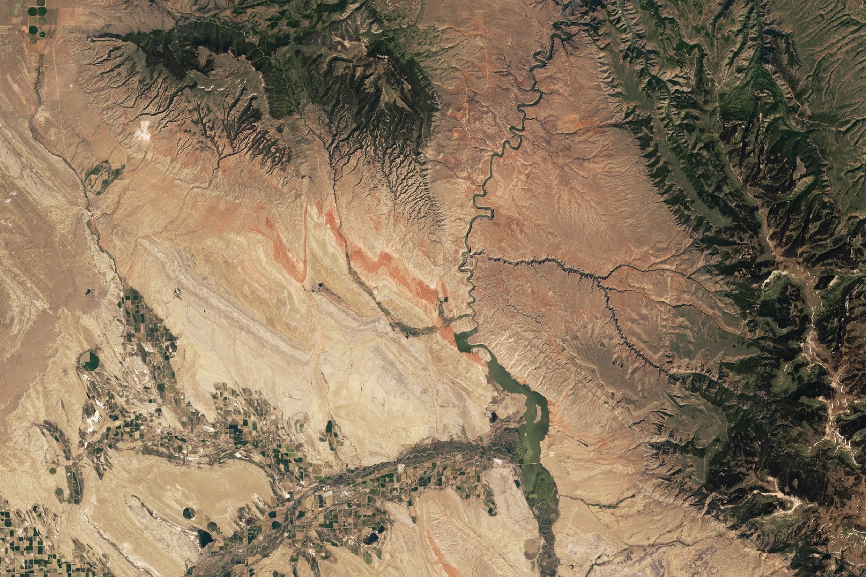
A newly released satellite image from NASA’s Earth Observatory has unveiled dramatic evidence of the extreme weather phenomena that shaped the prehistoric American West.
The image, captured by the Landsat 9 satellite’s Operational Land Imager-2 in June 2024, shows deep red rock formations outcropping in Montana and Wyoming that scientists believe were formed by ancient “megamonsoons” some 220 million years ago.
Read more: [https://www.newsweek.com/nasa-megamonsoons-western-usa-wyoming-pangaea-triassic-2061053](https://www.newsweek.com/nasa-megamonsoons-western-usa-wyoming-pangaea-triassic-2061053)
Dang. On first scan, I thought that said megamongoose.
Here’s the actual link If you don’t want newsweek to blast you with ads – https://earthobservatory.nasa.gov/images/154176/relics-of-a-red-world-in-bighorn-basin