Software used: QGIS and Blender
Datasource: from Federal Institute for Geosciences and Natural Resources (Living Atlas) and Esri Germany
Posted by hemedlungo_725

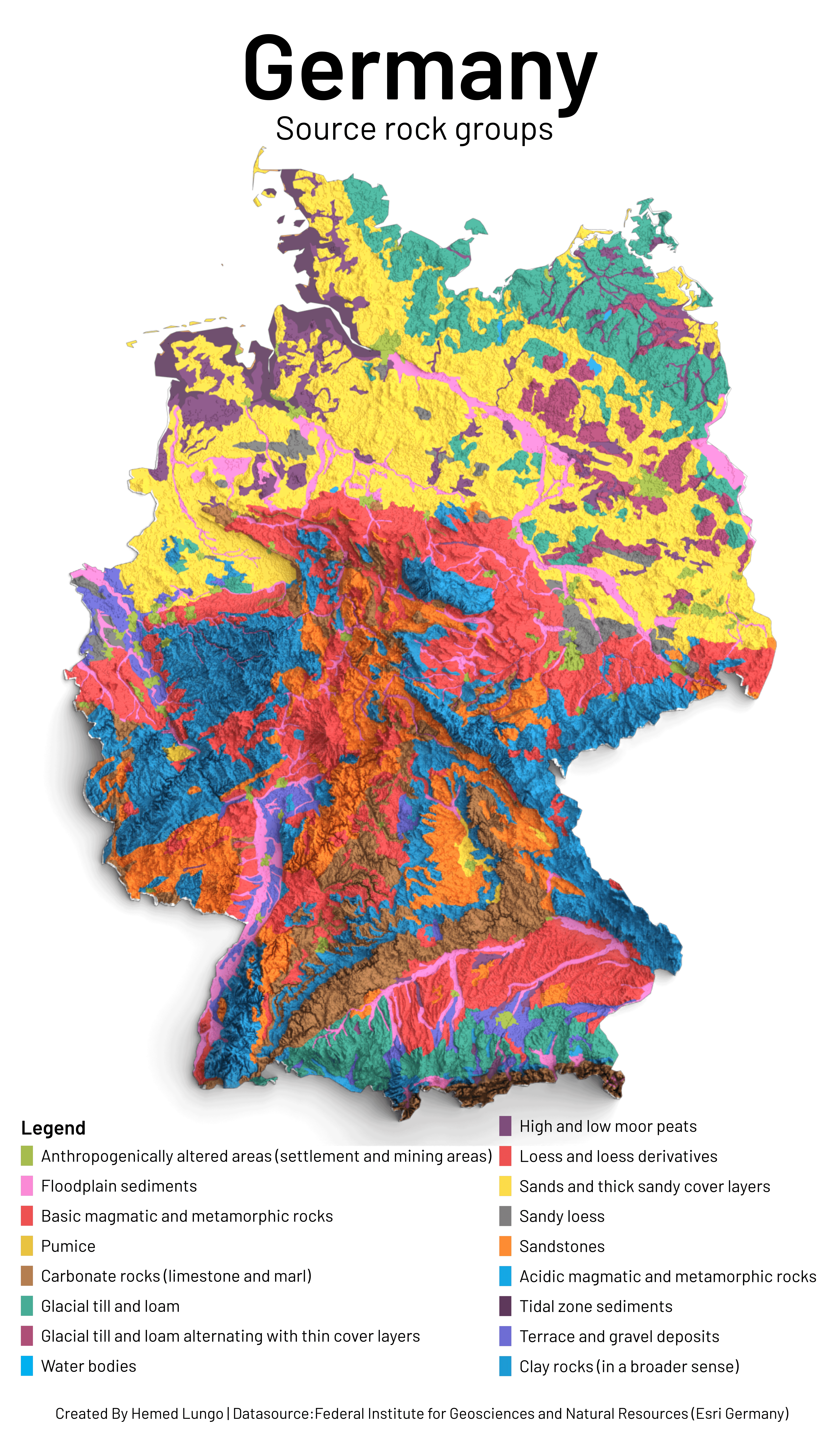
![[OC] A Map showing Source rock groups in Germany 🇩🇪 🗺️
Rock type map created on Qgis and Blender Softwares ,Data source from Federal Institute for Geosciences and Natural Resources (Living Atlas) and Esri Germany](https://www.byteseu.com/wp-content/uploads/2025/04/4juvzlk2j7we1-896x1536.png "[OC] A Map showing Source rock groups in Germany 🇩🇪 🗺️
Rock type map created on Qgis and Blender Softwares ,Data source from Federal Institute for Geosciences and Natural Resources (Living Atlas) and Esri Germany")
Software used: QGIS and Blender
Datasource: from Federal Institute for Geosciences and Natural Resources (Living Atlas) and Esri Germany
Posted by hemedlungo_725
5 Comments
Software used: QGIS and Blender
Datasource: from Federal Institute for Geosciences and Natural Resources (Living Atlas) and Esri Germany
Its nice presentation, but the subtle difference between Blue And blue And blue -ish makes it unreadable. Would work better if it was interactive, because there are just So many groups
I see the Schwäbische Alb!
Would be cool to see Rammstein on here.. or are they more a metal group?
A German rock map that doesn’t include Kraftwerk or Scorpions, that’s a paddlin