

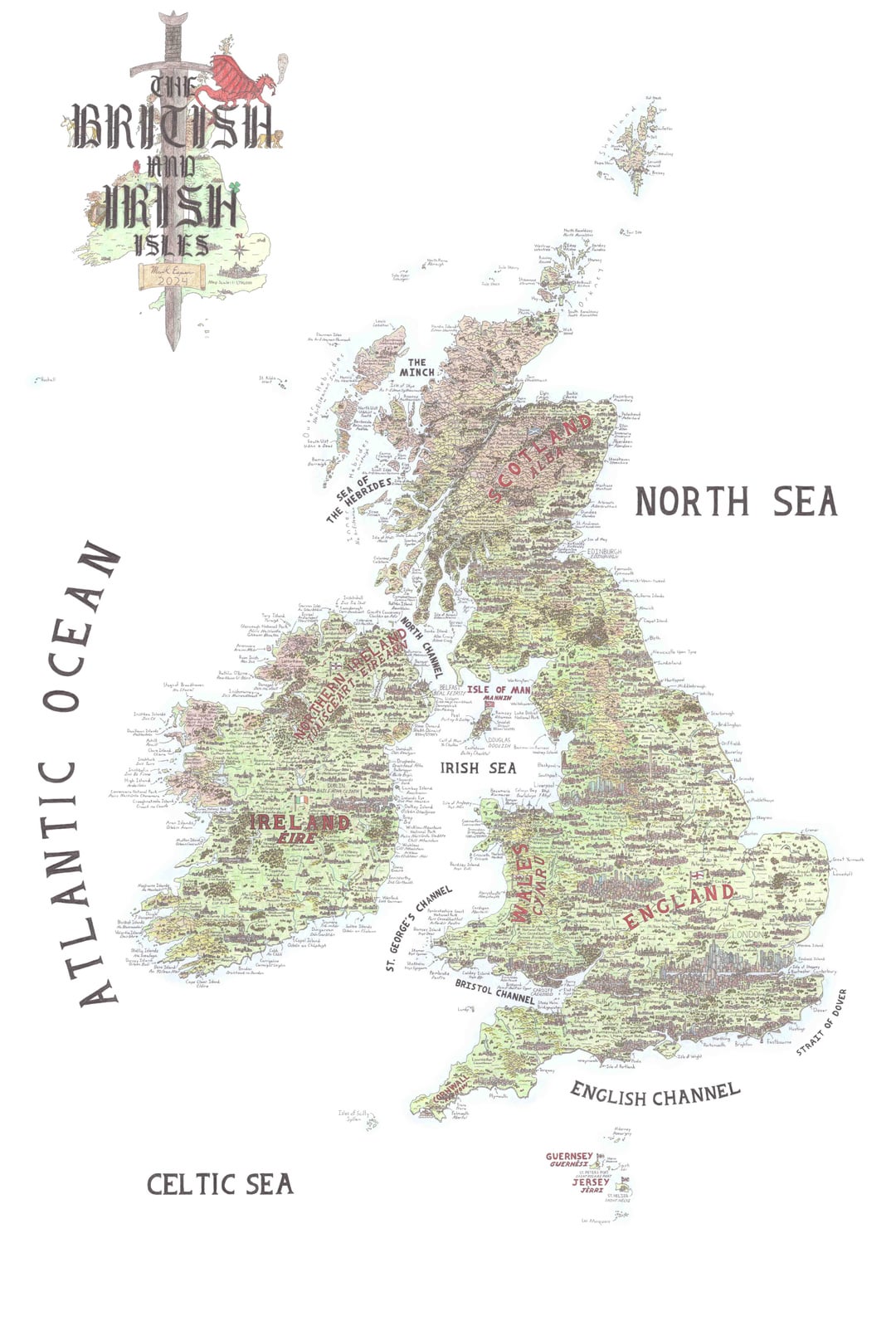
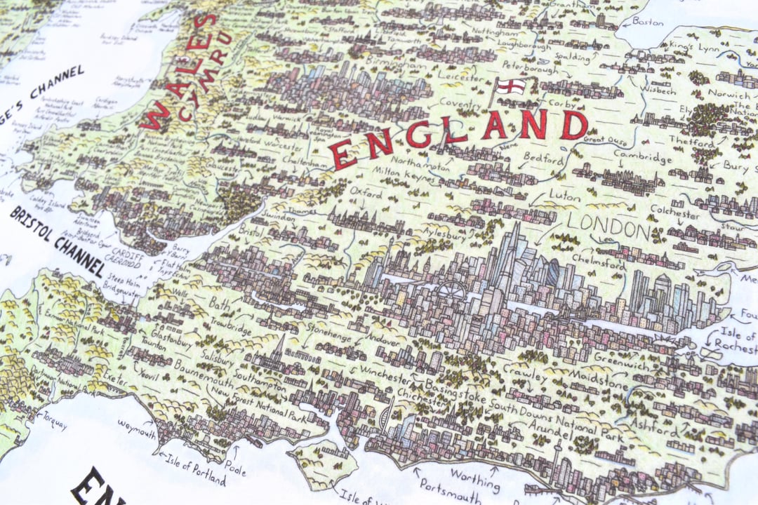
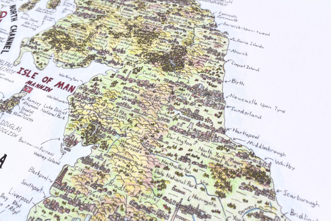
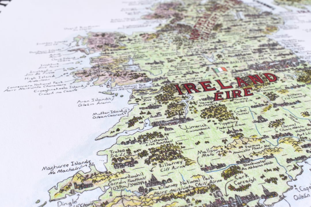
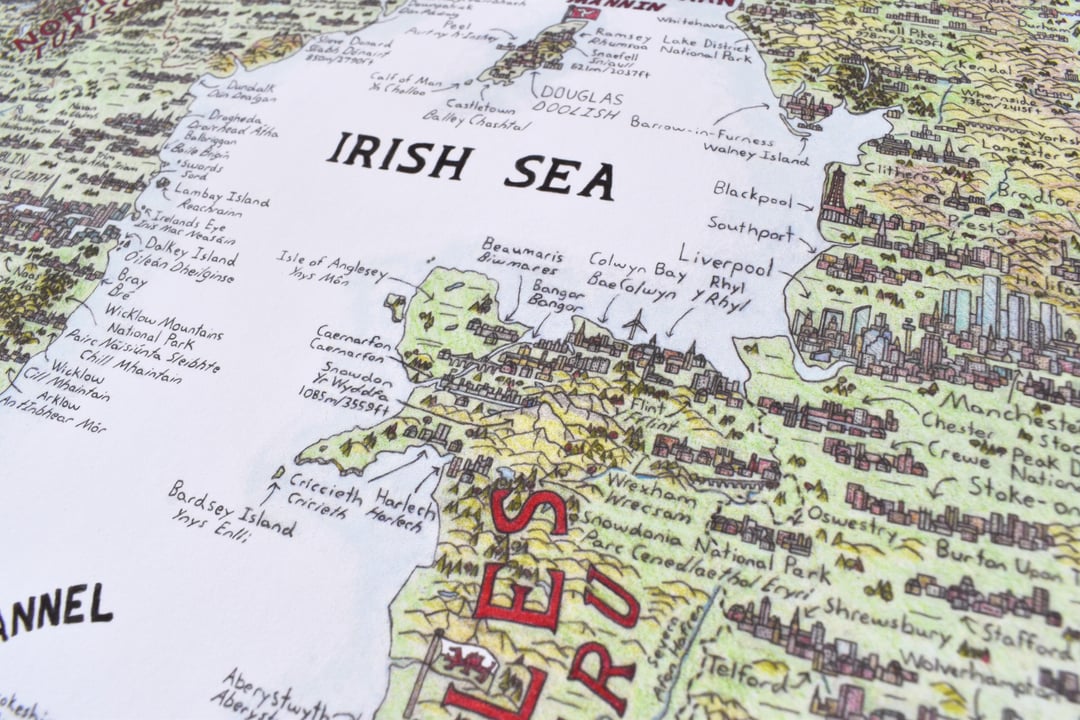
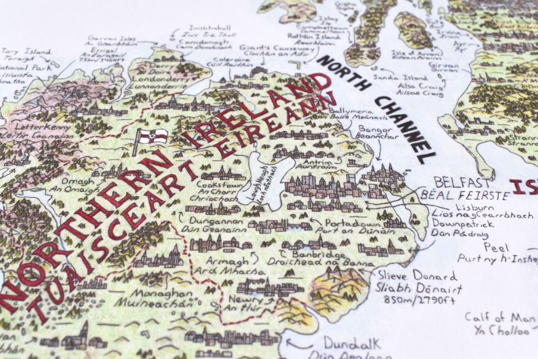
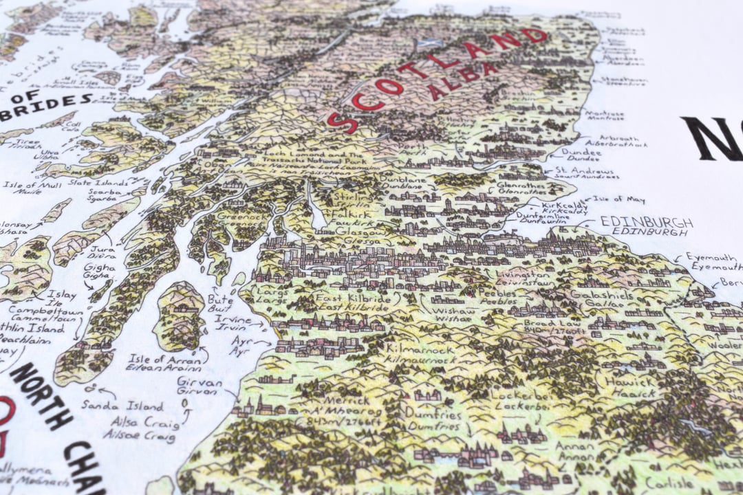
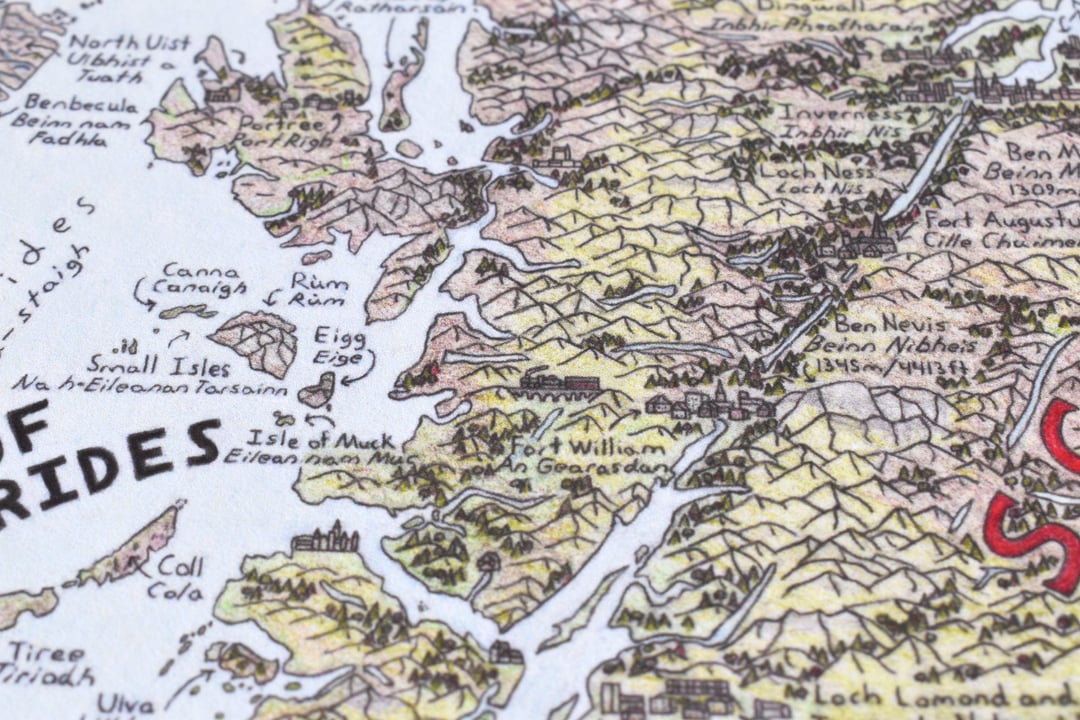
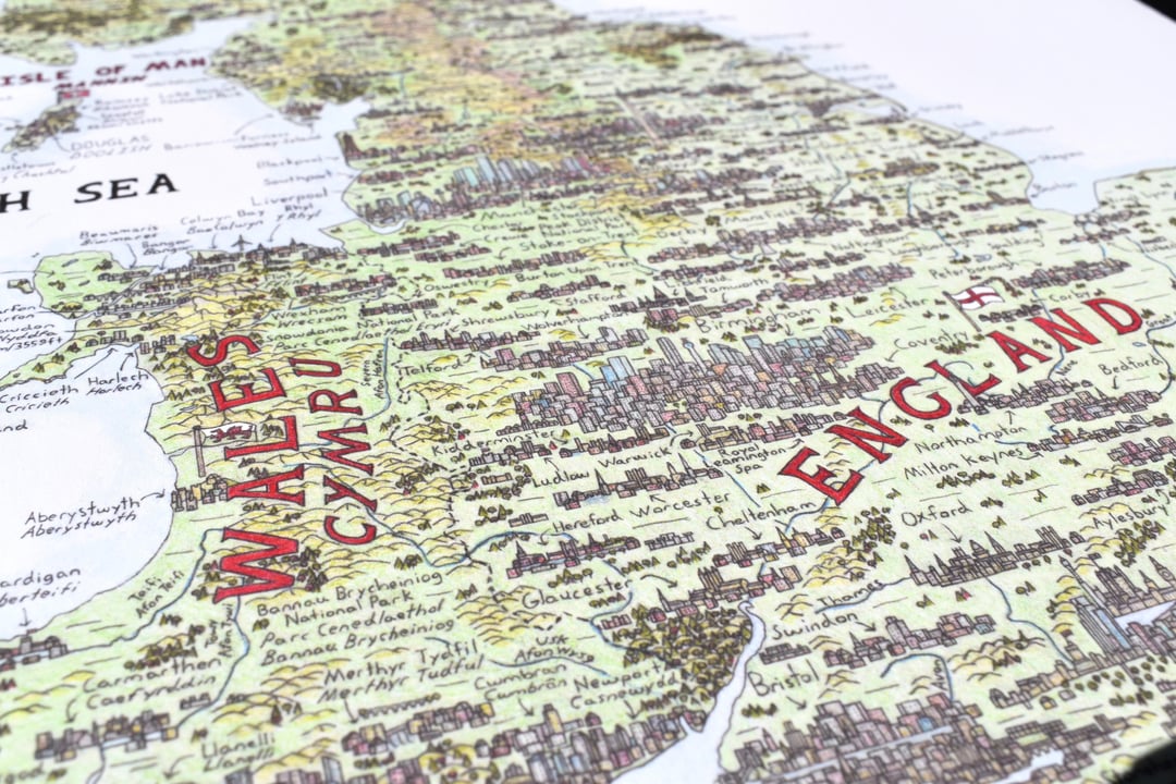
Hand drawn pencil map of the United Kingdom, Crown Dependencies and Ireland that I have been working on for the past 1.5 years. There are 12 languages used across the map, as well as over 280 cities. National Parks, castles, monuments and viaducts are also included. Size is 24×36" (610x914mm).
https://www.reddit.com/gallery/1k5lb7i
Posted by MarkREsper
7 Comments
Beautiful
Will you be selling prints? I’d love to grab one sometime, finances permitting!
The Irish Isles?
Map would have looked a lot better by not drawing and adding Preston.
Guess this is the only way Reading will get city status.
“Fraserburgh” has an H at the end btw, looks cool though
That’s an incredible drawing but I feel duty bound to point out that there is more than one dale in Yorkshire which is why it’s called the “Yorkshire Dale**s**”.