

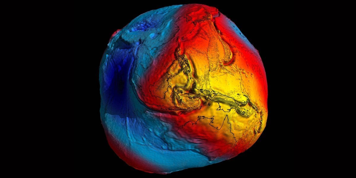
In 2015 scientists in the International Association of Geodesy voted to adopt the International Height Reference Frame, or IHRF, a worldwide standard for elevation. It’s the third-dimensional counterpart to latitude and longitude, says Laura Sanchez, a geodesist at the Technical University of Munich in Germany, who helps coordinate the standardization effort. (Geodesists study our planet’s shape, orientation, and gravitational field.)
Now, a decade after its adoption, geodesists are looking to update the standard—by using the most precise clock ever to fly in space.
That clock, called the Atomic Clock Ensemble in Space, or ACES, launched into orbit from Florida last month, bound for the International Space Station. ACES, which was built by the European Space Agency, consists of two connected atomic clocks, one containing cesium atoms and the other containing hydrogen, combined to produce a single set of ticks with higher precision than either clock alone.
From space, ACES will link to some of the most accurate clocks on Earth to create a synchronized clock network, which will support its main purpose: to perform tests of fundamental physics.
https://www.technologyreview.com/2025/05/22/1117294/a-new-atomic-clock-in-space-could-help-us-measure-elevations-on-earth/?utm_medium=tr_social&utm_source=reddit&utm_campaign=site_visitor.unpaid.engagement
3 Comments
Finally. This is what we’ve needed and been waiting for!!
What happens to the standard when the ISS deorbits? Shouldn’t this have been a satellite?
I found that one of the limitations of measuring latitude by remote sensing is that buildings and tree cover mess up the real elevation on the ground. To the point that some cities that seem invulnerable to sea level rise with an elevation in 10-20 meters actually lies close to sea level. This is kind of accurate since once the Great Flood comes, the buildings will still stick out the water surface just the streets get flooded.
But there are other limitations in measuring elevation, too. In older sea level rise maps, you can see the Mekong Delta is flooded in a striped pattern after sea level rise. But that’s actually because the satellites measure the elevation by swathes, and each swath has a different error in elevation. Since the Mekong Delta lies mostly below 1m, and the error can be close to or more than the actual elevation, this results in a striped pattern between 0 to 3 meters in elevation. I think once the new atomic clock is in place, that would be most useful in measuring the extremely low land’s elevation.