
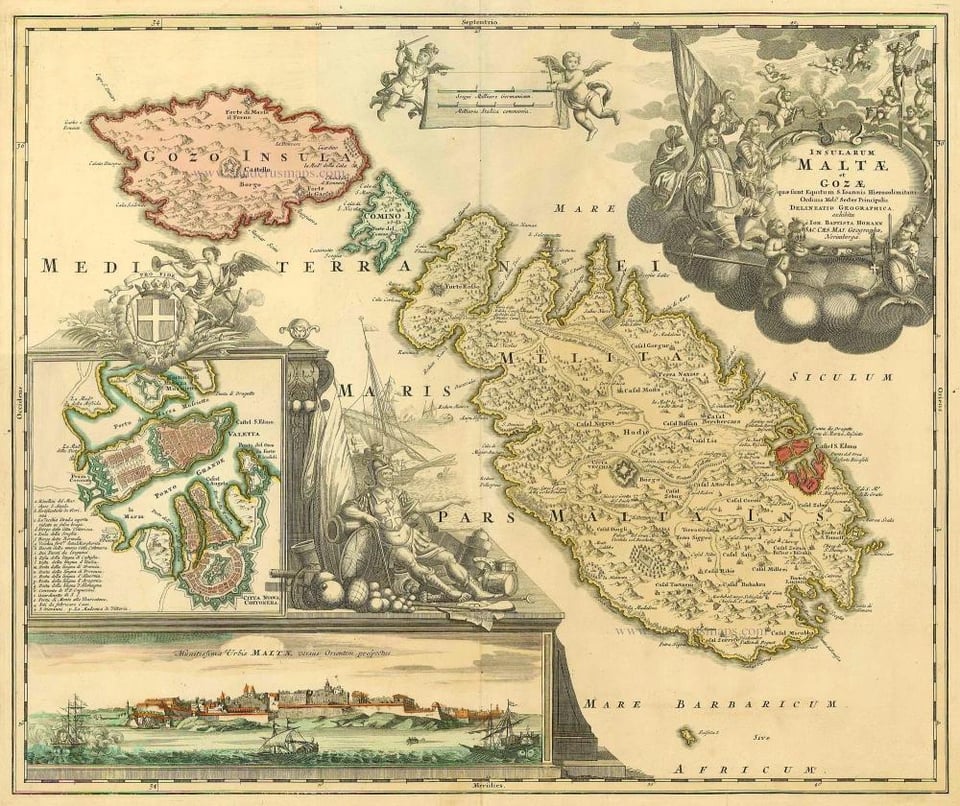
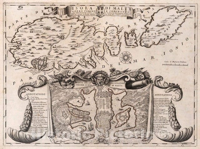
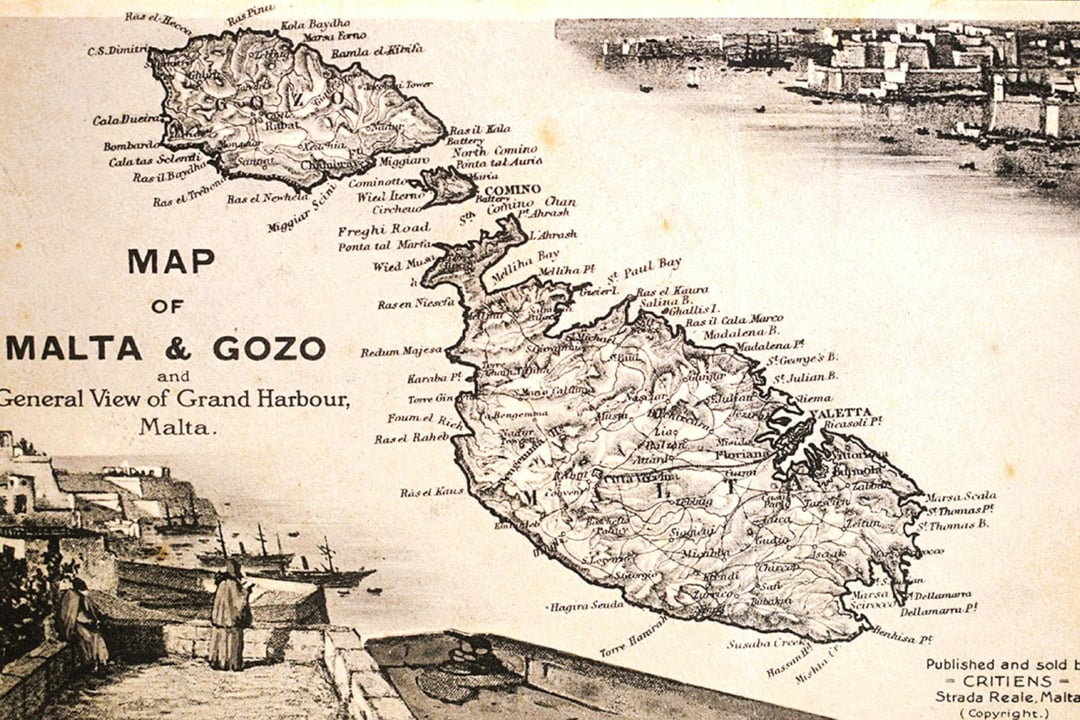
Hello all,
I’m looking for some assistance in finding an old map of Malta (a print, not genuine antique, as nice as that would be).
Ideally it would be pre-1900 (older is better, Knights era ideally) and I would welcome some additional illustrations.
My main concern is size and quality of the image(no blurriness or pixelation). Ideally something 60cm wide or larger.
It can be framed or just a print on canvas, whatever is available. Color image ideal.
I’ve added a few example images of the sort of thing I’m looking for.
Would love to buy locally rather than risk ordering something online that doesn’t turn out great.
Any reccomendations (and chat about some antique illustrations of the islands) are greatly appreciated!
Thanks
https://www.reddit.com/gallery/1kx2grr
Posted by Certain-Return-3259
4 Comments
Wow 😳 where did you find them?
[https://arkivji.org.mt/maps-and-survey-sheets-of-malta-and-gozo](https://arkivji.org.mt/maps-and-survey-sheets-of-malta-and-gozo)
[https://www.vintage-maps.com/en/antique-maps/europe/malta:::85](https://www.vintage-maps.com/en/antique-maps/europe/malta:::85)
[https://www.raremaps.com/gallery/detail/97636/the-maltese-islands-pictorial-map-of-malta-ciqheri](https://www.raremaps.com/gallery/detail/97636/the-maltese-islands-pictorial-map-of-malta-ciqheri)
I believe the first 2 are commonly found in tourist shops, check the shops in Mdina maybe
I’ve got truly excellent prints from The Unique Maps Co. I’ve got 3 very nice maps (of S.E. Asia, Iceland, and Sicily, not yet Malta).
[Here’s a really nice one of Malta](https://uniquemaps.eu/products/old-map-of-malta-by-homann-1788-valletta-mdina-fortifications-boats)