
![[OC] Elevation of Mountain Ranges in Nevada (+Distance from Las Vegas+Tallest and Most Prominent Peaks)](https://www.byteseu.com/wp-content/uploads/2025/07/4fz8gh9f8paf1-1024x1536.jpeg "[OC] Elevation of Mountain Ranges in Nevada (+Distance from Las Vegas+Tallest and Most Prominent Peaks)")
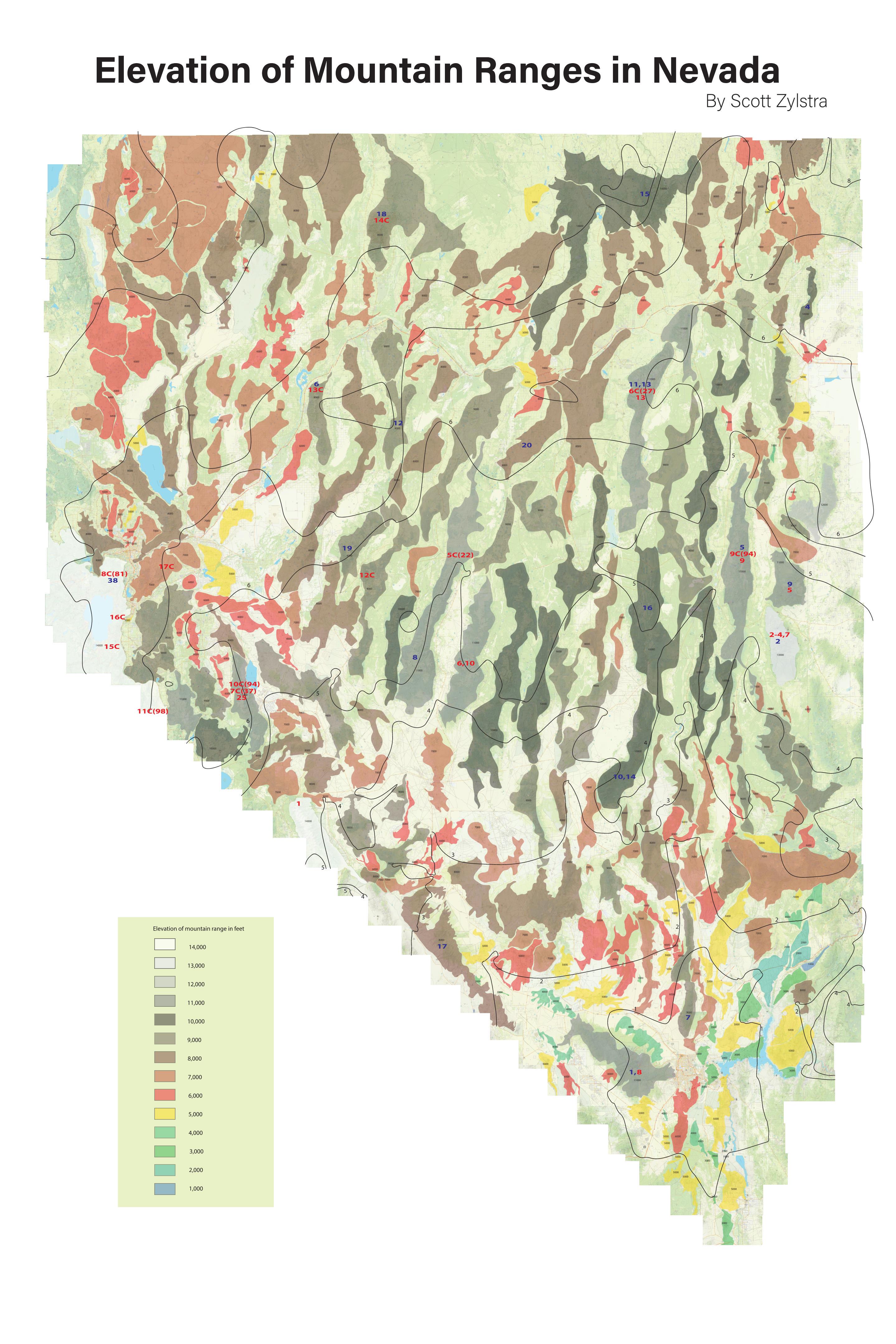
Original content: Each range is the color of its tallest peak (see the legend for details). The black contour lines indicate the distance from Las Vegas (specifically, southeast Henderson near Railroad Pass) in hours. Blue numbers indicate the peak's rank in Nevada of prominence, and red numbers indicate the peak's rank in Nevada in elevation. A red 12C(81) would indicate 12th highest county point in Nevada, and 81st highest in the state overall.
Please provide me some feedback and let me know if you have any questions!
Posted by Silestra
5 Comments
The image is blurry and I can’t zoom in
I used to think that Nevada was mostly flat land occasionally punctuated by mountain ranges. Then I drove US-50 both directionslast fall, and realized that Nevada is mostly mountain ranges occasionally punctuated by narrow valleys.
How did you get the outlines of the mountain ranges?
I wouldn’t have used white in the symbology for the highest class. Makes the no-color in the valleys confusing. But this isn’t r/mapporn so we can let it slide
Do you have an overlay of the major cities and highways? I feel that would help give the map more context.