
![[OC] An interactive, subway-style map of the Colorado Rockies](https://www.byteseu.com/wp-content/uploads/2025/07/QYCZqs-gr8h_iUI1mYLvOOY8D2GPAeT7p-LsnUsfQqg-1024x665.png "[OC] An interactive, subway-style map of the Colorado Rockies")
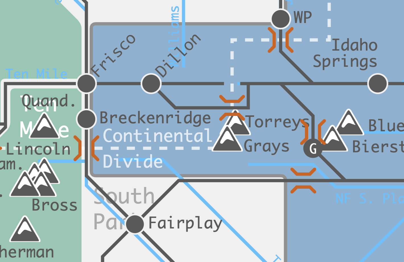
Hi folks! I created this interactive graphic to explore the mountains of Colorado. You can currently click and explore:
- Major mountain ranges/valleys
- The Continental Divide / Major and Minor Rivers
- Notable/highest peaks
- Major roadways, towns and passes
- National Parks/Monuments, Ski Areas, Hot Springs
Check it out and let me know what to add next!
(It's a little janky on mobile right now, but works great on a computer)
Posted by astroMuni
2 Comments
*All elevations and prominences related to mountain peaks come from* [*listsofjohn.com*](https://www.listsofjohn.com/)*, which makes use of some relatively recent LiDAR-based surveying data. You will definitely see other numbers around the internet (and on physical signage!) that disagree with these numbers.*
*As discussed above, the boundaries of mountain ranges come from* [*peakbagger.com*](https://peakbagger.com/)*. Some of them could be controversial (the Front Range reaches Salida?!). Population numbers and town/pass elevations come from Wikipedia, and are typically the latest estimates I could find.*
*A broad host of other sources and tools informed the rest of the map elements and their descriptions.* [*14ers.com*](http://14ers.com)*, CalTopo, GoogleMaps, Wikipedia, local newsapers (The Colorado Sun, Summit Daily, Vail Daily, Aspen Times, …). The list goes on.*
Cool. Where would you put the “Never Summer” Mountains?