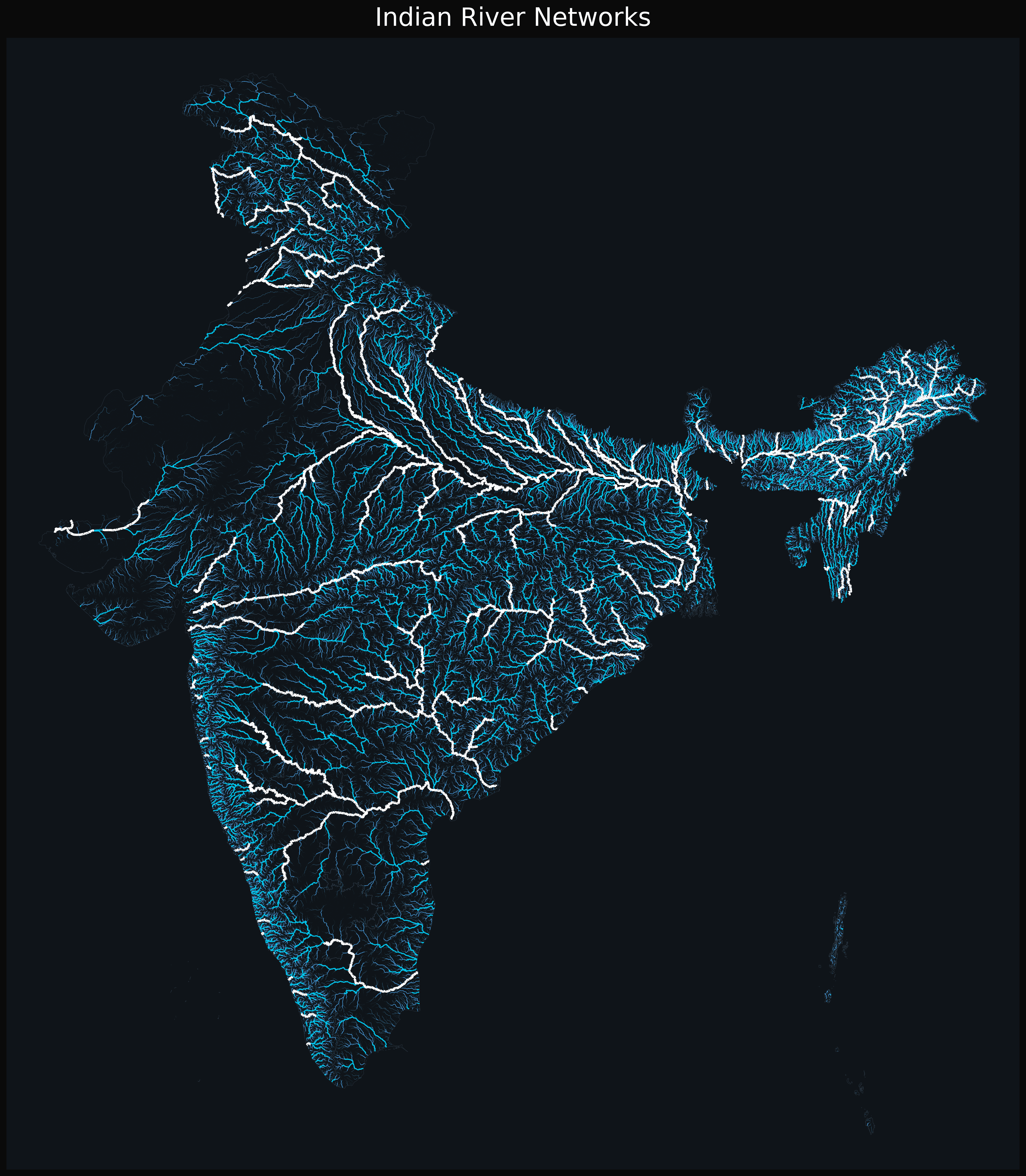
Share Facebook Twitter LinkedIn Pinterest Bluesky Threads [OC] Indian river networks. Posted by ramnamsatyahai
ramnamsatyahai on August 14, 2025 12:17 pm Source: HydroSHEDS , [https://www.hydrosheds.org/products/hydrorivers](https://www.hydrosheds.org/products/hydrorivers) Tools : Python , GeoPandas
suggestiveinnuendo on August 14, 2025 12:23 pm This is why the India Pakistan partition guarantees never ending tension is this data though? it just looks like a water map
DandelionWhim on August 14, 2025 12:52 pm Nature’s circuit board 🔥 Looks less like rivers, more like India’s got its own PCB for managing the flow of life!
r0ark5 on August 14, 2025 5:25 pm this is incorrect. there is no river that flows through district Kutch in Gujarat.

![[OC] Indian river networks.](https://www.byteseu.com/wp-content/uploads/2025/08/3kl8ereg8zif1-1339x1536.png "[OC] Indian river networks.")
7 Comments
Source: HydroSHEDS , [https://www.hydrosheds.org/products/hydrorivers](https://www.hydrosheds.org/products/hydrorivers)
Tools : Python , GeoPandas
wrong sub, you are looking for mapporn probably
This is why the India Pakistan partition guarantees never ending tension
is this data though? it just looks like a water map
Nature’s circuit board 🔥 Looks less like rivers, more like India’s got its own PCB for managing the flow of life!
You should probably open source your work.
And sadly a little over half are polluted.
this is incorrect. there is no river that flows through district Kutch in Gujarat.