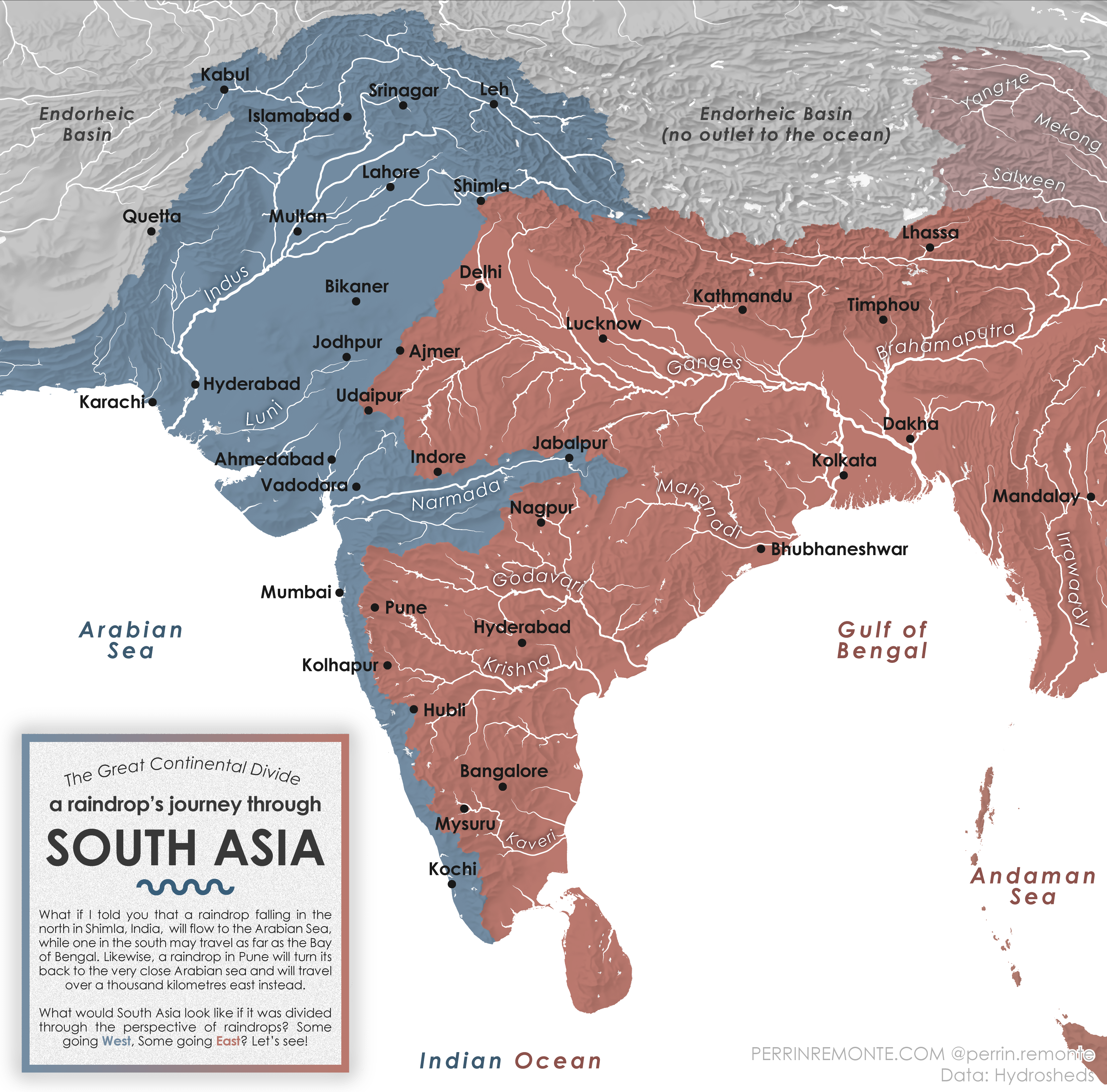
After making one for Europe – you can see it [here](https://www.perrinremonte.com/thema-eng), on my website – I decided to make another for South Asia, a.kl.a, the Indian Subcontinent!
Data is from [Hydroshed](https://www.hydrosheds.org/), I processed it with QGIS and used Adobe Illustrator for the graphic design!
Let’s follow together a raindrop’s journey though South Asia by visuliasing the watersheds… I love how the geography of India, especially with the Wester Ghats, make for an unexpected pattern of drainage areas, while there are hundreds of thousands of square kilometres of endorheic basin to the north of the very populous Indus and Ganges valley.

![A Raindrop's journey through South Asia [OC]](https://www.byteseu.com/wp-content/uploads/2025/09/t7d9eeyjzmnf1-1536x1515.png "A Raindrop’s journey through South Asia [OC]")
1 Comment
After making one for Europe – you can see it [here](https://www.perrinremonte.com/thema-eng), on my website – I decided to make another for South Asia, a.kl.a, the Indian Subcontinent!
Data is from [Hydroshed](https://www.hydrosheds.org/), I processed it with QGIS and used Adobe Illustrator for the graphic design!
Let’s follow together a raindrop’s journey though South Asia by visuliasing the watersheds… I love how the geography of India, especially with the Wester Ghats, make for an unexpected pattern of drainage areas, while there are hundreds of thousands of square kilometres of endorheic basin to the north of the very populous Indus and Ganges valley.
Fellow map enthousiasts, hope you like the map, there are more on my [website](https://www.perrinremonte.com/fraccueil-1) (much more user friendly on a laptop!