
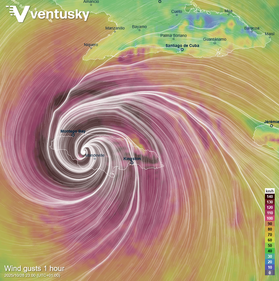
This is the unique visualization of Hurricane Melissa from the high-resolution HARMONIE model, calculated specifically for the Caribbean: https://ventusky.com/?p=17.00;-76.66;8&l=gust&m=harmonie_car&w=soft There are very few regional models available for this area, and the HARMONIE model is now helping to improve forecasting here. Local models are crucial for accurately capturing the interaction of rainfall and wind with the island.
Posted by LuborS
7 Comments
Umm. Is the island being evacuated?
Have a lot of coworkers here. Sigh. Hoping everyone stays safe… somehow.
Stay safe guys, this looks terrifying. Hurricane force winds extending 60 miles from the centre, and up to 40″ of rain?! That’s 4,000 tonnes per acre. Best wishes from Barbados
I remember reading The Cay in middle school
You’re Jamaican me sad for all those people in its path
That really is a beautiful image.
The scale here is literally off (this) chart. Reported wind speeds are estimated currently to be 280 km/h!