

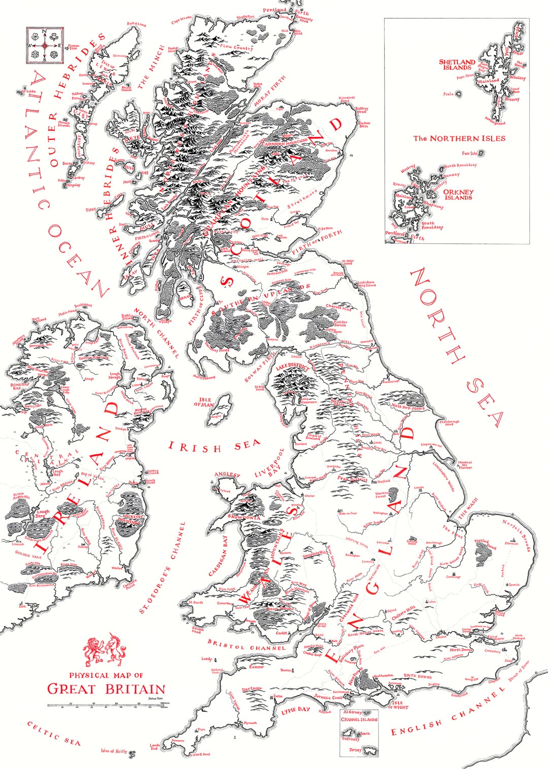
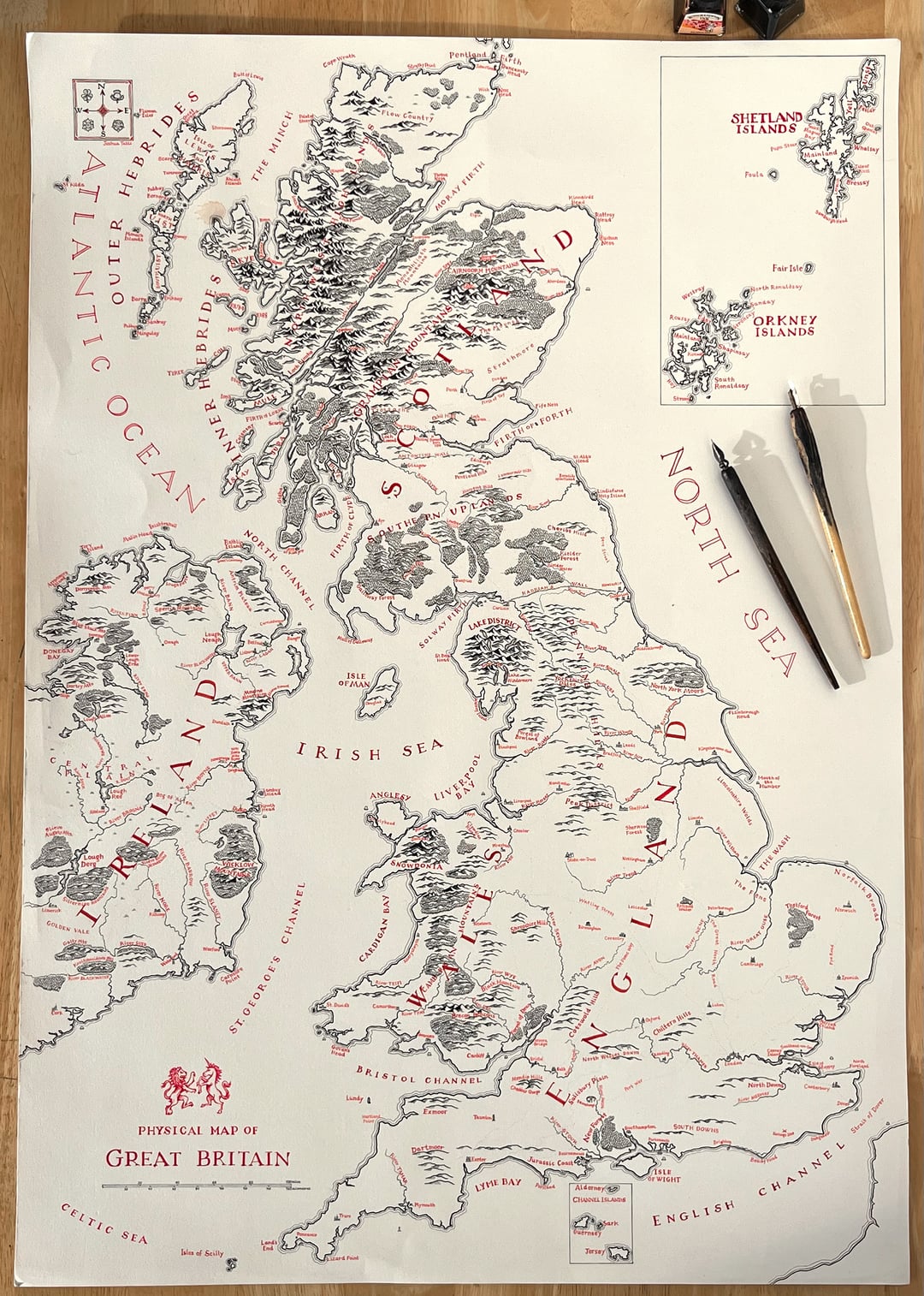
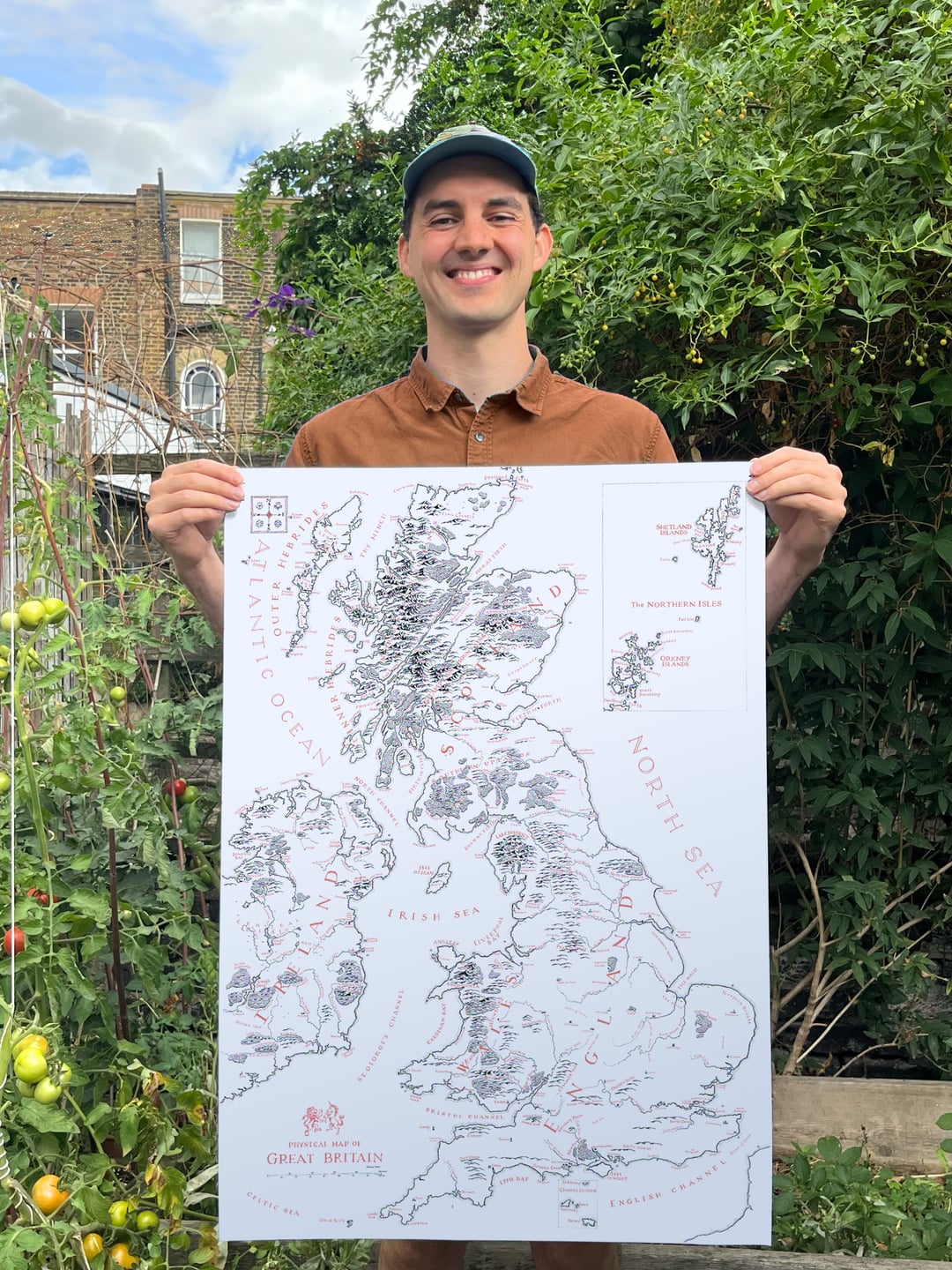
A Map of Great Britain, hand-drawn by myself using old dip pen and ink, in the style of Tolkien’s fold-out maps! Having already drawn Scotland, Ireland and Wales, I’m planning on making a more focused version of England, so please suggest any landmarks I must include!
https://www.reddit.com/gallery/1osexxp
Posted by NACHODYNAMYTE
27 Comments
Hahah screw you France, you get an outline and NOTHING ELSE!
orr hee hoorrr
England, Scotland and Wales, yet no Northern Ireland 🤔
Holy that looks INSANE, how many hours was that??
Stonehenge for definite
The Malvern hills
Durham please
This is absolutely wild, great work.
There’s a couple of things I think you should include in England:
– Derby
– Possibly Lancaster, depending on what era this is supposed to reflect, it was extremely important at various times in history
– Some east-west route through the Pennines, probably Snake Pass and the Calder gap, both of which are historic routes, possibly the A66, and the Newcastle-Hexham-Carlisle road along the Wall
Also
– I think it’s the Antonine (not Antontine) Wall?
Could you add all the castles?
Luton? Bloody Luton? Hatfield has much more history. Shameful 😉
Really cool. Caernarfon would be a good add, North Wales is looking rather empty
I’d put some ruins like Stonehenge or Whitby Abbey onto it.
You missed out Mordor, I mean Burnley…
First: amazing work, that’s stunning – you should sell prints!
Second: as a landmark suggestion, Jodrell Bank.
Amazing!
Shitterton, Dorset.
The Ikea of Warrington
You’re going to release a print of this for people to buy, right? 🥹
Man, that is beautiful.
Sherwood Forest has got to be in there!
Nice drawing. It is not Great Britain though. At least, not only Great Britain, which should be the largest landmass only of the British Isles.
Go for a few of the major castles
Epping Forest & Hatfield Forest, Audley End House. Beautiful work!
Included York but missed out Lancaster. Are you going to stoke the old rivalries?
Love it! Glastonbury Tor might be a good inclusion.
It would be even better with the real irish names translated. Eg Dublin-Dubhlinn-dark pool
That’s fantastic
you selling prints?