

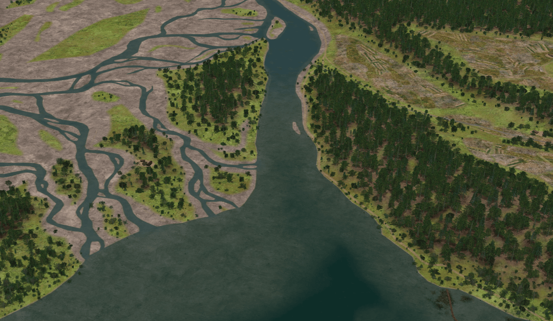
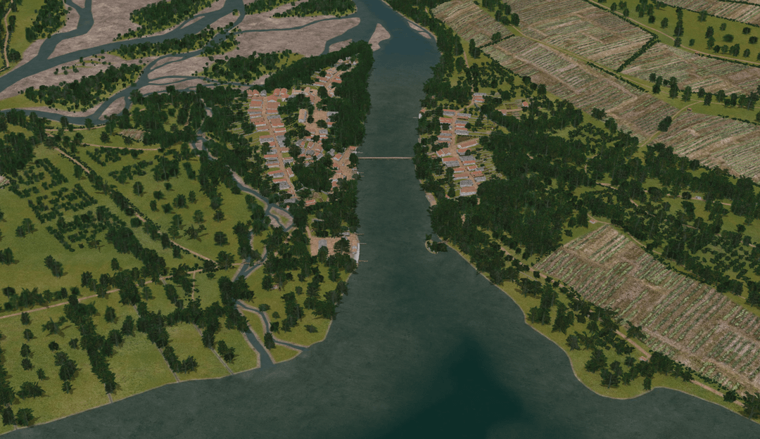
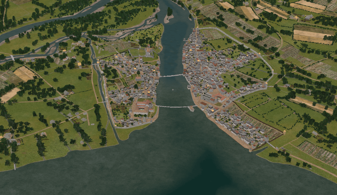
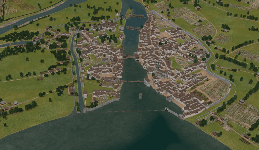
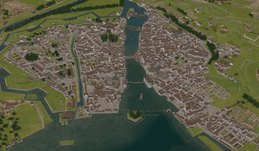
The application “Zurich 4D” is an interactive, three-dimensional map that shows the structural development of the city from the past through the present and into the future. Zurich 4D is based on the 3D city model of the City of Zurich.
Zürich 4D
https://www.reddit.com/gallery/1p8sqpd
Posted by TestingGravity
10 Comments
This is the coolest thing !!!
This is the coolest thing !!!
This is the coolest thing !!!
WOW!
is it possible to export STL/ DEM models?
This is when you should have bought the land..
Interesting the location . I understand rivers are a really important connection network , but with all that rivers around, the possibility of a flood must be really high and I have never understood why not move the cities around big rivers a little bit further away and high, not kilometers, but searching for the highest point around a river.
This is the coolest thing !!!
Best video for this:
https://youtu.be/DOfjgazybsI?si=hbmQchbJcGEf7MOV
I really recommend it.
this is very cool!
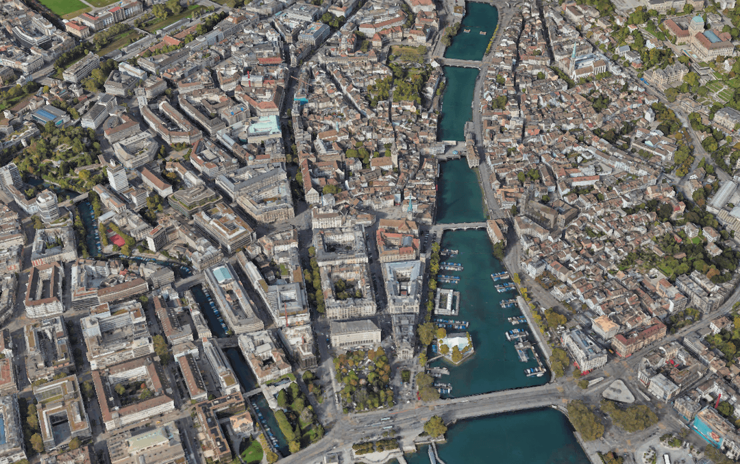
It still surprises me how much how Bahnhofstrasse used to be a river (/sewage?). In general it’s interesting how the Sihl going into Zürisee was moved/ blocked up over the years. Must have been a nice place way back when. Also the development of the exit of Zürisee, esp now around HB is crazy. I guess everything about this is crazy. From nothing to something with so much money
Bahnhofstrasse used to be “Fröschengraben”
https://de.wikipedia.org/wiki/Fr%C3%B6schengraben?wprov=sfti1#
Also basically everything between Zürihorn and Mythenquai are landfills from the 1850s, including Bellevue, Bürkliplatz, Rentenwiese, Quaibrücke, etc.
https://de.wikipedia.org/wiki/Quaianlagen_(Z%C3%BCrich)?wprov=sfti1#Einzelnachweise
The poshest and most postcard looking part of Zurich is literally built on shit and landfills. Including the insurances residing there now, standing for stability and credibility.