
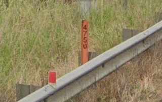
The Orange ones are found along the NSW & Victoria side of the Princes Highway and the Hume Highway. In Victoria, they seem to be marking the kilometers since the start of the road, but they are definitely not marking that in NSW.
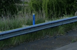
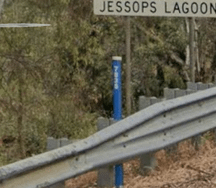
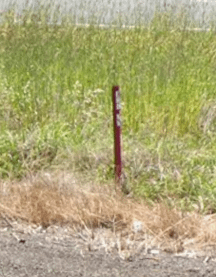
The blue ones and the red ones appear more random, found only on the NSW sides of those highways. The red ones seem to appear in pairs, labelled "START" and "END", not regularly spaced.
Anyone know what these mean?
https://www.reddit.com/gallery/1qq7h5l
5 Comments
“Hello Emergency services, I’ve had an accident”
“I’m on State Highway X, and looks like I’m near *road marker 124456*, please send assistance”
Hmmm, I’m going to take a guess here and I’m bracing myself to get roasted by the wider community that knows more than me.
I work in emergency services, and used to do a lot of remote area work. Those markers were meters to the nearest crossroads or intersection, and I think they were used by councils for… something? Not sure? But we certainly used to use them to pace count to turn off points.
Road assets or infrastructure – culverts etc?
Surveyors?
Are you in NSW? If so, it’s to mark large groups of roadside living weeds. (If marked start or finish) Stopping inbetween the start and finish markers is discouraged because spread.
If it’s any other state, then I have no idea….
For NSW they denote road segments for road working crews to more precisely identify locations. Not sure if emergency services have access to the same database or would bother to use them since other landmarks would generally be sufficient, but for roads where the pavement is literally indistinguishable for long sections, road workers need a system to better identify the locations.