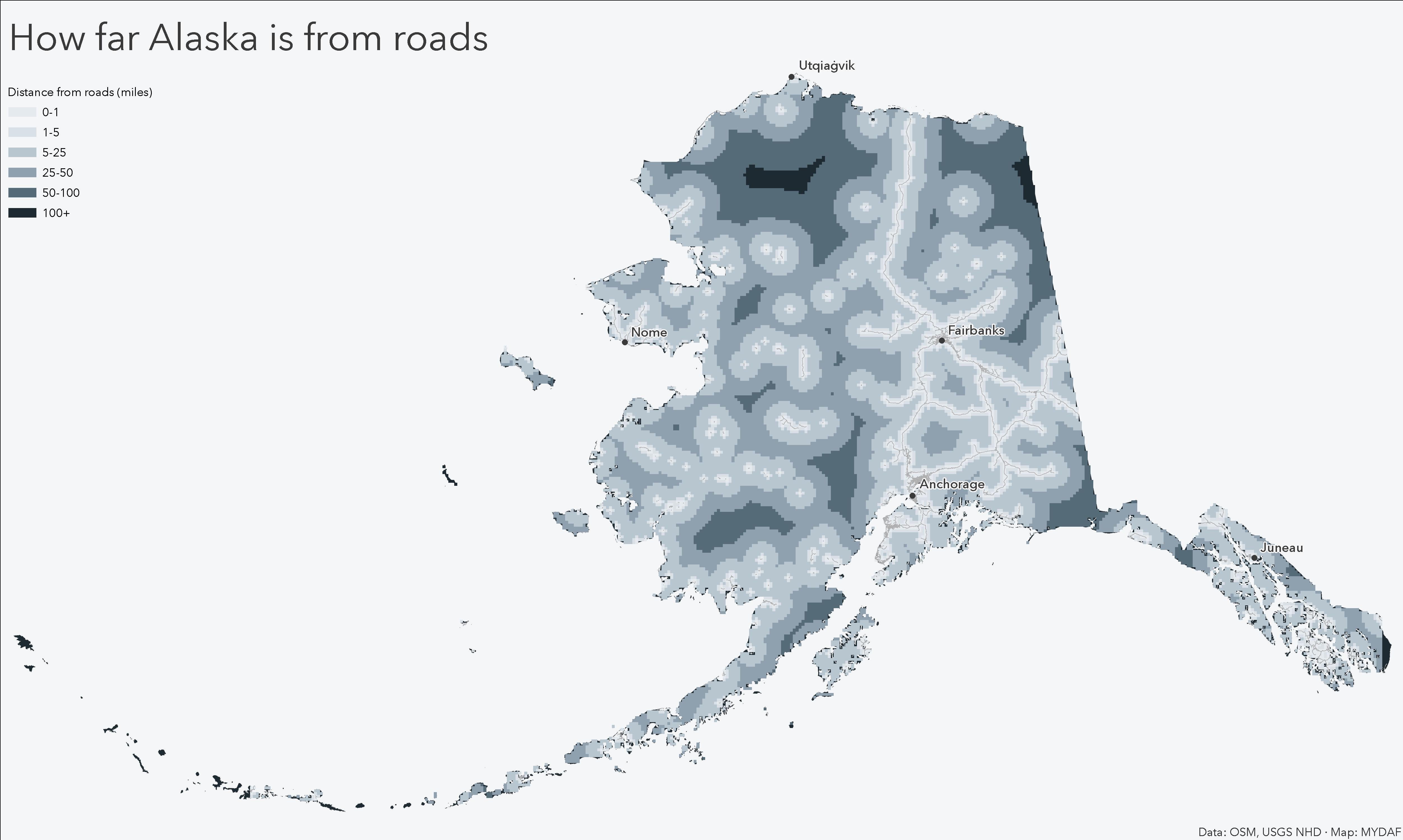
Each pixel shows the distance to the nearest mapped road in Alaska.
Calculated using road centerlines and Euclidean distance to highlight how much of the state lies far from road access.
Posted by MapsYouDidntAskFor

![[OC] Distance to the nearest road in Alaska](https://www.byteseu.com/wp-content/uploads/2026/01/nopzxwgypcgg1-1536x920.jpeg "[OC] Distance to the nearest road in Alaska")
Each pixel shows the distance to the nearest mapped road in Alaska.
Calculated using road centerlines and Euclidean distance to highlight how much of the state lies far from road access.
Posted by MapsYouDidntAskFor
16 Comments
**[OC]**
Data source: OpenStreetMap road centerlines
Method: Distance Accumulation (Euclidean distance)
Tools: ArcGIS Pro
What are the islands? What kind of road isn’t connected to the rest of the road network? Are they places with roads that are only reachable by airplane?
Ain’t no roads where we’re going…
You know what this tells me. If you want to find a rare species or plant check those areas.
What’s the name of the dark place? I need to live there physically instead of just mentally.
Shouldn’t all the white spots be connected (by roads)?
Where we’re going we don’t need roads
There’s only one road in the northern half of the state the Dalton highway
In the winter the snowpack becomes the roadway…
This would be better if it was roads connected to a port. Some of these “roads” are just a half mile strip connecting the bush plane runways to the villages.
This is truly beautiful data. Thanks for sharing!
Are they considering roads in remote villages as a road network?
Wouldn’t this just generate a road map?
This should be paired with three more maps (just for fun) a railroads in Alaska, airports/helipads in Alaska, and a Navigable rivers in Alaska.
That would give you a good picture of how people across the state get around the state.
If I wasn’t lazy I’d do it myself.
From the dusty mesa
Her looming shadow grows
Most those white spots are “roads” simply connecting the runway to the nearest building.