
![[OC] I mapped all of the OSHA, Department of Labor, National Labor Relations Board, EPA, and Debarment violations for the past ten years.](https://www.byteseu.com/wp-content/uploads/2026/03/7f60i0c422ng1-1024x384.png "[OC] I mapped all of the OSHA, Department of Labor, National Labor Relations Board, EPA, and Debarment violations for the past ten years.")
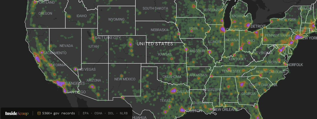
I got pissed that all of these public government records are impossible to read, so I mapped them all to be freely viewed.
Sources:
Data | Occupational Safety and Health Administration
NLRB Data on Data.gov | National Labor Relations Board
Happy to answer any questions about the data sources, methodology, or the project in general.
Posted by Insidescoop-app
11 Comments
that’s a r/peopleliveincities map of all time
No violations in Washington, North Dakota, the UP, or Maine huh?
Also known as a population map.
Very cool. Thanks for the per-capita map for more context.
Thank goodness there are never any violations in Alaska and Hawaii.
My god it’s the same as the map of ice cream shops and the map of dogs and the map of number of cars! They are all related to OSHA violations!
Surprised cali isnt more purple
Would be interesting to add MSHA data / reports to the list (the federal agency that deals with mine / quarry safety and reporting).
I think it might be more interesting to graph them over time. Still, good on you for looking into this.
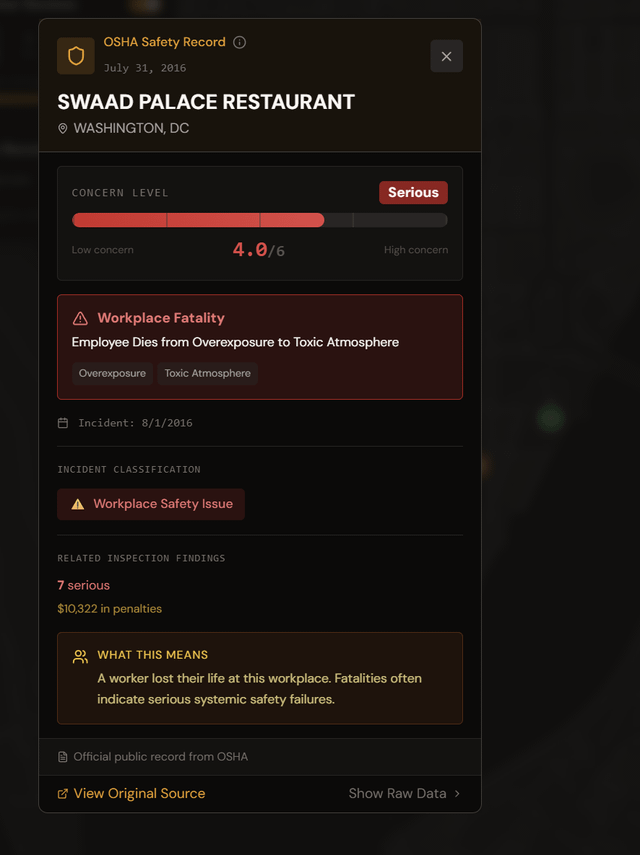
Hang on, a death is a 4/6 severity? What makes it worse? Mass casualties?
I’d love to see this remade but weighted by population density.