

If you’ve ever stood at a Norwegian ferry dock wondering whether the boat is actually coming, that’s the exact situation that made me build this.
My nephew was doing folkehøyskole in Lofoten and kept calling me frustrated because he couldn’t figure out if the hurtigbåt was running or not. The official apps show departure times, but not where the boat actually is right now. I’d had the same experience at Bognes. You just stand there and hope.
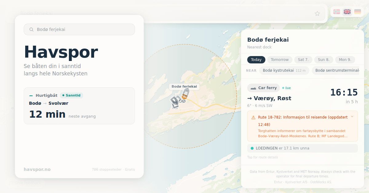
havspor.no shows you the boats on a map. Live positions updated every 30 seconds. You can see it approaching. You can see if it’s delayed (+2 min, +5 min). You know before you leave the house.
It also shows weather and wave conditions at your stop, which is honestly the thing I didn’t expect to be so useful. If you’re doing Bodø to Moskenes and the sea state shows "rough"maybe take the seasickness tablets.
Works in English (and German), covers the entire Norwegian coast. 786 stops from Lindesnes to Kirkenes. No app to download. Just open havspor.no on your phone.
Built it as a solo developer using open government data that was already there (Entur for departures, Kystverket AIS for vessel positions, MET.no for weather). Free, no login, no ads.
If anyone’s planning a trip involving coastal boats, or you live along the coast and take ferries regularly, I’m curious what info you wish you had. What would make this more useful?
If you're taking ferries or hurtigbåt in Norway, you can now see where the boat actually is on a live map
byu/oddonline inNorway
Posted by oddonline
5 Comments
What does this do that https://nais.kystverket.no/ doesn’t?
Looks really nice 👍
It took me straight to the closest dock and shows the ferry nearby, amazing 🤩
Hey, that’s really cool 😎
Tar båt hver dag – denne var kjempefin!
Lugger litt på iPhone 15, både ved søk og scrolling av kart.