Chennai’s water crisis mapped across 200 wards – not a single river meets safe water quality standards [OC] Posted by SmOokey16
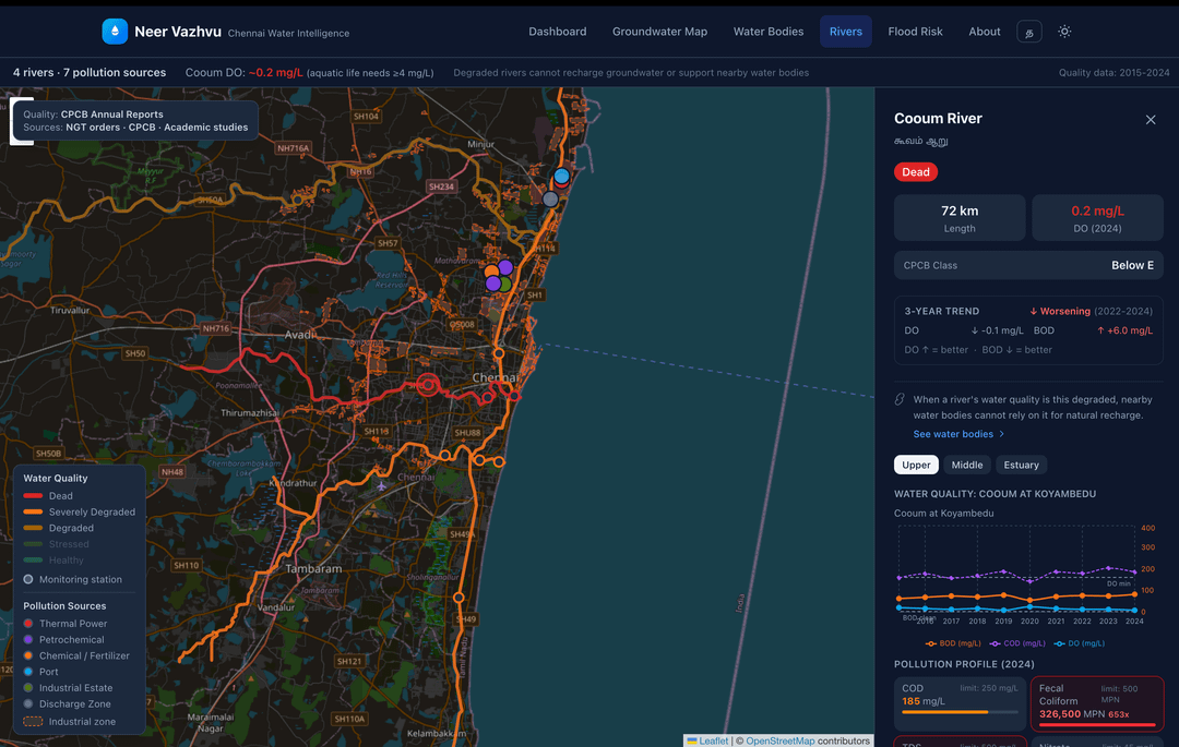
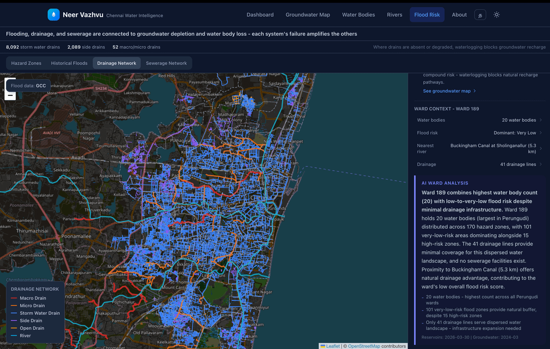
SmOokey16 on March 31, 2026 7:28 am I combined data from 6 Indian government sources to map Chennai’s (Tamil Nadu, India) water situation at the ward level: * CMWSSB (reservoir storage) * CGWB/OpenCity (groundwater depth) * CPCB (river water quality) * GCC CFLOWS (flood hazard zones) * GCC (storm water drainage) * CMWSSB (sewerage infrastructure) 1,635 water bodies mapped. 14 wards face both groundwater stress and high flood risk. All four rivers – Cooum, Adyar, Kosasthalaiyar, Otteri Nullah – exceed safe pollution limits. Tools: Next.js, Python, Leaflet, Claude (AI narratives) Interactive version: [neervazhvu.org](http://neervazhvu.org) Source code: [github.com/SundareshPrasanna/neer-vazhvu](http://github.com/SundareshPrasanna/neer-vazhvu)
Kallelinski on March 31, 2026 7:59 am “shocking news” nobody could forsee considering how they treat the rivers.

![Chennai's water crisis mapped across 200 wards - not a single river meets safe water quality standards [OC]](https://www.byteseu.com/wp-content/uploads/2026/03/5fnsqiqv1csg1-1024x649.png "Chennai’s water crisis mapped across 200 wards – not a single river meets safe water quality standards [OC]")


3 Comments
I combined data from 6 Indian government sources to map Chennai’s (Tamil Nadu, India) water situation at the ward level:
* CMWSSB (reservoir storage)
* CGWB/OpenCity (groundwater depth)
* CPCB (river water quality)
* GCC CFLOWS (flood hazard zones)
* GCC (storm water drainage)
* CMWSSB (sewerage infrastructure)
1,635 water bodies mapped. 14 wards face both groundwater stress and high flood risk. All four rivers – Cooum, Adyar, Kosasthalaiyar, Otteri Nullah – exceed safe pollution limits.
Tools: Next.js, Python, Leaflet, Claude (AI narratives)
Interactive version: [neervazhvu.org](http://neervazhvu.org)
Source code: [github.com/SundareshPrasanna/neer-vazhvu](http://github.com/SundareshPrasanna/neer-vazhvu)
That says a lot about the people
“shocking news” nobody could forsee considering how they treat the rivers.