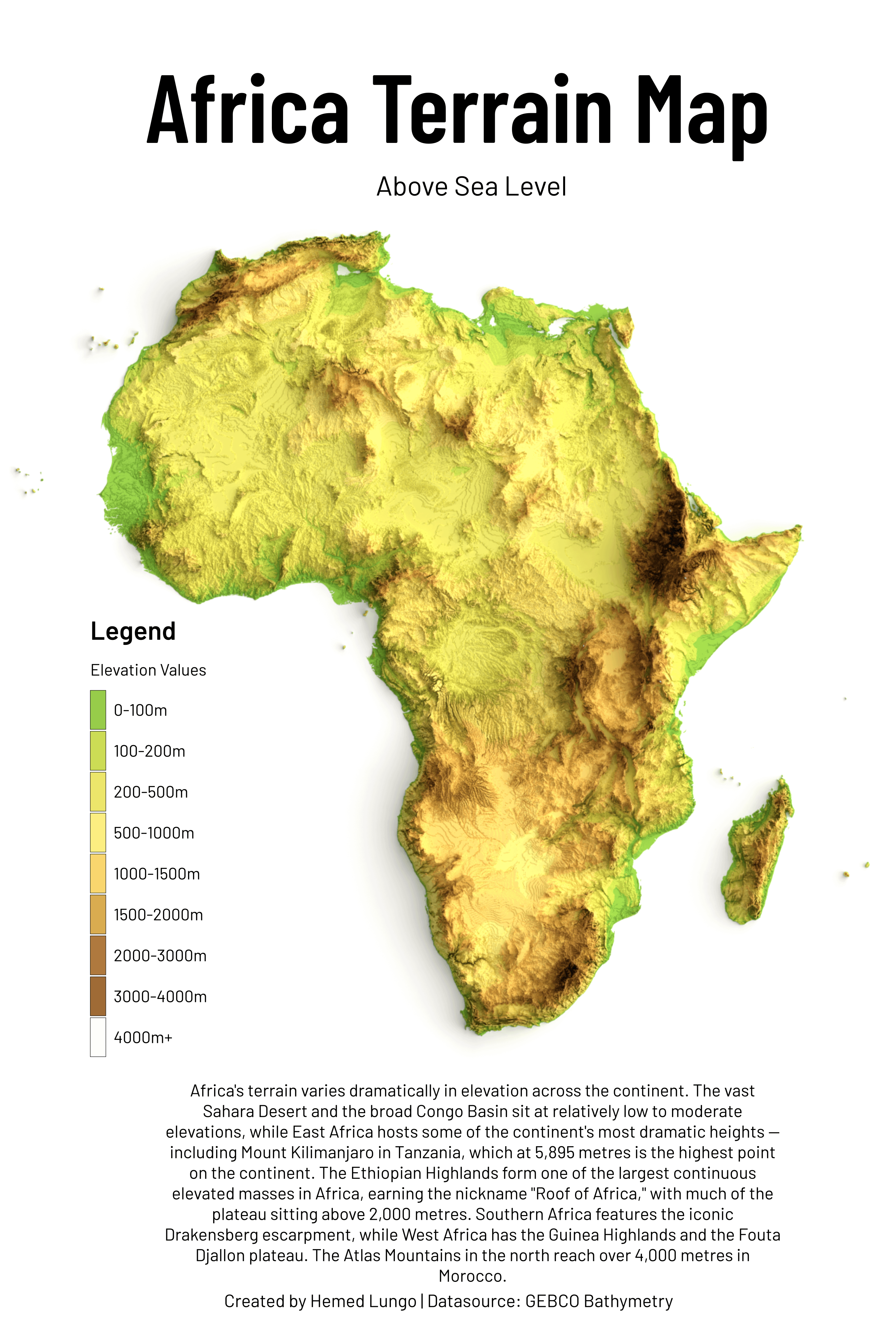
Crazy how Africa is surrounded by a wall of 4000m+ mountains.
4675636b2e on
Would be nice to have 16-bit per channel elevation maps… That “terracing” is bothering me.
Demortus on
This is a great map. It really illustrates well how geographically isolated sub-Saharan Africa is from the rest of the world. In the north, you have the regions directly bordering the Mediteranian separated from the rest of Africa by a massive desert. In South and Central Africa, you have massive mountains walling off most of the coastline.
Mr_Nock on
Dont lie, this an open and spread out avocado, isn’t it?

![[OC] Africa Terrain Map](https://www.byteseu.com/wp-content/uploads/2026/04/iarkxq97umsg1-1039x1536.png "[OC] Africa Terrain Map")
4 Comments
Crazy how Africa is surrounded by a wall of 4000m+ mountains.
Would be nice to have 16-bit per channel elevation maps… That “terracing” is bothering me.
This is a great map. It really illustrates well how geographically isolated sub-Saharan Africa is from the rest of the world. In the north, you have the regions directly bordering the Mediteranian separated from the rest of Africa by a massive desert. In South and Central Africa, you have massive mountains walling off most of the coastline.
Dont lie, this an open and spread out avocado, isn’t it?