
![[OC] London Revealed By Trees](https://www.byteseu.com/wp-content/uploads/2026/04/1775588636_ettqq86klrtg1-1536x1289.png "[OC] London Revealed By Trees")
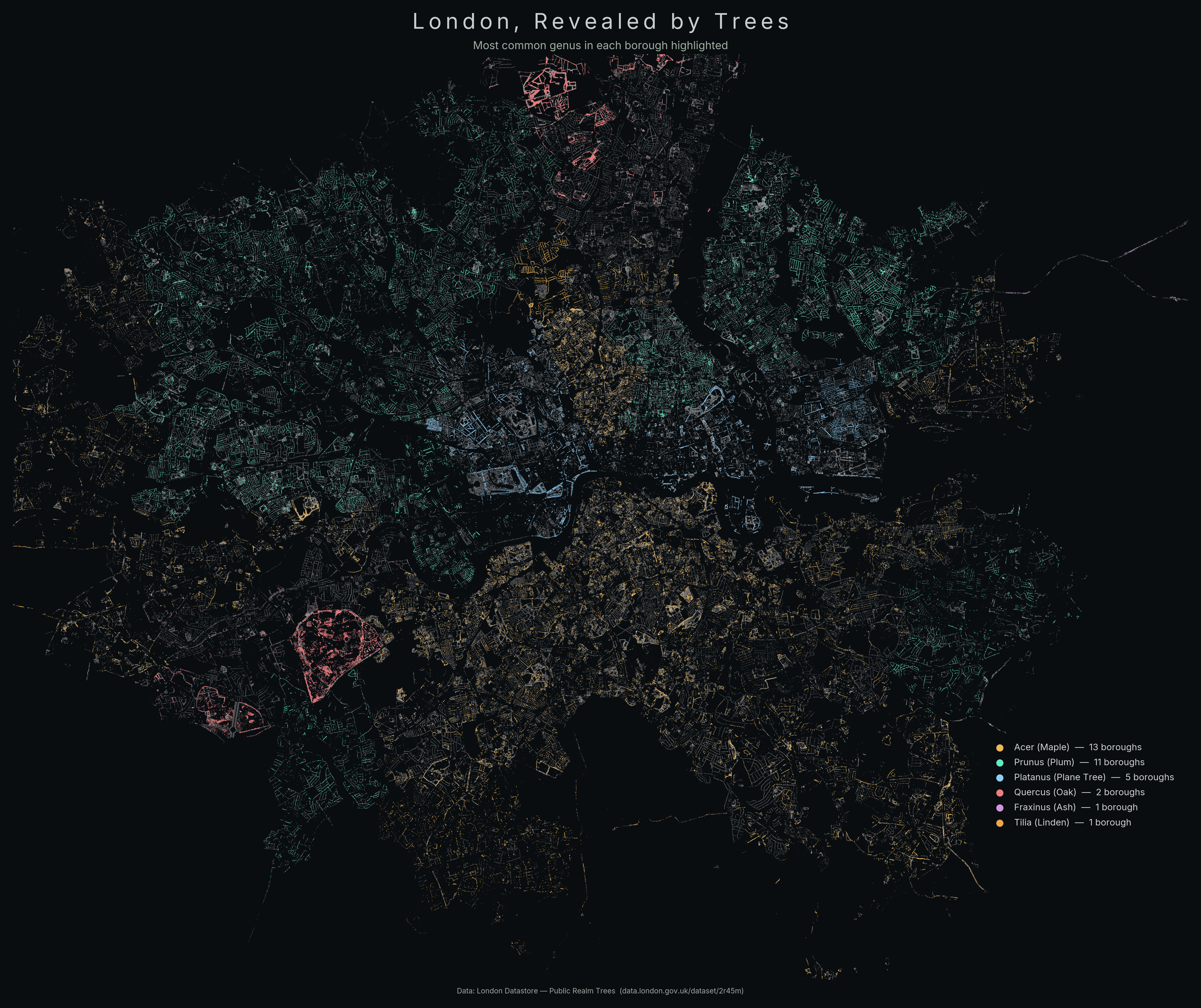
Data source: London – Public Realm Trees. Point cloud of all trees in there; the shape of the city emerges organically. Coloration was tricky; picking one genus per borough was a way to highlight the distribution differences that got muddied with all of them mixed.
Made with python (matplotlib, some manual color tuning). Code available here (along with other tree stuff).
Posted by Prestigious_Bench_96
1 Comment
Feels very strange to do this map and not include trees in a lot of the parks. Hamstead Heath is that big black area in the north middle, and this is a random streetview of it – [https://maps.app.goo.gl/EybtBL2ubocZZUvb9](https://maps.app.goo.gl/EybtBL2ubocZZUvb9)