

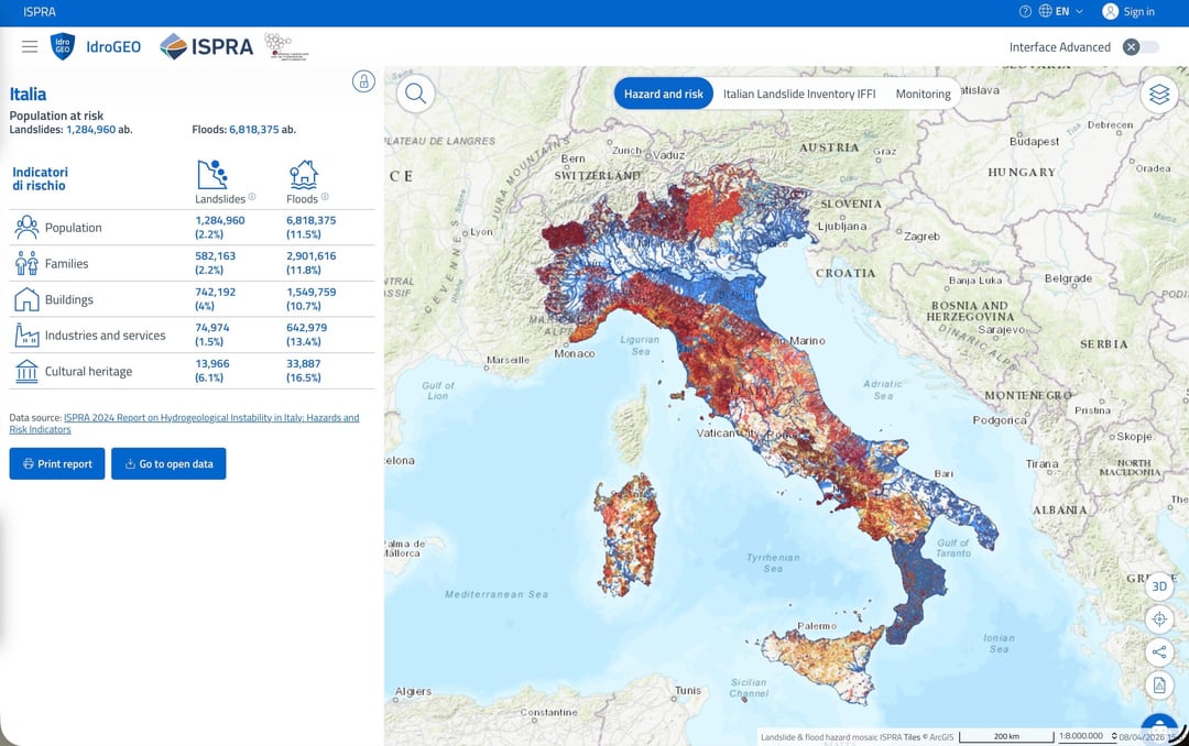
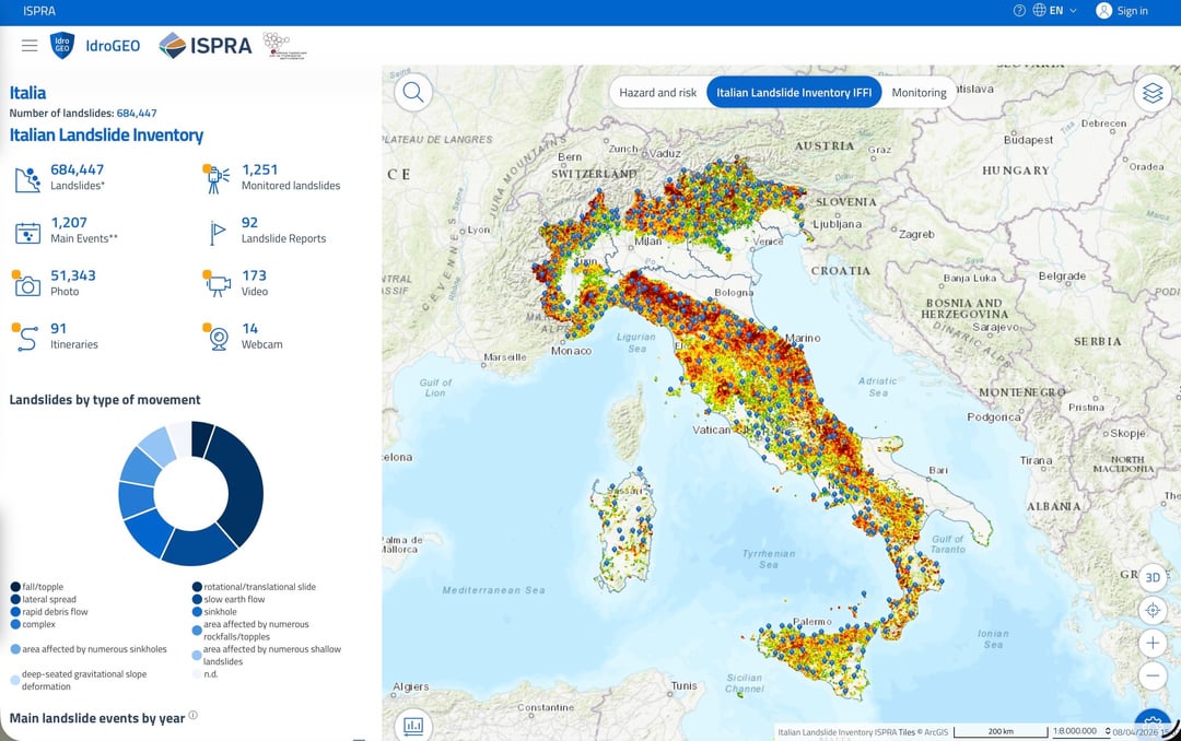
L’ISPRAin collaboration with Regions and Autonomous Provincestakes a daily census of i main landslide events and damage to buildings, cultural assets, primary communication infrastructures, economic and productive fabric, to publish them on the national platform IdroGEO.
IdroGEO is a tool that is easy to use even with a smartphone, developed by the Institute with the aim of encourage community involvement and one greater awareness of risks that affect their territory. With “Check for danger” the user can search for an address, or geolocate themselves on the map and identify the level of danger for landslides and floods in a radius of 500 meters from the point of interest (home, economic or productive activity).
the link for those who haven’t seen it in the text above: https://idrogeo.isprambiente.it/app/
https://www.reddit.com/gallery/1sfsujc
Posted by sr_local
2 Comments
Praticamente dove la tua casa non rischia di crollare, muori per quello che respiri.
Com’è che Valle d’Aosta e provincia di Trento hanno i confini nettissimi?