

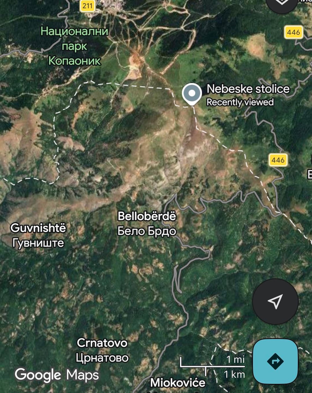
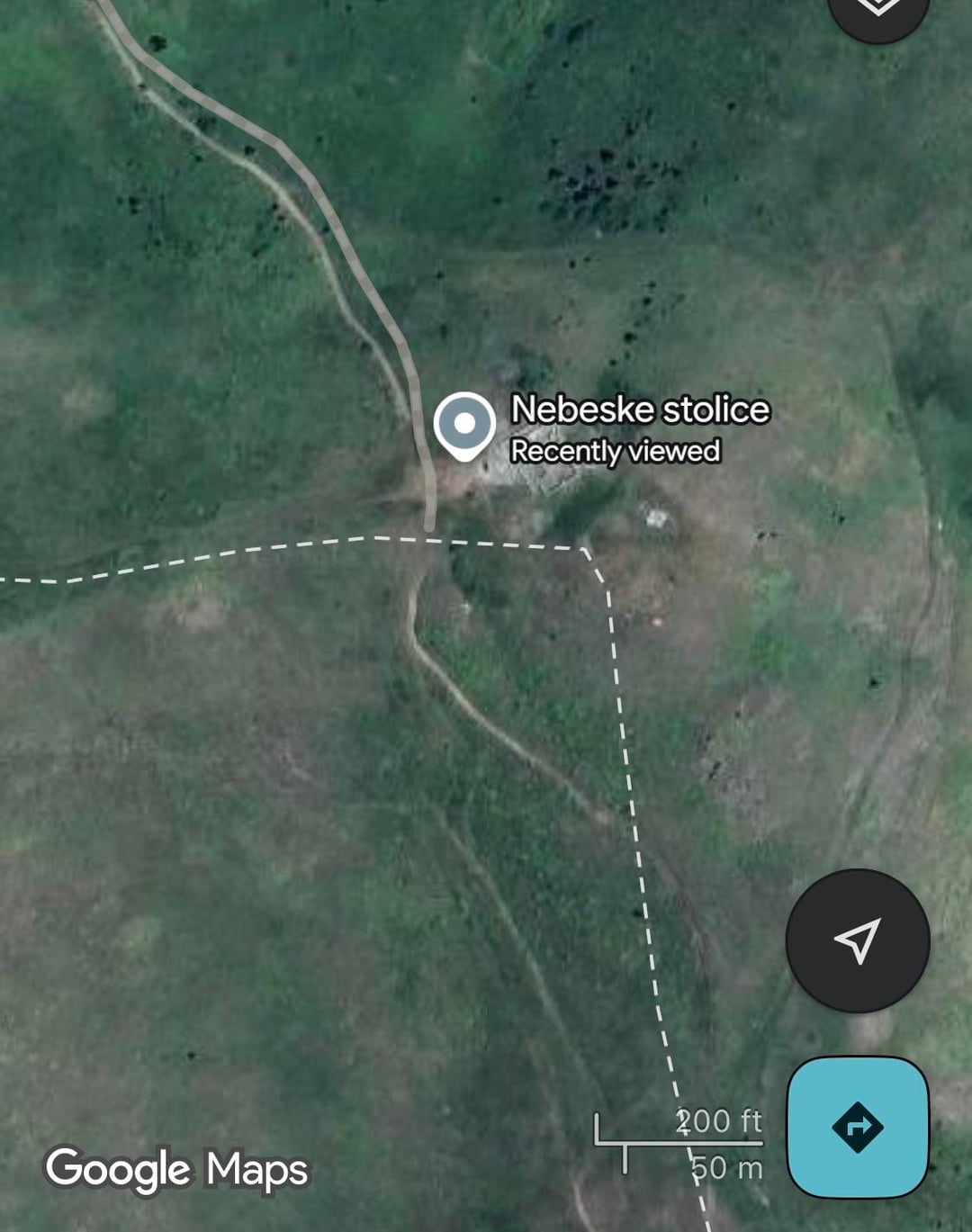
This is an archaeological site that Serbs call Nebeske Stolice, located in the north of Kosovo in the Kopaonik mountains on the border with Serbia. It belongs to the 3rd-4th centuries with an intervention in the 5th-6th centuries, completely before the Slavic invasions, and the beam was destroyed approximately at the time when the Slavs came to Ballakan. Until 1-2 years ago, when I looked at this, they were in the territory of Kosovo, and a few meters further, they had the border with Serbia, while now it is in the territory of Serbia (photo 2). Does anyone know when and why this change happened? The Serbs use it as a holy place, although it was most likely destroyed by them during the floods in the 6th-7th century.
https://www.reddit.com/gallery/1sib5qb
Posted by Local_Geologist_2817
6 Comments
satelitet dalin dallash kapak me foto edhe livritin kaniher ne google maps, kta e vren nese i kqyr hartat e vjetra ne gjeoportal ose google earth. Ndodh qe eshte inqizimi i ri edhe ja ka huq per nja 10 metra
Google maps nuk eshte gjithmone e sakt me kufi.
Shikoje me ndonje hart tjeter, sdi po pati kosova harte shteterore sikur kjo https://arkeologjia.iktk.gov.al/ASHA/Pages/Map.aspx
Ps: nga gugell mapsi po shof qe as me te voglin kontroll ska kosova aty, plot me shkije e flamuj te tyre
Shum mir qe e paske vrejt po kjo si intereson kerkujt (shtetit). Puntort ose ma mir me than mospuntort e shtetit jon t’koncentrum tash qe u nxeh moti me pi naj kafe, naj buk me hanger mir, naj udhtim krejt t’pagume mi pas, meditje etj etj.
Ksi vendbanime t’lashta n’gishta t’dorve i ngjeh n’kosov.
Edhe ne [gjeoportalin e Kosoves](https://geoportal.rks-gov.net/portal/main) te Agjencise Kadastrale ky vend gjendet ne anen tjeter te kufirit.
https://preview.redd.it/9civ2ne96jug1.png?width=1920&format=png&auto=webp&s=a5e57e0b30a809daf8ea27a54ffc867a757f6920
https://preview.redd.it/rn8wsuy8hkug1.jpeg?width=1170&format=pjpg&auto=webp&s=4818a75699dae3004d7d28beb57763b1a81c932a
Apple Maps e paska brenda Kosovës