
![[OC] The geography of soil color](https://www.byteseu.com/wp-content/uploads/2026/04/f174sqbpp9vg1-1024x583.png "[OC] The geography of soil color")
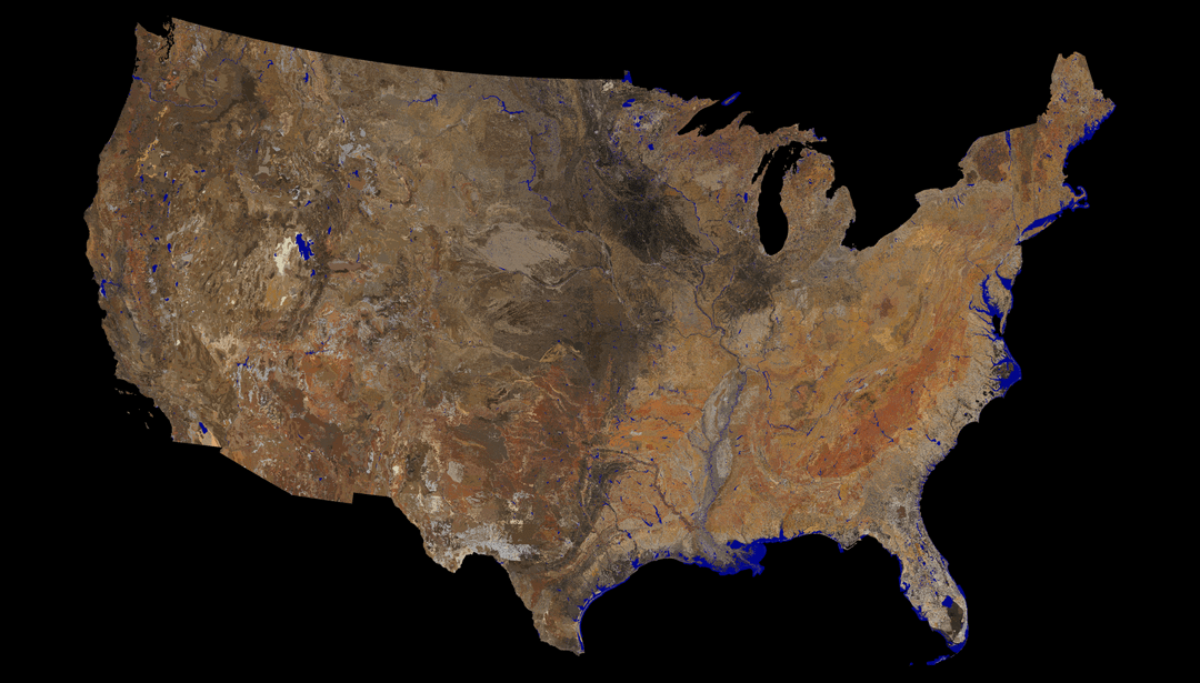
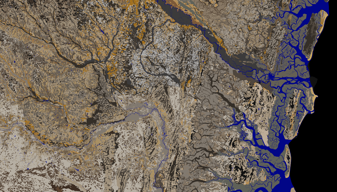
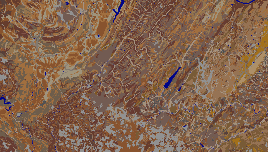
These images are a depiction of moist soil colors at 25 and 50cm depth, created from the USDA-NRCS detailed soil survey of the USA. The source data have been progressively updated over the last 100+ years by thousands of individuals, as part of the National Cooperative Soil Survey. This is not a satellite image; it is a hand-drawn map, representing an incredibly detailed natural resource inventory developed one hole at a time.
Spatial data from SSURGO and STATSGO2. Colors are derived from field observations and Official Series Descriptions.
Full resolution GeoTiff and PNG images for the 2026 version will be published soon, along with printed posters available for order.
Explore the 2025 version of these data via SoilWeb.
The 2018 version of these data, metadata, and links to sources can be found here.
Map made in QGIS. All data processing steps performed in R. Munsell to sRGB color conversion via aqp.
Posted by aquisalid
10 Comments
Growing up in the dead center of the dark spot in the rich farm land of upper Midwest, it never occurred to me how rare that might be until seeing this. I always assumed that the color of your dirt being the exact same as potting soil was generally common.
This is incredible work. The fact that it’s hand-drawn from field observations rather than satellite imagery makes it so much more impressive — basically a century of scientists cataloging soil one hole at a time.
What jumps out to me is how clearly you can see the Great Plains transition from darker soils (high organic matter) to the lighter arid West. If you’ve ever worked with land parcels in those regions, the soil color alone tells you a lot about productivity and value.
The SSURGO dataset is honestly one of the most underrated public data resources out there. Pair it with county-level land transaction data and you can start to see some really interesting patterns in how soil quality drives pricing. Thanks for putting this together — looking forward to the 2026 GeoTiff release.
Sound about right, from SC midlands and the soil under the sand/dirt is always red rustic clay colored.
Now this is some incredibly beautiful data. One of the best things I’ve ever seen on this sub.
How cool! I live in the Blackland Prairie ecoregion in TX and the soil color basically perfectly lines up with the map of the ecoregion.
Here’s a post with all the ecoregions in the US, it’s neat to try and identify them by soil color alone.
https://www.reddit.com/r/MapPorn/s/B7P0TbpjEl
Note: the ecoregions in the linked map are not named correctly.
I grew up with the Oklahoma red dirt. That stuff stains everything. It’s cool seeing how the red clay region is so expansive
this is fantastic. well done.
I can see my house from here
Looks like Florida is all sand.
‘hand-drawn map’ and ‘map made in QGIS’? Which one is it?