
")
Hello,
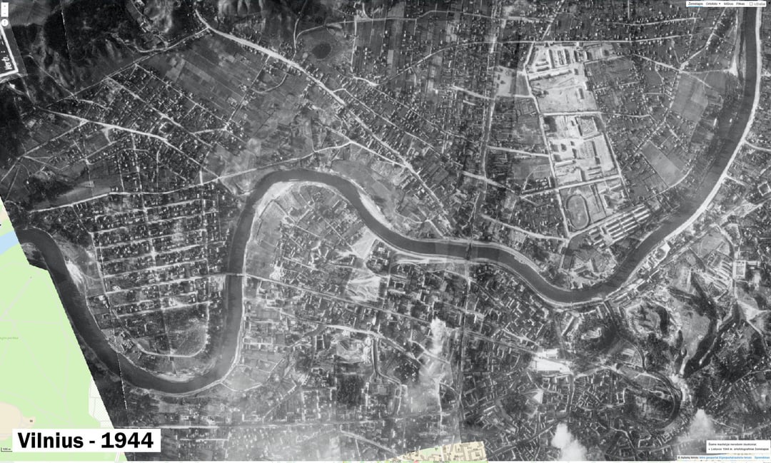
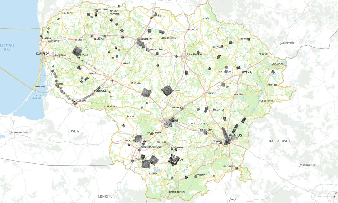
One day I planned the route and used it www.geoportal.lt check the boundaries of private plots. I decided to see what else this page has to offer and I found 1944 orthographic maps of Lithuania. There are other periods since 1995.
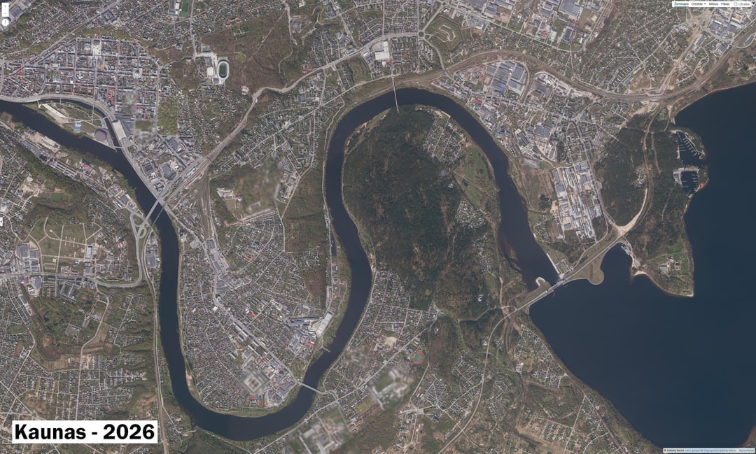
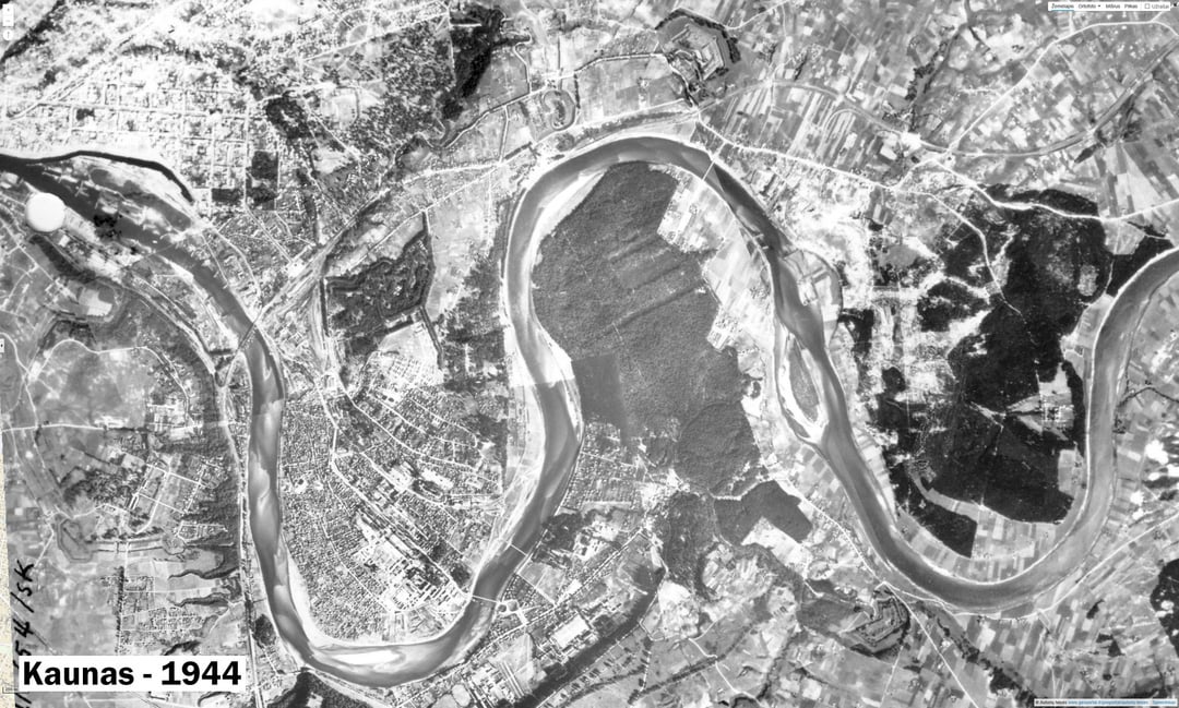
Not much photographed, but interesting to compare with the current map. It is difficult to tell the purpose of the photos, but some of them have markings of certain objects (eg: Palemon railway station, Kaunas). There are also Polish inscriptions on the photos of the Vilnius region, and German inscriptions on Kaunas and many others.
If you want to see for yourself: https://www.geoportal.lt/map/
Menu > Public Services > Orthographic maps
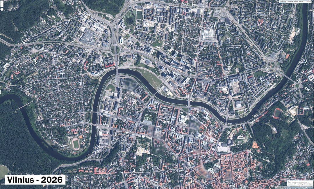
They will additionally enable a newer map, from the list, it will be displayed above the old one and you will be able to see the differences more clearly.
https://www.reddit.com/gallery/1t0mu6z
Posted by User19734
3 Comments
Dar pridesiu daug gausesni, irgi panasaus laikotarpio.
[https://www.arcgis.com/apps/mapviewer/index.html?webmap=faee54e3666e4b0fbf145ca713061041](https://www.arcgis.com/apps/mapviewer/index.html?webmap=faee54e3666e4b0fbf145ca713061041)
Čia yra ir daugiau Vilniaus isotrinių žemėlapių: [https://zemelapiai.vplanas.lt/vilniausdnr/lt/maps/compare/review/a4fc36ac-f3f4-4327-a79b-bfe95cd6cef7?x=582413.2493492374&y=6061785.245705083&zoom=15](https://zemelapiai.vplanas.lt/vilniausdnr/lt/maps/compare/review/a4fc36ac-f3f4-4327-a79b-bfe95cd6cef7?x=582413.2493492374&y=6061785.245705083&zoom=15)
Istoriniai žemėlapiai puikiai parodo kaip žiauriai sugadintas dešinysis Neries krantas. Vietoje vientisos natūralios miesto tąsos velniop išgriautas Šiaurinis Žvėrynas, vakarinis Naujamiestis ir Šnipiškės, nuolėštas gabalas Vingio parko, sunaikintas ežeras. Vietoje to įkištos miesto autostrados ir vietoje miesto ten turime užmiestinio tipo tranzitinio transporto mazgą.
žvėrynas buvo kaimas su vištom, arkliais, karvėm. dabar ne