
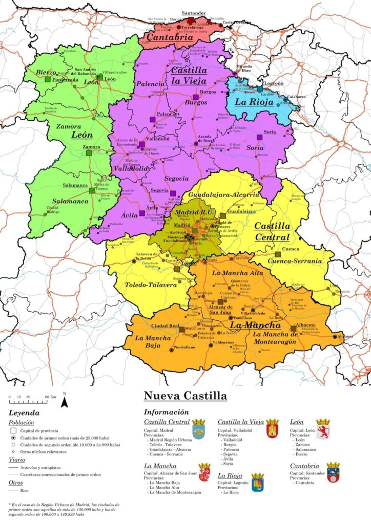
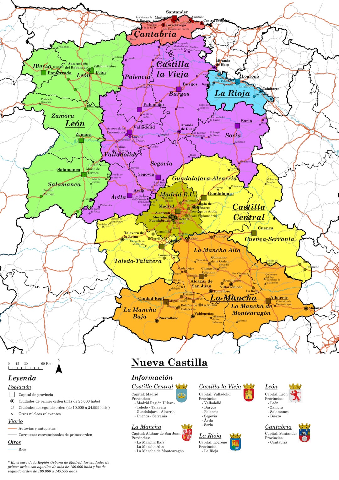
Continuing with my previous posts, I have decided to make a more detailed map of what the historical territory of Castile is, in response to the debate that occurred in the comments in relation to it. What do you think?
I would be interested in opening a debate on this matter, always with respect, especially due to, in my opinion, the problems caused by the provincial division of 1833 and the homogenization that it gave rise to in some territories (which is why I have “disfigured” some provinces).
To do so I have based myself on the map of Floridablanca’s municipalities from 1785, as well as on the INE classification of the Functional Urban Area of Madrid and on a small investigation into the historical and cultural reality of the region.
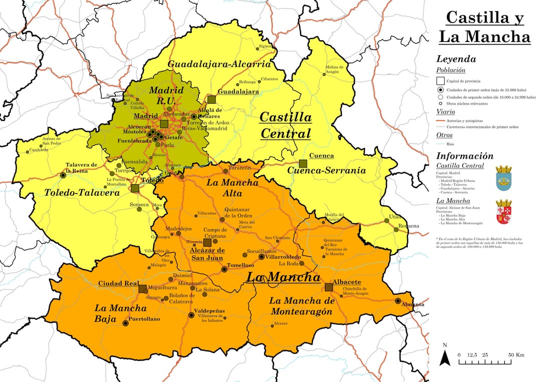
With this I have tried to address the separation of Castilla-La Mancha, giving its own entity to La Mancha as a region and separating it from the purely Castilian part of the Autonomous Community and ending those slight frictions with Guadalajara.
I have also added Madrid to this remaining Castilian part of Castilla-La Mancha, creating Central Castilla, a region that, although it has its own cultural entity, responds to the current urban reality and the influence of Madrid on the territory.
For its part, I have also separated the most Murcian territories from what is now Albacete, joining them with said region. And I have added the Señorío de Molina and the Utiel-Requena region to Cuenca, as it was prior to the current division.
The Alcarria region, for its part, is now part of the same province, joining the Alcarrias of Guadalajara, Cuenca and Madrid (those municipalities outside the functional urban area of the capital), giving more recognition to this region that today appears distributed.
On the other hand, the southern face of the Sierra de Gredos is now Toledo, and not Ávila, which is located on the other side of the mountain range, with the dividing line between the two being approximately the line of the summits. Continuing with the mountain and Toledo theme, the municipalities of the Montes de Toledo are part of Toledo, extending the size of the province in this region, in response to the loss of the La Mancha territory.
In Castilla y León, for its part, I have mainly separated Castilla la Vieja and León, creating two autonomous communities of their own.
Within León I have created the province of Bierzo, with its capital in Ponferrada.
On the other hand, I have added the region of Campoo de Cantabria to the province of Palencia, addressing in a middle ground the debate about whether Cantabria should be part of Castilla or not. With this I have given its own entity to the most Atlantic part of Cantabria, while I have returned the region of Campoo to the provinces of Old Castile, as it was prior to the provincial division of 1833.
I have also added to Soria the territories that were part of the province in what is now Guadalajara, prior to 1833. And the County of Treviño is now part of the province of Araba.
La Rioja, for its part, continues to maintain its entity as an Autonomous Community separate from Castile.
That said, anyone who wants to comment is welcome, I am delighted to read you 🙂
PS: I know that this vision may not be liked by those who are more Castilian, who defend the union of all the territories in the same Castilian region. And while it is true that it is one way of looking at it, in my opinion there are enough differences to justify this division (at least between Old Castile and New Castile).
PS2: If you see any errors on the map, let me know so I can correct them.
https://www.reddit.com/gallery/1dmzd5j
Posted by IntroductionShort338
5 Comments
Adjunto el mapa de intendencias de Floridablanca de 1785.
https://preview.redd.it/cpzwlsa0pe8d1.jpeg?width=2500&format=pjpg&auto=webp&s=893abd734d5875071d36a43caf19f76ff2ad6602
Muy interesante, pero no crees que La Mancha debería formar parte de Castilla?
Interesante, pero sigo pensando que La Mancha es una comarca castellana más, como la Alcarria, Ocaña o Tierra de pinares.
En cuanto a Castilla Central me parece un buen enfoque.
Como talaverano creo que poner Arenas de San Pedro en nustra provincia tiene mucho sentido incluso en la actualidad, pero ponernos junto a Toledo aun no creo que sea algo que nos gustaría a ninguna de las 2 ciudades.
Me gustan mucho tus mapas, y creo que te lo has currado… sin embargo, por negar un poco la mayor en tu primer párrafo y añadir un pequeño matiz, León no es históricamente parte de Castilla. Si consideras León Castilla por estar en la misma corona durante la baja Edad Media, también tienes que considerar Galicia, Asturias, Extremadura, buena parte del País Vasco, de Andalucía… Castilla, y eso no es históricamente correcto.